Colorado State University is calling for a somewhat below-average 2026 Atlantic hurricane season, with El Niño expected to play a major role in limiting the development of tropical cyclones across the Atlantic basin.
CSU’s First Outlook for 2026
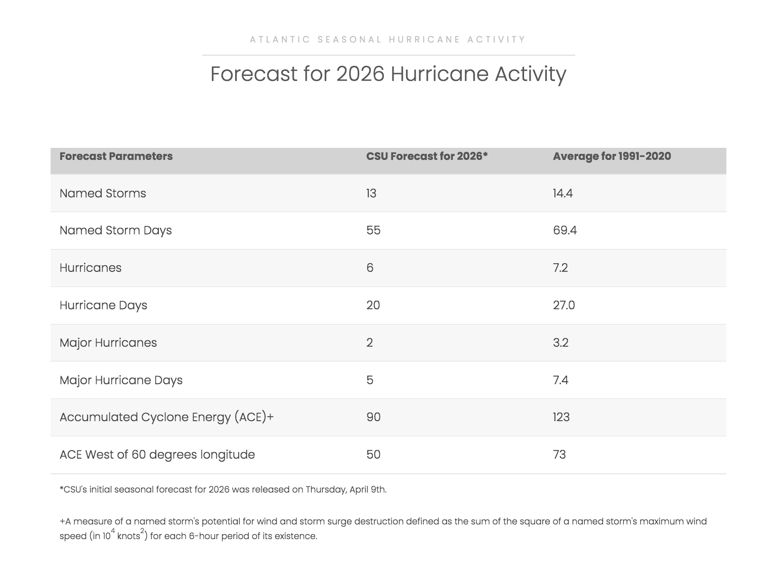
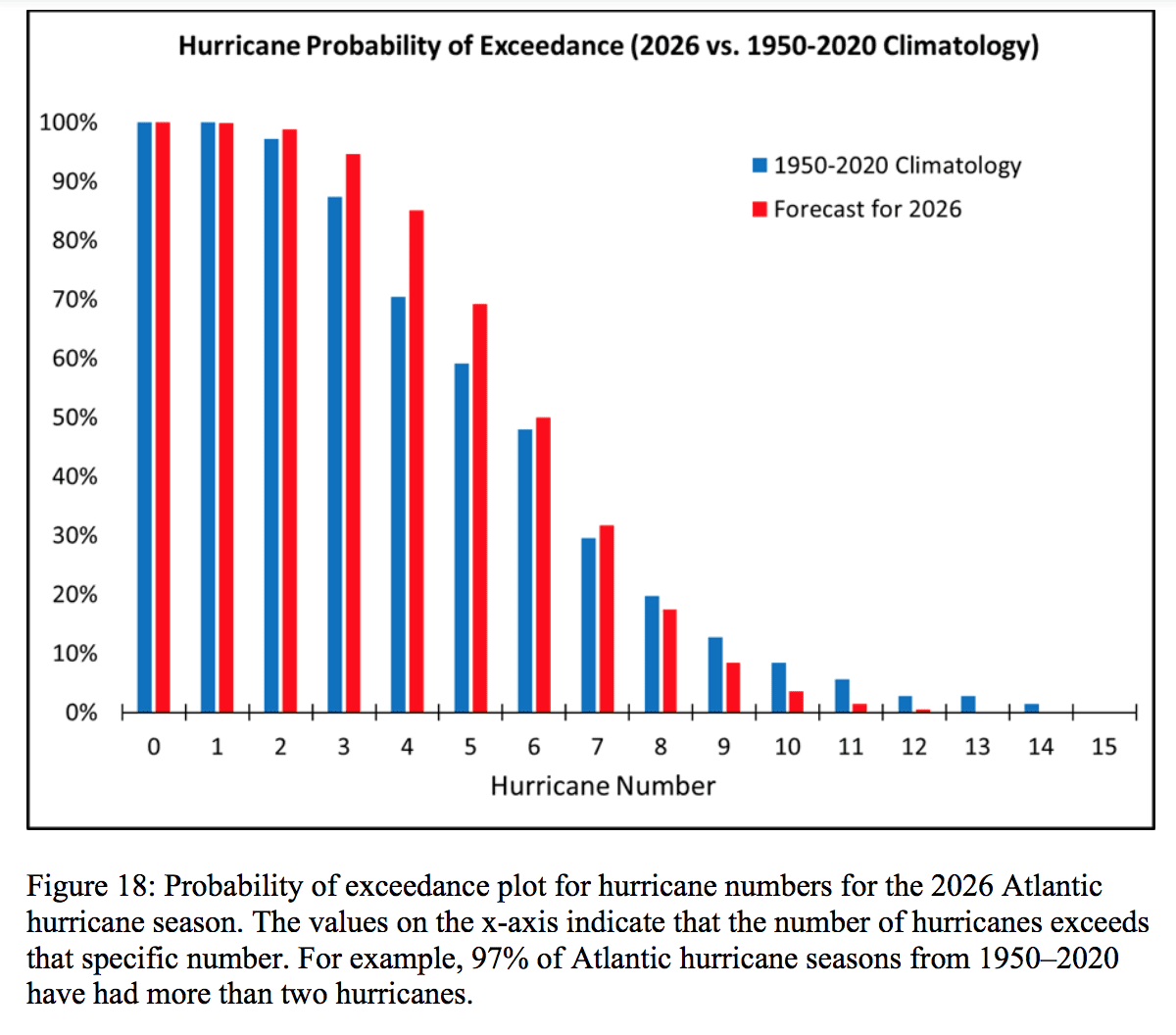
In its first outlook of the season, which was released on Thursday, the Tropical Cyclones, Radar, Atmospheric Modeling, and Software Team at Colorado State University predicted 13 named storms, including six hurricanes and two major hurricanes of Category 3 strength or higher. That is below the long-term seasonal average cited in the university’s release of 14 named storms, seven hurricanes and three major hurricanes.
CSU explained that multiple environmental factors are anticipated to influence this year’s Atlantic hurricane season, including ocean water temperatures and the amount of dry Saharan dust that may arrive across the region. However, one of the chief reasons for the quieter outlook is the expected evolution of an El Niño weather pattern.
“We anticipate that the 2026 Atlantic basin hurricane season will have somewhat below-normal activity,” CSU said. “Current weak La Niña conditions are likely to transition to El Niño in the next few months, with the potential for a moderate to strong El Niño for the peak of hurricane season. Sea surface temperatures in the western tropical Atlantic are warmer than normal but slightly cooler than normal in the eastern and central tropical Atlantic. We anticipate El Niño being the dominant factor for the upcoming hurricane season, driving increased levels of tropical Atlantic vertical wind shear,” CSU explained.
How El Niño Could Suppress Atlantic Activity
According to the National Oceanic and Atmospheric Administration, “Scientists call the two opposing climate patterns of El Niño and La Niña the ‛El Niño-Southern Oscillation’ cycle. El Niño and La Niña can both have global impacts on weather, wildfires, ecosystems, and economies.” An ENSO-neutral phase typically occurs between phases of a La Niña or an El Niño event.
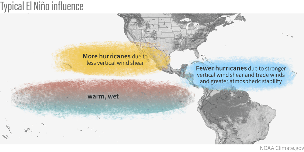
El Niño, which involves a warming of the equatorial Pacific Ocean, usually helps to increase wind shear — a change in wind direction and velocity with height in the atmosphere. In the Atlantic Ocean, the increase in wind shear from El Niño helps to rip apart storms and prevent hurricane formation and intensification. This is the opposite of a La Niña cycle, when the ocean waters across the equatorial Pacific cool significantly. During La Niña, wind shear typically decreases in the Atlantic, and a reduction in wind shear can favor cyclone development.
The latest update from NOAA’s Climate Prediction Center, which was released on April 9, adds additional context to the development of El Niño this year. In its most recent ENSO Diagnostic Discussion, NOAA/CPC said ENSO-neutral conditions are now present and favored through April and June, with El Niño likely to emerge in May-July and persist through at least the end of the year. CPC said the range of possible outcomes still stretches from neutral to a very strong El Niño.
Signals of a Below-Average Season
A press release included with CSU’s report provided additional details about what could be in store for this year’s season, including referencing years in the past that could be comparable to this year’s season:
“So far, the 2026 hurricane season is exhibiting characteristics similar to the 2006, 2009, 2015 and 2023 seasons,” said Phil Klotzbach, a senior research scientist in the Department of Atmospheric Science at CSU and lead author of the report.
“Our analog seasons ranged from well below-average Atlantic hurricane activity to somewhat above average,” said Klotzbach. “While the average of our analog seasons is somewhat below normal, the large spread in observed activity in our analog years highlights the high levels of uncertainty that typically are associated with our early April outlook.”
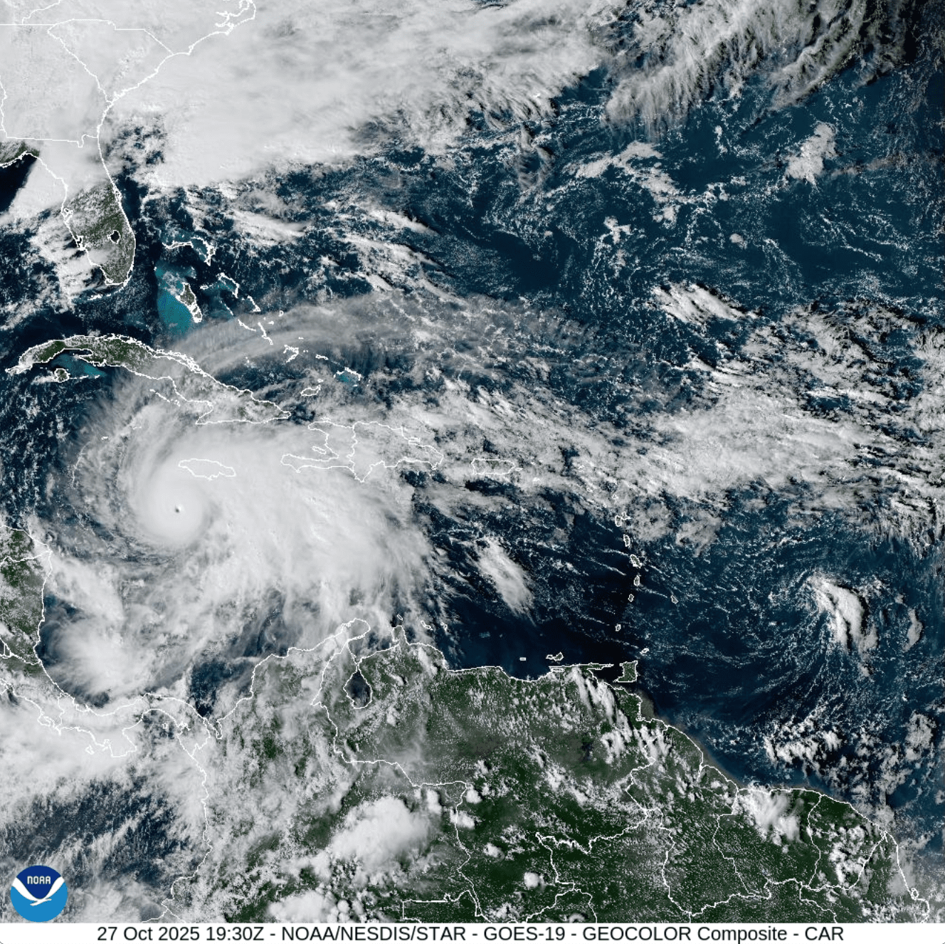
“The team predicts that 2026 hurricane activity will be about 75% of the average season from 1991–2020. By comparison, 2025’s hurricane activity was about 105% of the average season. The most significant hurricane of the 2025 Atlantic hurricane season was Hurricane Melissa, which made landfall as a Category 5 hurricane in Jamaica, resulting in nearly $9 billion in damage and causing 95 fatalities across the Caribbean,” CSU stated.
AccuWeather Also Sees a Less Active Season
The CSU forecast arrives on the heels of AccuWeather’s late March hurricane season outlook. As the Source previously reported, AccuWeather similarly called for a near- to below-average season overall. In its forecast, AccuWeather projected 11 to 16 named storms, four to seven hurricanes and two to four major hurricanes, while also stressing that a quieter overall season does not eliminate the threat of damaging impacts.
Only One Storm Can Create a Devastating Season
While the prediction of a potentially less-active Atlantic hurricane season comes as welcome news, forecasters emphasized that seasonal numbers do not tell the whole story for any one island or coastline.
In CSU’s update, the probability of at least one major hurricane tracking through the Caribbean region was forecast at 35%, below the long-period average of 47%.
CSU also forecast a 32% chance of at least one major hurricane making landfall along the entire continental U.S. coastline, compared with the historical average of 43%. For the U.S. East Coast, including the Florida Peninsula, the probability was placed at 15%, below the average of 21%. Along the Gulf Coast, from the Florida Panhandle westward to Brownsville, Texas, the forecast probability was 20%, compared with the long-term average of 27%.
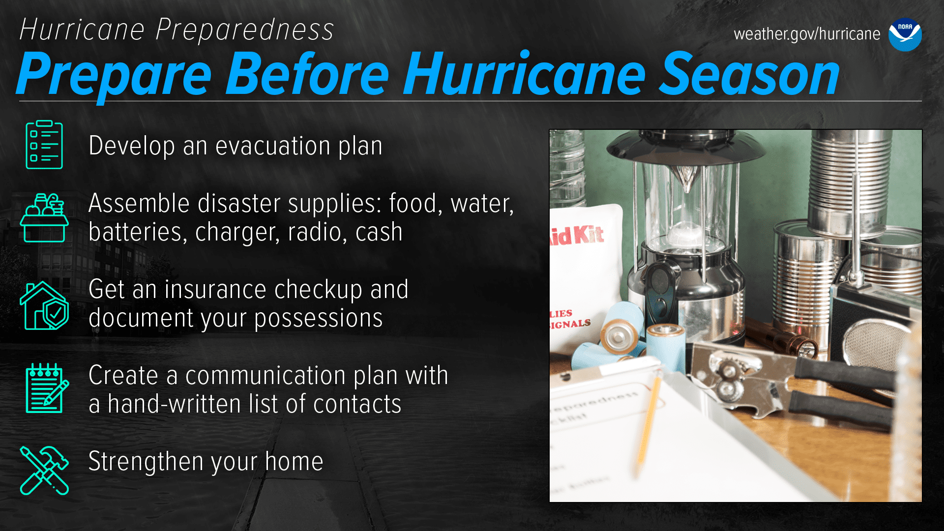
“We are forecasting a below-average probability for major hurricane landfalls along the continental United States coastline and in the Caribbean. As with all hurricane seasons, coastal residents are reminded that it only takes one hurricane making landfall to make it an active season. Thorough preparations should be made every season, regardless of predicted activity,” CSU warned.
Local Weather Information
The Atlantic hurricane season runs from June 1 through Nov. 30, and CSU plans to release additional tropical forecasts over the coming months. Residents can follow CSU’s updates on the organization’s official website and NOAA’s Climate Prediction Center for ENSO updates. Additionally, the local weather forecast for the U.S. Virgin Islands is regularly updated on the Source Weather Page. Individuals can also find helpful weather information, emergency preparedness, and alerts from the Virgin Islands Territorial Emergency Management Agency.