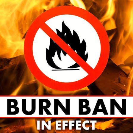
A territory-wide burn ban is now in effect across the U.S. Virgin Islands as dry weather, gusty winds, and elevated fire concerns continue across the region.
VIFEMS Issues USVI Burn Ban
The Virgin Islands Fire and Emergency Medical Services announced the burn ban on Monday.
“Effective immediately, VIFEMS announces a territory-wide burn ban,” according to a press release issued Monday. “This decision has been made in response to increased fire risks and high winds currently affecting the territory,” VIFEMS stated.
The agency said the ban applies broadly to open flames and outdoor burning.
“The burn ban will remain in effect until further notice and applies to all open fires, including campfires, bonfires, trash, yard debris, or brush burning,” VIFEMS said.
VIFEMS also reminded the public that Water Island already has a permanent burn ban.
“Residents and visitors are reminded that a permanent burn ban remains in effect on Water Island. Open burning is prohibited on Water Island at all times,” the agency said.
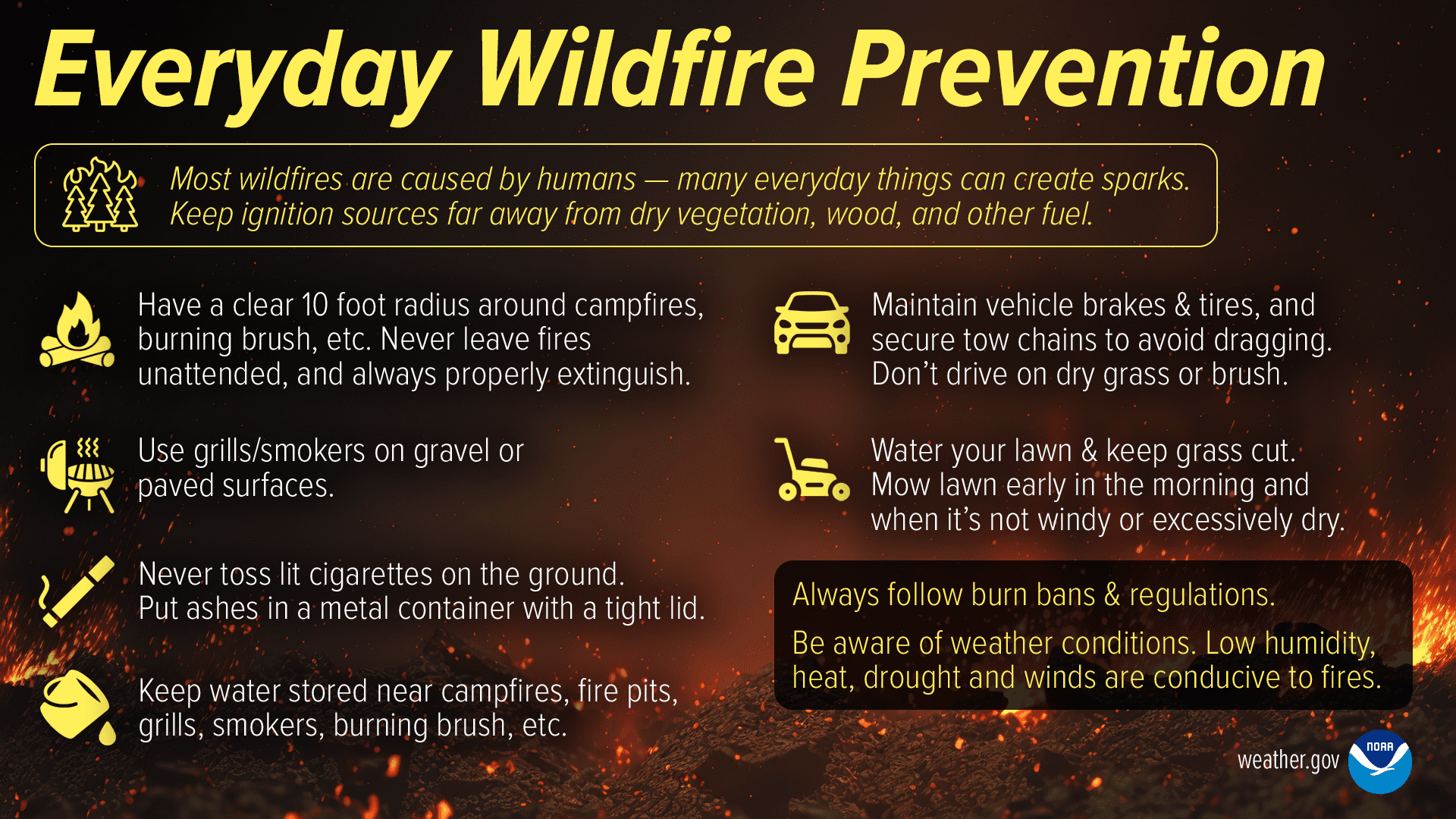
Residents are encouraged to use safer alternatives for yard debris and to be cautious with grills and other outdoor cooking equipment.
“Alternative methods for disposing of debris, such as chipping or composting, are encouraged,” VIFEMS said. “Additionally, VIFEMS urges the public to exercise caution while using outdoor grills or cooking equipment with open flames. Properly maintaining and monitoring such equipment, and keeping a fire extinguisher nearby, can significantly reduce the risk of accidental fires,” VIFEMS explained.
Fire Weather Concerns and Hurricane Season Preparedness
Daryl Jaschen, director of the Virgin Islands Territorial Emergency Management Agency, also addressed recent fire weather concerns during a weekly Government House Press Briefing. Jaschen noted that the National Weather Service in San Juan, Puerto Rico, issued a Red Flag Warning for St. Croix on Saturday, June 13.
According to information from the NWS, “A Red Flag Warning is issued in conjunction with land management agencies to alert land managers to an ongoing or imminent critical fire weather pattern. NWS issues a Red Flag Warning when fire conditions are ongoing or expected to occur shortly.”
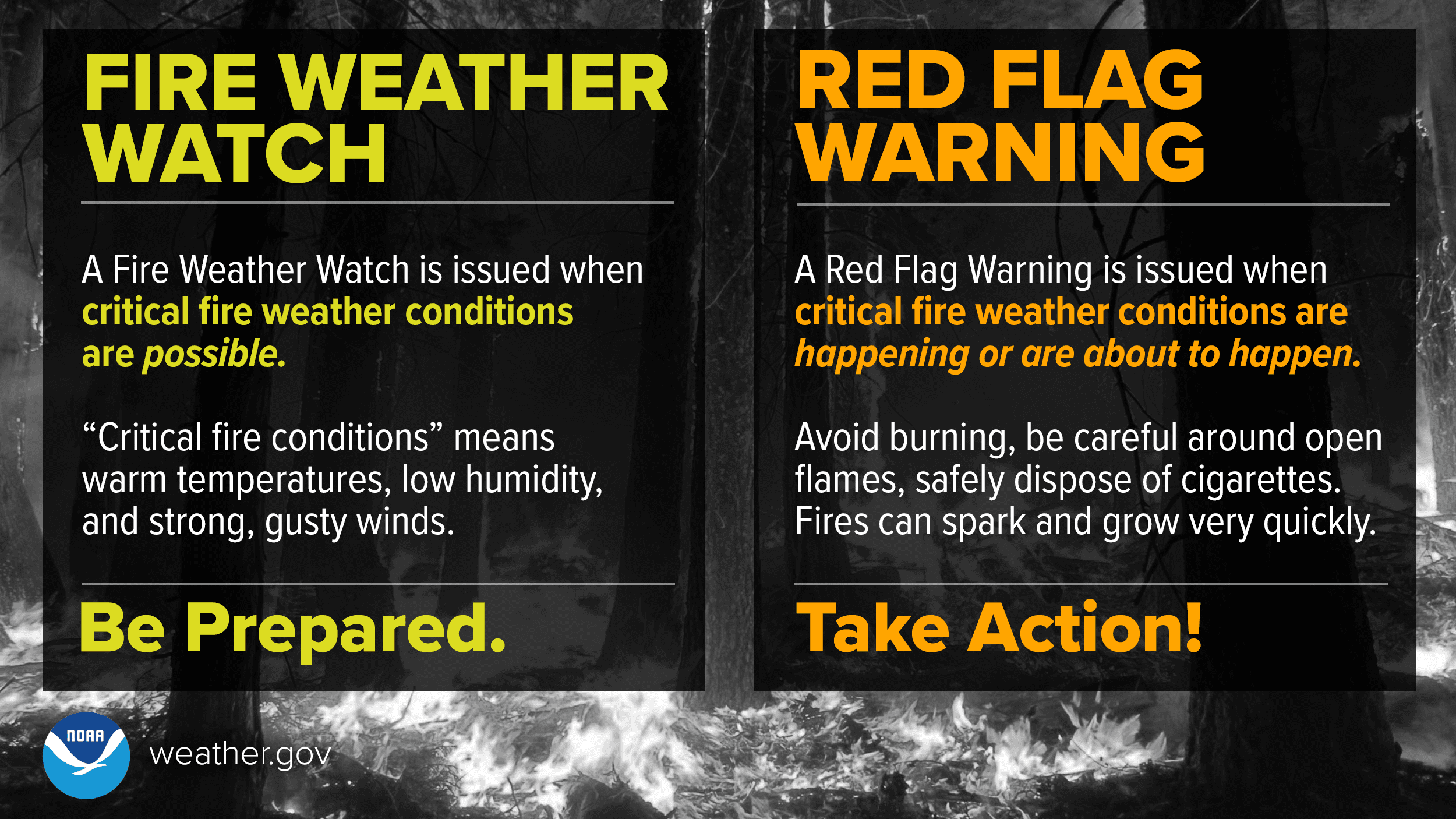
Jaschen said the combination of gusty winds and low humidity created conditions favorable for the rapid spread of fire.
“On Saturday, we had gusty winds between 20 and 30 miles per hour, and we had relatively low humidity. Levels were classified as dangerous for spreading a fire,” Jaschen said. “A Red Flag Warning signals that conditions are right for rapid ignition and spread of wildfires or brush fires.”
Jaschen said VIFEMS will regularly evaluate conditions and urged residents to report any signs of fire immediately.
“VIFEMS will continue to monitor the weather conditions, assess fire risks throughout the territory, and inform the public when the burn ban is lifted,” Jaschen stated. “In the meantime, if you smell smoke or see smoke or fire, please call 9-1-1 immediately.”
Jaschen reminded residents that the Atlantic hurricane season is currently underway, and that hurricane preparedness remains important. He encouraged residents to use the current stretch of relatively quiet weather to check homes, emergency supplies, and insurance coverage. He also recommended that individuals across the islands be prepared with sufficient food, water, and medication for several days after a potential storm.
Jaschen also encouraged residents to rely on trusted sources for official updates.
“Sign up for AlertVI through VITEMA. We want you to stay informed, be prepared, and stay vigilant,” Jaschen declared.
Local Weather and Tropics Outlook
According to the NWS in San Juan, mostly fair weather along with gusty winds is expected through much of the week, and some precipitation may occur later in the week. However, significant rainfall is not expected at this time. Rain would be welcome across the region, as an update from the National Integrated Drought Information System indicates that all three of the main islands of the USVI are experiencing very dry weather.
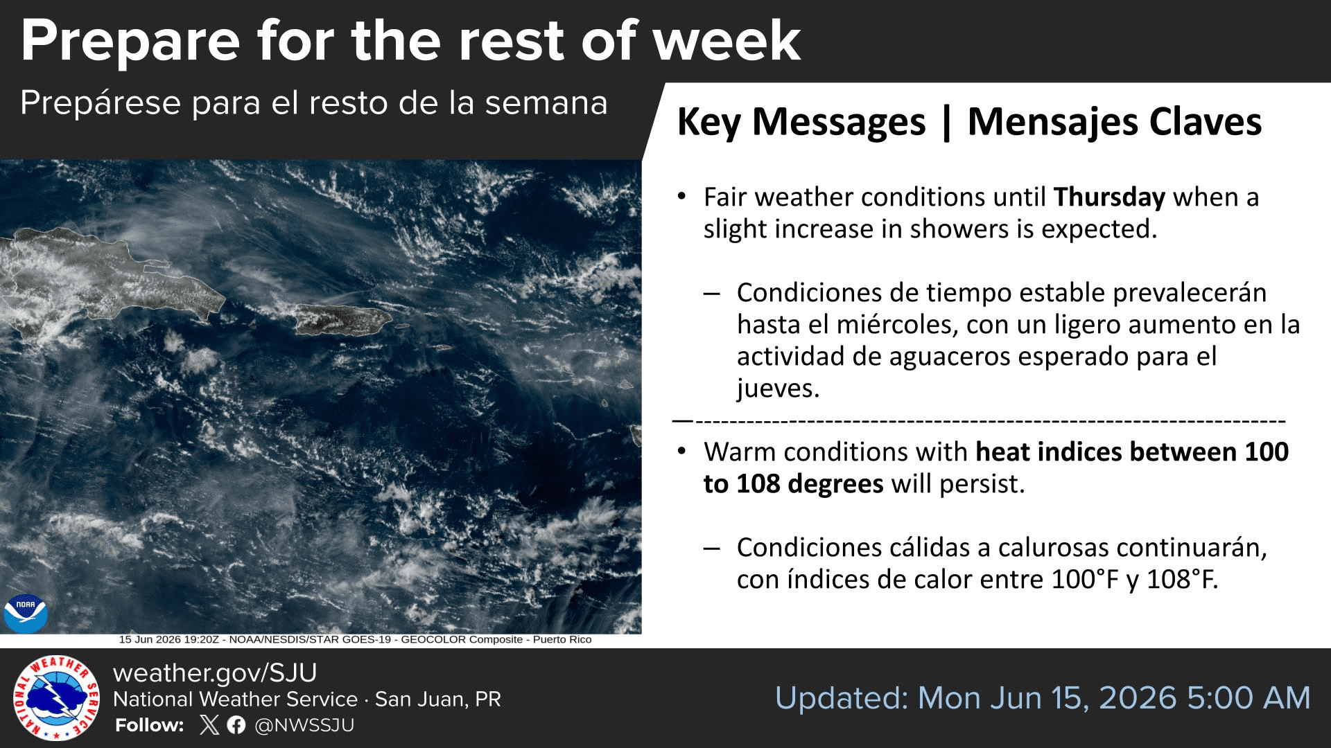
“Generally stable and fair weather conditions will prevail through much of the week, although a slight increase in moisture and shower activity is possible toward the end of the week,” the NWS said on Monday.
Forecasters said warm to hot and dry conditions will continue, and Saharan dust may become more noticeable in the coming days.
“A plume of moderate to high dust concentrations is expected to arrive around Thursday, resulting in hazy skies, reduced visibility, and deteriorating air quality,” the NWS said.
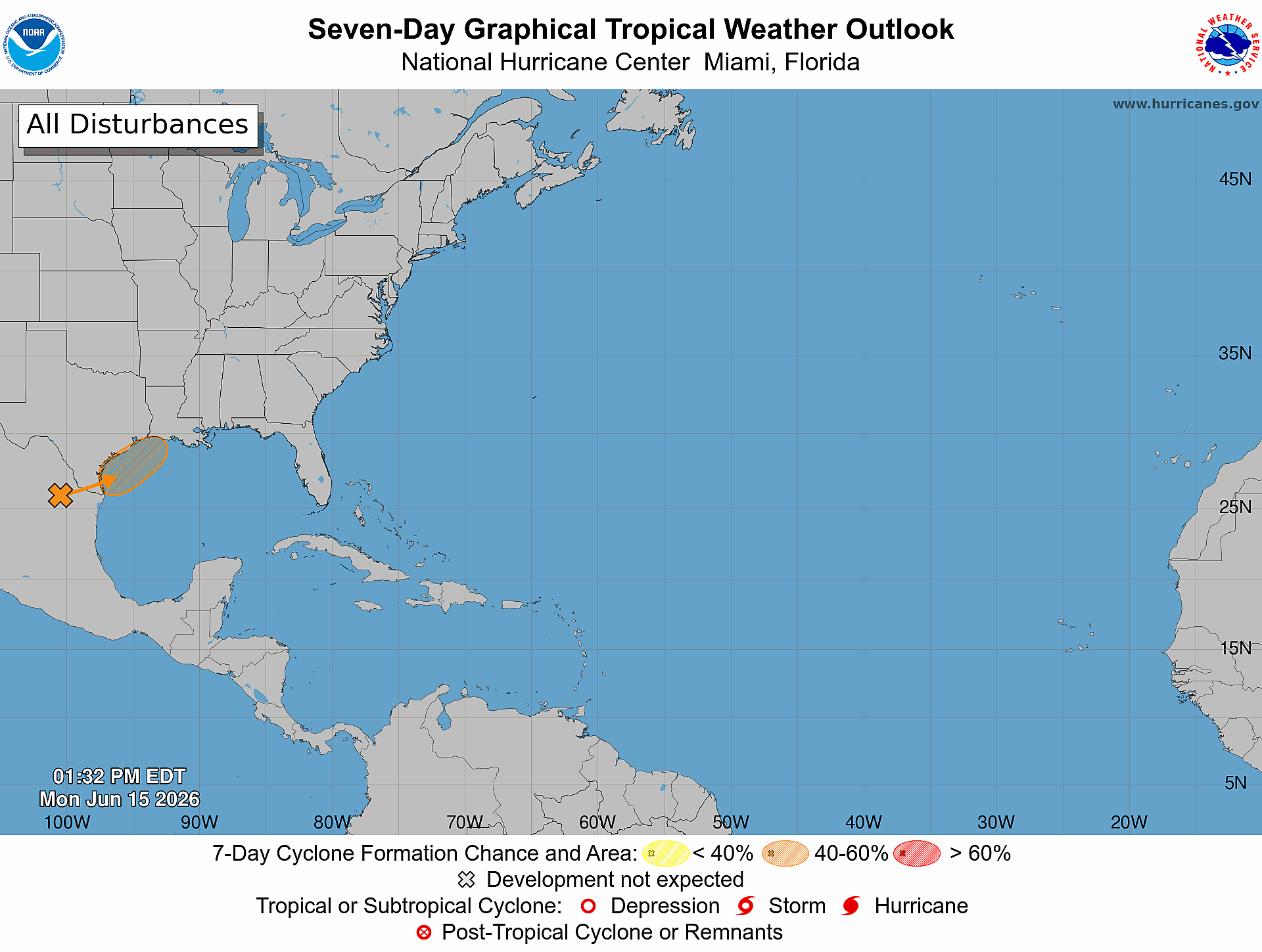
In the tropics, the National Hurricane Center is monitoring a disturbance near the northwestern Gulf region near Texas, well away from the Virgin Islands.
“A trough of low pressure located over northeastern Mexico is producing a large area of disorganized showers and thunderstorms,” the NHC said Monday afternoon. “However, the system could reemerge over the northwestern Gulf late Tuesday or Wednesday, and environmental conditions there are marginally conducive for the formation of a short-lived tropical storm on Wednesday into Thursday.”
The NHC gave the system a medium chance of development, with formation odds of 40% through 48 hours and 50% through seven days. The system does not pose a threat to the U.S. Virgin Islands or Puerto Rico. However, if the storm organizes sufficiently, it would be designated “Arthur,” the first named cyclone of this year’s Atlantic hurricane season.
While several more tropical waves are being watched across the Atlantic, there are no additional areas of concern for tropical activity across the Atlantic basin as of Monday afternoon.
Daily Weather Updates
Information regarding the weather across the USVI, including marine forecasts, is available from the NWS and NOAA.
The local forecast is regularly updated on the Source Weather Page, and a weekly video forecast is available. Additionally, residents and visitors can view weather alerts and disaster preparedness information from VITEMA.