Updated 5/25/24 at 7:24 p.m. AST
VI SOURCE WEATHER UPDATES
! The NWS has noted that an unstable weather pattern is expected to continue on Sunday and over the next few days, and precipitation will be possible. Very warm temperatures are also expected, and Heat Advisories and Heat Warnings may be issued. The Heat Index will be high, and it is important to remain hydrated and stay cool. Additionally, a tropical wave is forecast to move across the region around Monday, raising the possibility of rain and thunderstorms.
! A NEW Weekly Weather Update Video is available here!
! NEW Article: NOAA Forecasts Above-Average 2024 Hurricane Season, Expects High Number of Named Cyclones
Series: “Extreme Weather in the Caribbean”
- Part 1: Caribbean Earthquakes and Tsunamis
- Part 2: Caribbean Volcanoes
- Part 3: Rip Currents
- Part 4: Hurricanes
- Part 5: Wildfires
- Part 6: Flash Floods
- An article about earthquakes in the Caribbean is available here!
- An informational video about drought conditions in the USVI is available here!
- Article: Colorado State University Predicts Extremely Active 2024 Atlantic Hurricane Season
- Article: La Niña Weather Pattern May Spawn an Active 2024 Atlantic Hurricane Season
SUNDAY’S WEATHER FORECAST: 5/26/24
Happy Sunday!
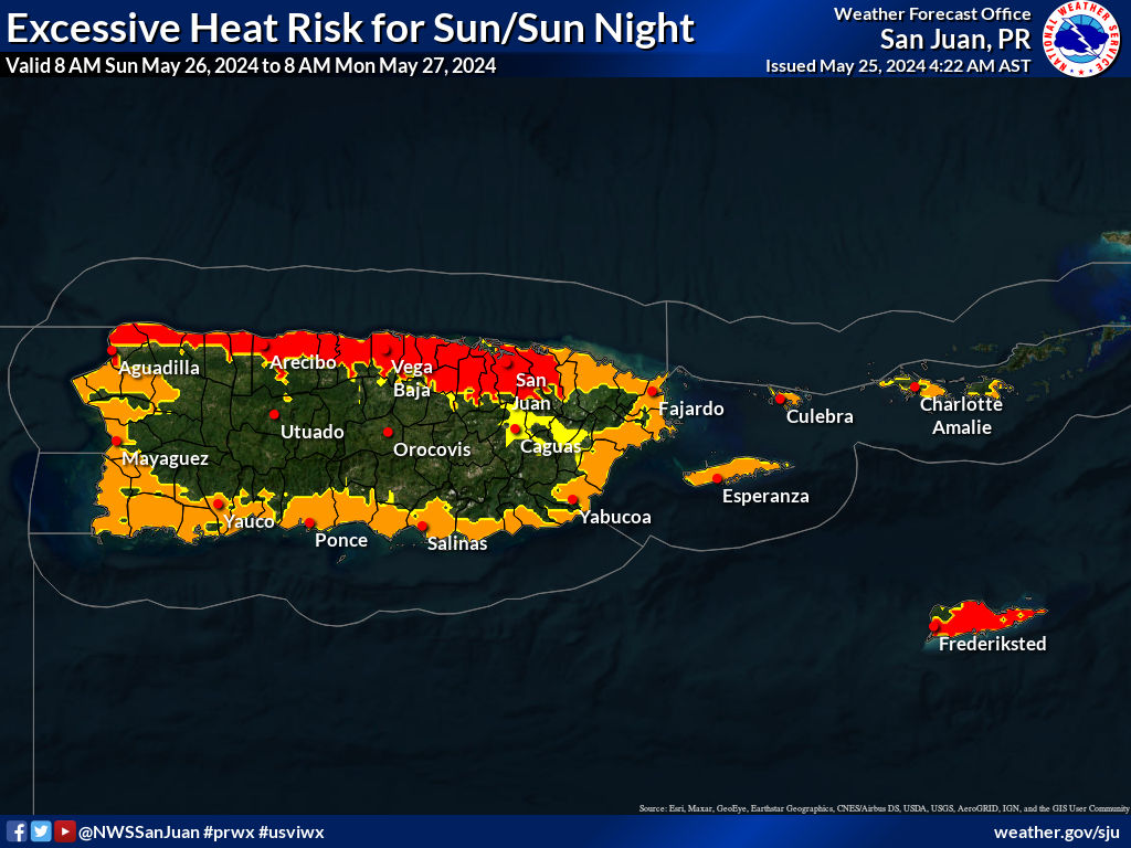
According to the National Weather Service (NWS) in San Juan, Puerto Rico, Sunday will be mostly sunny and warm, with isolated showers. The high temperature will be approximately 88°F, 31.1°C, with winds out of the east at about 14 mph. The Heat Index will be high, and staying hydrated and cool is essential. The chance of rain on Sunday is approximately 20 percent. Please remember that the ground is very saturated; additional rain could lead to flash flooding or mudslides.
Sunday night will be mostly cloudy, with scattered showers and thunderstorms. The low temperature will be approximately 82°F, 27.7°C, with winds out of the east at about 9 to 14 mph. The possibility of rain on Sunday night is roughly 60 percent.
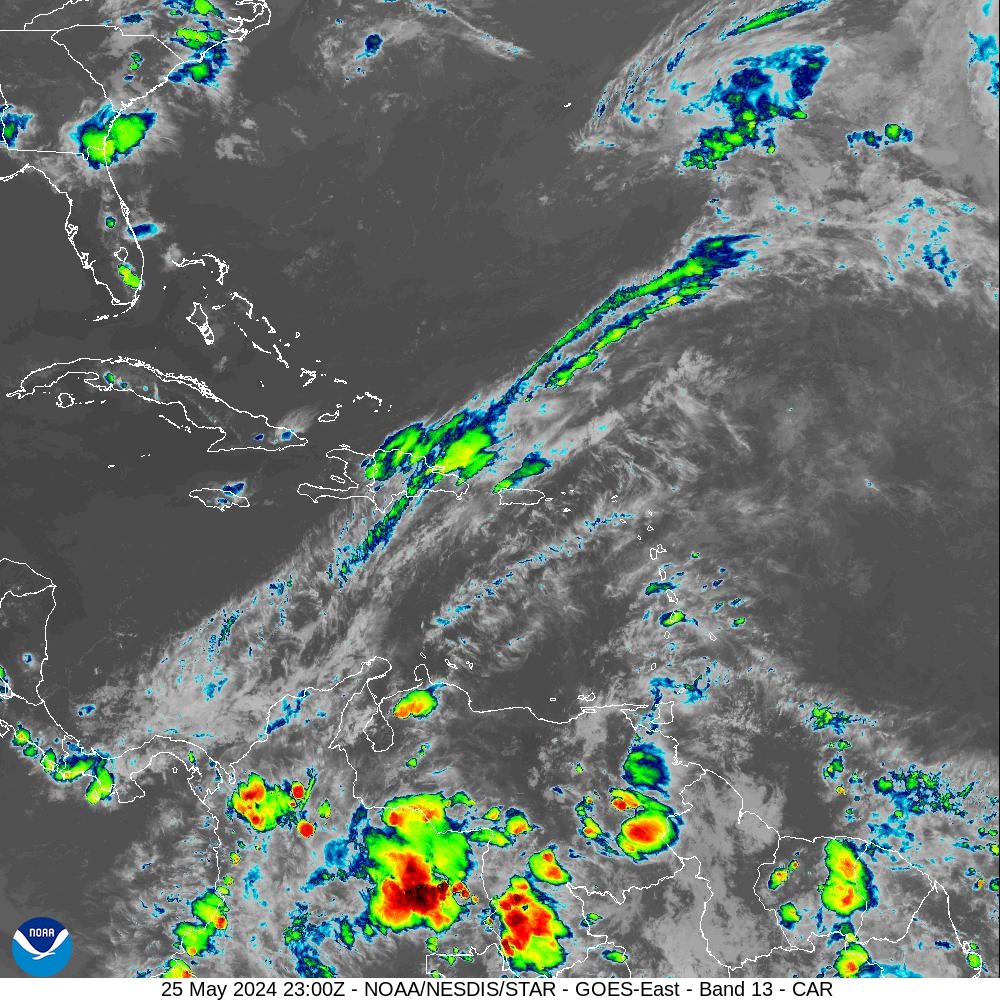
Below: Infrared satellite imagery obtained at 7:00 p.m. AST on Saturday indicates a mostly cloudy sky with rainfall around the USVI and Puerto Rico.
MARINE WEATHER UPDATE
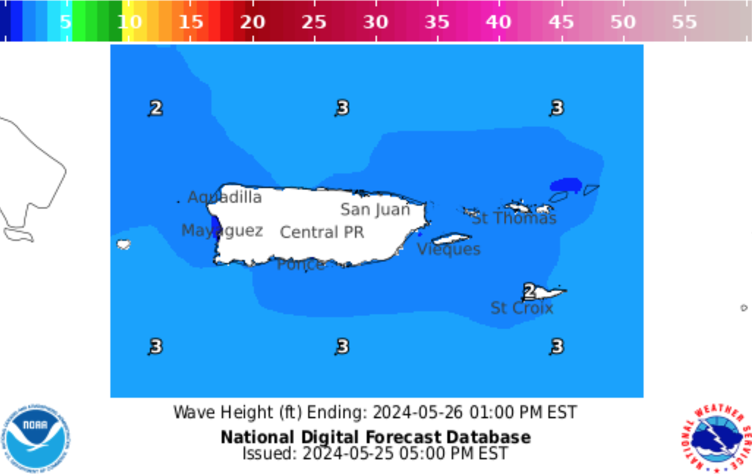
On Sunday, the seas will be approximately 2 feet. Winds will be out of the east at about 10 to 15 knots.
On Sunday night, the seas will be approximately 2 feet. Winds will be out of the east at about 10 knots.
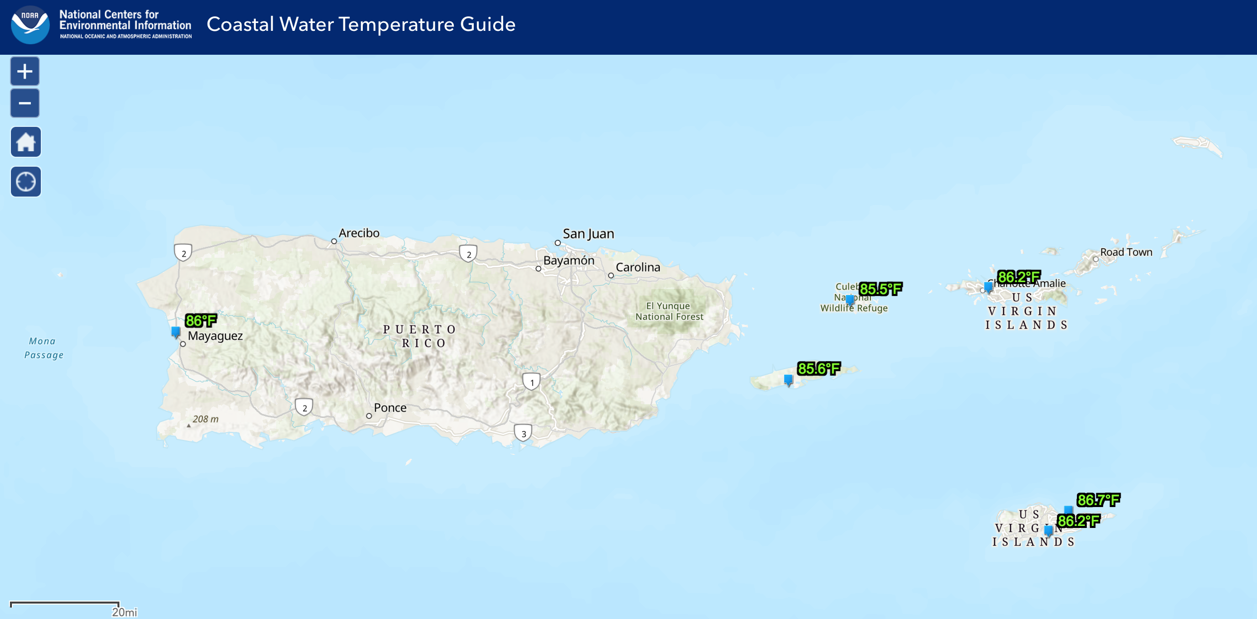
The water temperature is approximately 85-86°F, approximately 30°C.
Ocean Water Temperature Map from 5/24/24, courtesy of NOAA:
Wave Height Forecast Map courtesy of NWS:
HAZARDOUS CONDITIONS
Rip Currents: The risk of rip currents is projected to be low across most of the region on Sunday. A slightly higher risk of rip currents is possible across portions of St. Croix.
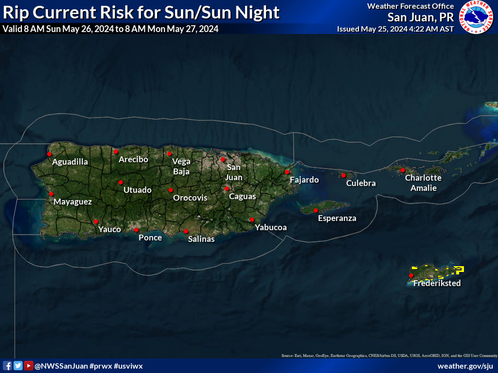
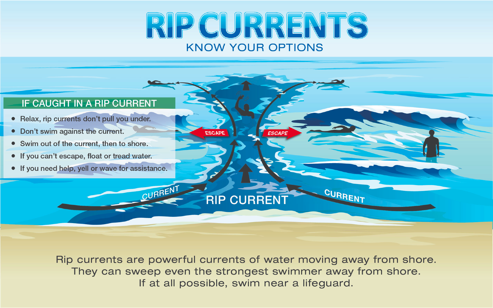
Learn more about rip current safety in an interview between the NWS and the VI Source here.
TROPIC WATCH
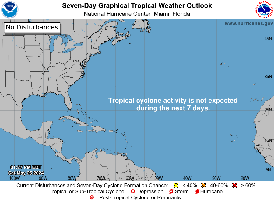
Tropical Activity: The National Hurricane Center does not expect any cyclone development over the next 7 days.
NEW Article: NOAA Forecasts Above-Average 2024 Hurricane Season, Expects High Number of Named Cyclones
Click here to learn tips on being prepared for the 2024 Atlantic Hurricane Season.
Days Until 2024 Atlantic Hurricane Season: 6 Days
OBSERVATIONS
Sunrise: 5:45 a.m.
Sunset: 6:51 p.m.
Ocean water temperature: Approximately 85-86°F, approximately 30°C.
UV index: 10+ out of 10 (VERY HIGH)
Saturday’s high temperature: 87°F, 30.5°C
Saturday’s low temperature: 82°F, 27.7°C
Preparation for extreme weather events in the Caribbean, such as earthquakes and tropical cyclones, is important. Residents and visitors in the USVI are encouraged to stay updated on weather events on the V.I. Source Weather page and sign up for alerts from the National Weather Service and the Virgin Islands Territorial Emergency Management Agency.


