

The National Hurricane Center is monitoring Tropical Depression Two over the northeastern Gulf region, threatening parts of the northern Gulf Coast with heavy rain, gusty winds, and possible travel disruptions. The storm poses no threat to Puerto Rico or the U.S. Virgin Islands, where worsening drought remains the more immediate concern.
Tropical Depression Two
The NHC continued issuing advisories Monday afternoon for Tropical Depression Two as the system moved slowly over the northeastern Gulf. As of 5 p.m. AST on Monday, the depression was located approximately 105 miles south of Panama City, Florida, with maximum sustained winds of 35 mph. It was moving northwest at 3 mph and was expected to strengthen into a tropical storm by Tuesday, although the system is battling wind shear.
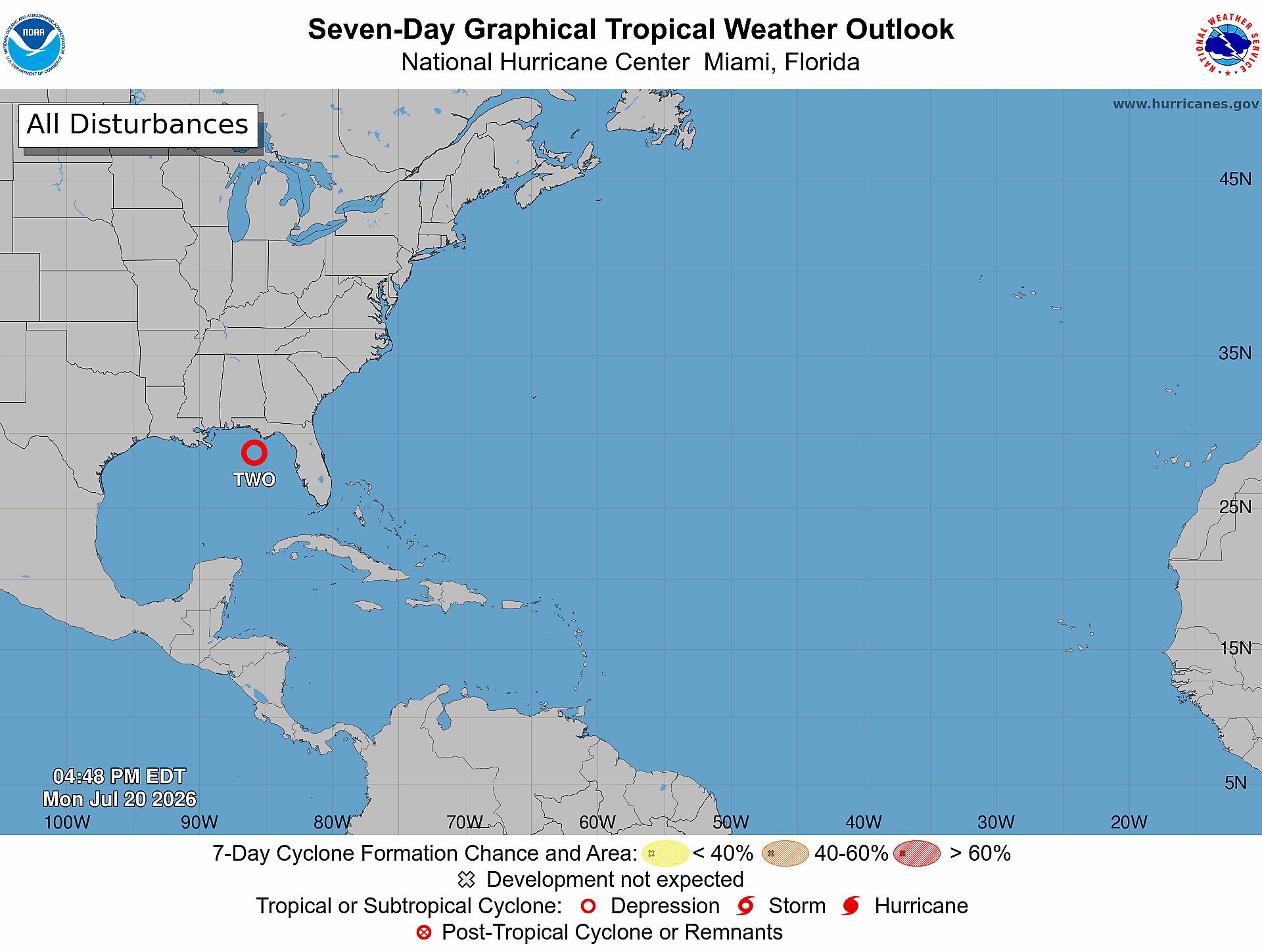
If the disturbance intensifies and is upgraded to a tropical storm, it will be designated “Bertha,” the second named storm of the 2026 Atlantic hurricane season.
Tropical Depression Two is expected to move near or along the Gulf Coast during the next several days. Forecasters warned that tropical storm conditions could affect portions of the Florida Panhandle and Alabama before the system moves generally westward toward Mississippi, Louisiana, and eventually Texas. Tropical storm and storm surge watches were in effect for portions of the Gulf Coast.
The NHC said that the system is forecast to produce two to four inches of rain, with isolated totals around six inches from Western Florida to the middle Texas coast through Friday. Flash flooding will be possible, particularly in urban areas. Storm surge, rough surf, and dangerous rip currents are also concerns along portions of the Gulf Coast.
The tropical depression will not affect weather in the northeastern Caribbean. However, travelers along the northern Gulf Coast should monitor airline notices, road conditions, and information from local National Weather Service offices.
Aside from Tropical Depression Two, as of Monday, the NHC is not monitoring any other areas in the Atlantic basin for potential tropical development.
The latest Global Tropics Hazards Outlook, released on July 14 by NOAA’s Climate Prediction Center, looked at the possible tropical forecast from July 22 through Aug. 4. As the Source recently reported, the outlook said the chances of tropical cyclone formation across the Caribbean and tropical Atlantic have increased compared with previous forecasts. However, confidence remains low, because the ongoing El Niño continues to contribute to a generally hostile environment for development across the basin.
Local Rain Chances Increase Slightly
The National Weather Service in San Juan, Puerto Rico, said that Monday began relatively dry, but a more unsettled weather pattern is expected Tuesday and Wednesday. A heat advisory was issued Monday for portions of Puerto Rico and the U.S. Virgin Islands, and additional heat advisories or even extreme heat warnings may be needed this week.
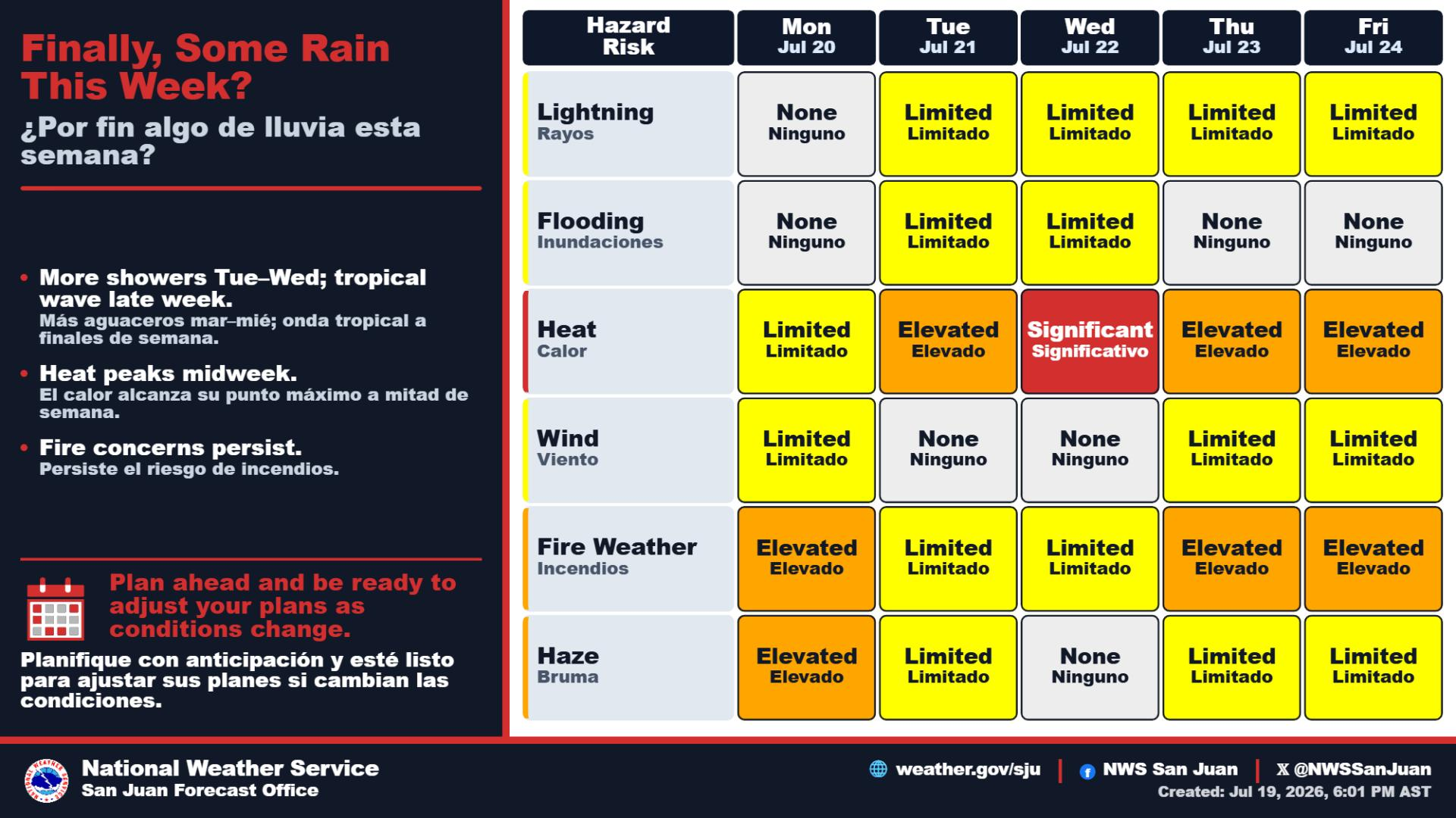
While instability is expected to increase on Tuesday as a trough of low pressure moves across the northeastern Caribbean, most of the activity is forecast across Puerto Rico. Still, passing showers may also reach portions of the U.S. Virgin Islands, and low to moderate amounts of Saharan dust are anticipated to affect the area during the second half of the week and into next week.
“A transition to a more unsettled weather pattern is expected Tuesday through Wednesday as moisture increases across the region and a trough moves across the area,” the NWS said on Monday. “Showers and isolated thunderstorms will become more likely each afternoon, especially across Western Puerto Rico, with a limited risk of localized urban and small-stream flooding,” the NWS continued.
Any rainfall would be welcome across the region, especially in the U.S. Virgin Islands, which is experiencing extreme drought, and across drought-stricken portions of Puerto Rico.
The Source contacted Emanuel Rodríguez-González, service hydrologist and meteorologist at the NWS in San Juan, for more information about the exceptionally dry weather across the islands. Rodríguez-González told the Source that any rainfall in the coming days, unfortunately, is unlikely to provide meaningful drought relief.
“A tropical wave will reach the islands tomorrow, which will bring a light to modest increase in showers,” Rodríguez-González said on Monday. “However, I’m not expecting any improvements from these rains,” he added.
“The chances of showers are better around July 26 and July 29, and some showers should reach the Virgin Islands at times,” Rodríguez-González stated.
Extreme Drought Develops Across USVI
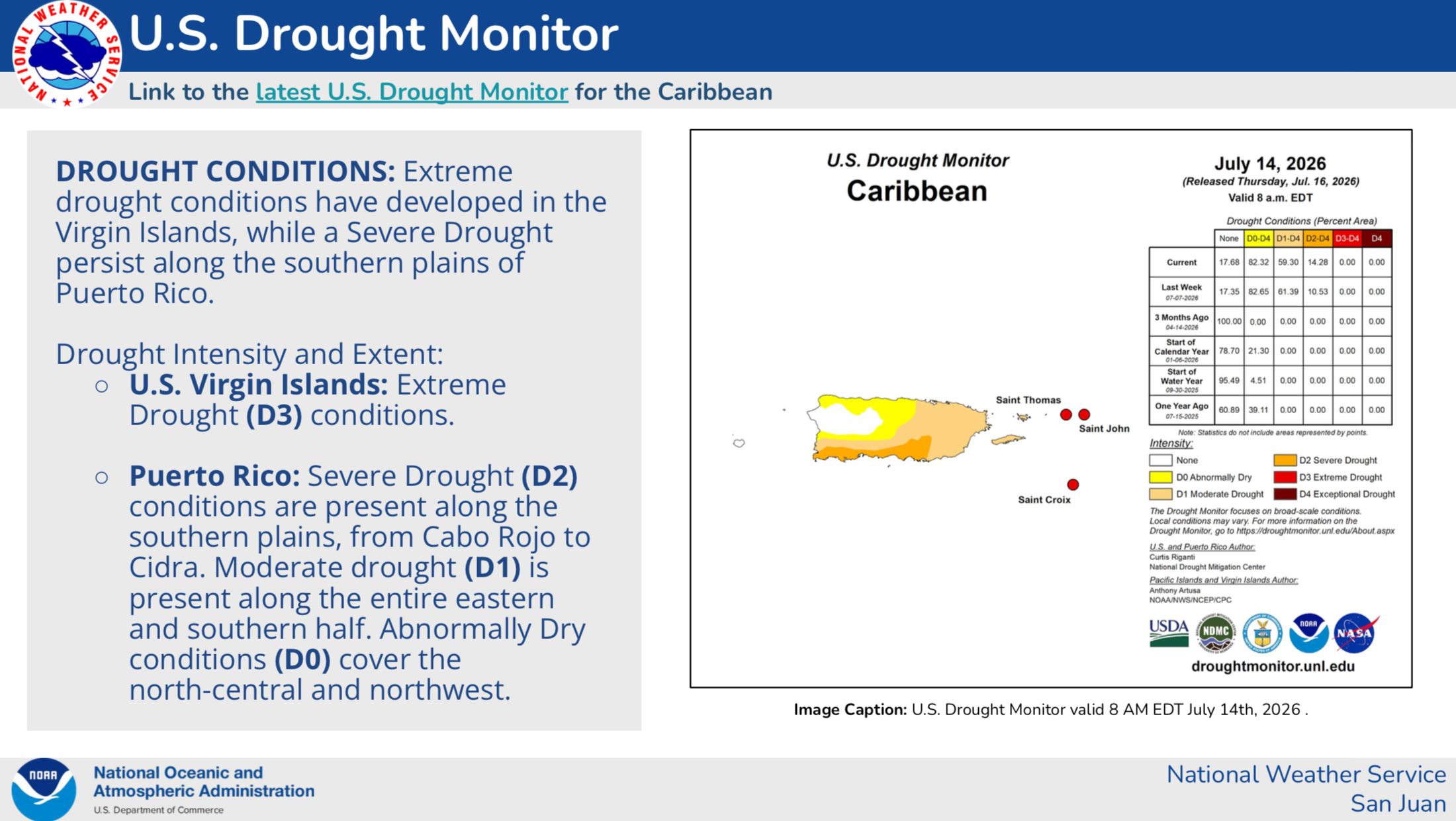
A Drought Information Statement issued on Friday by the NWS confirmed that extreme drought (D3), the second-highest category used by the U.S. Drought Monitor, has developed across the U.S. Virgin Islands.
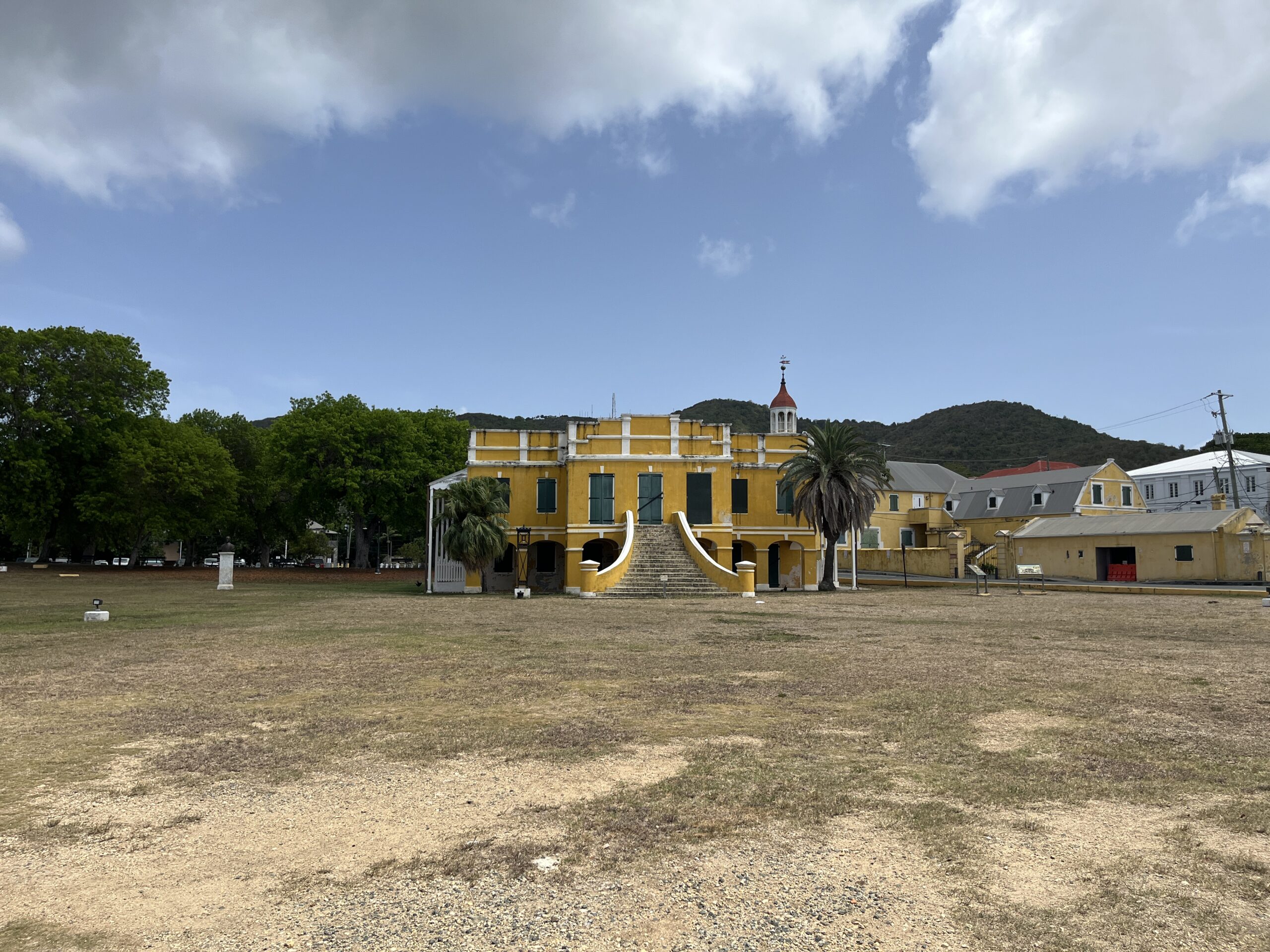
The drought report noted that Puerto Rico is also experiencing very dry conditions.
“Severe Drought (D2) conditions are present along the southern plains, from Cabo Rojo to Cidra. Moderate drought (D1) is present along the entire eastern and southern half. Abnormally Dry conditions (D0) cover the north-central and northwest,” the drought statement said.
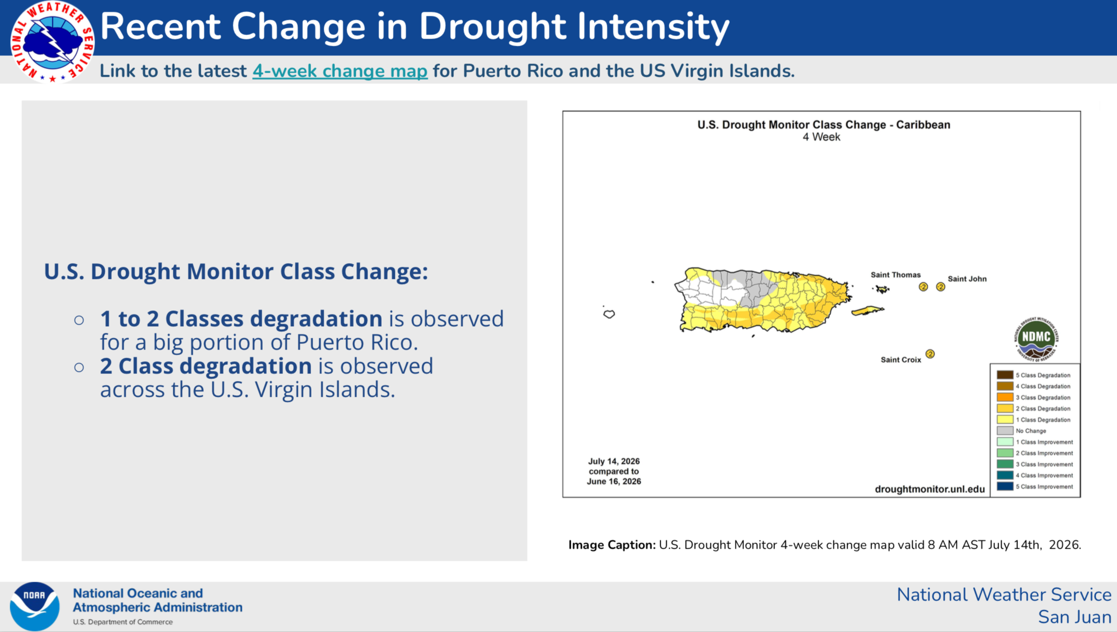
The update pointed to a two-category deterioration across the U.S. Virgin Islands during the previous four weeks. Nearly all of the weather observation stations monitored by the NWS Cooperative Observer Program and the Community Collaborative Rain, Hail and Snow Network across Puerto Rico and the territory have recorded below-normal rainfall during the past 60 and 90 days.
Rodríguez-González explained that the main reason the Virgin Islands entered D3 classification was due to objective data from the airports, rainfall being below-normal, and stressed vegetation observed by satellite imagery.
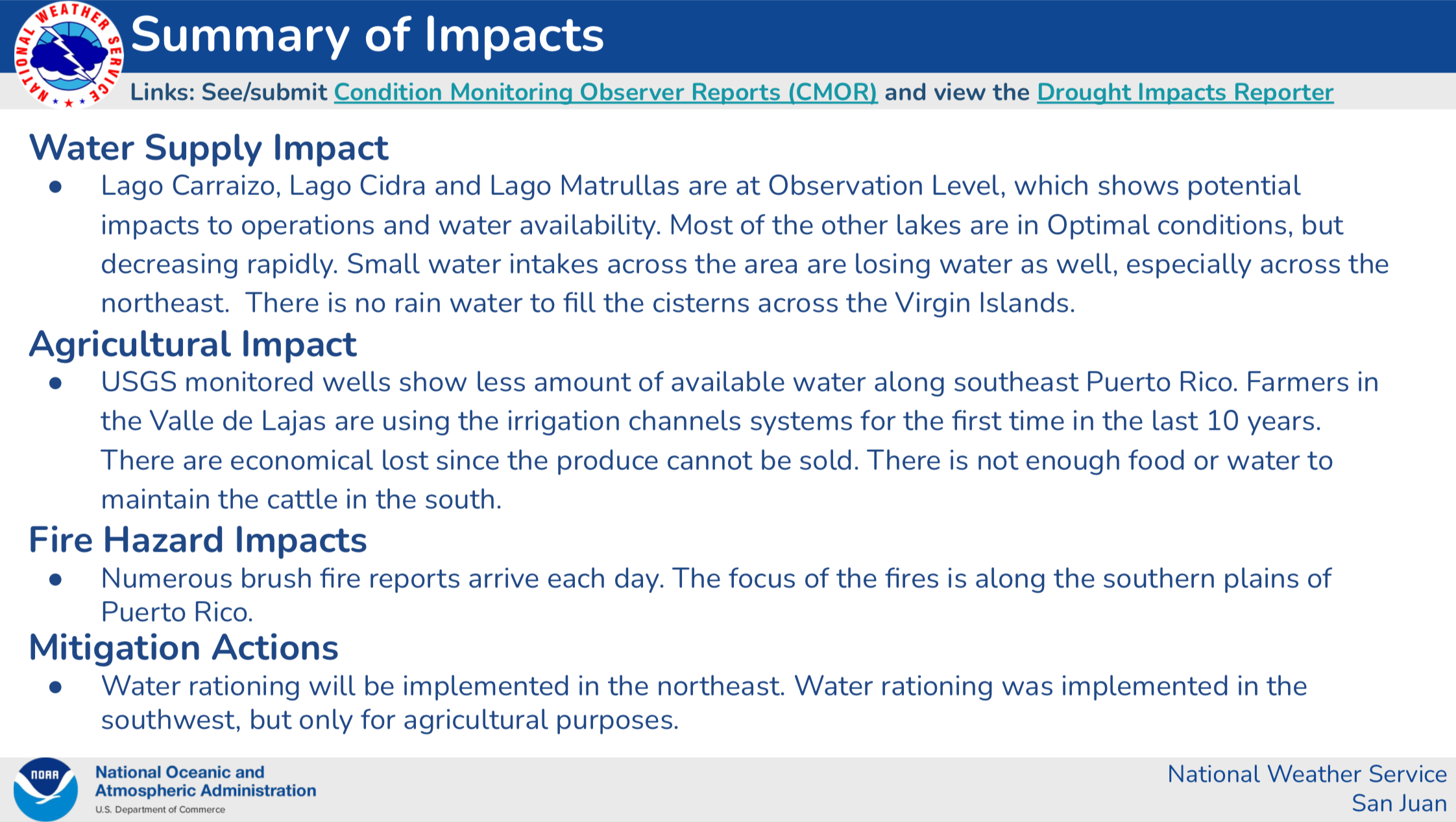
Reports submitted to drought observers have also described insufficient rainwater to replenish household cisterns. Dry vegetation may increase the possibility that brush fires can ignite and spread quickly.
Below-Normal Rainfall Conditions May Continue
The drought statement noted that NOAA’s longer-range outlook favors below-normal precipitation across the northeastern Caribbean through at least early August. A separate climate model forecast indicated a greater than 70% chance of extreme below-normal precipitation between August and October.
“Ultimately, climate models still predict below-normal precipitation stretching into the winter months,” Rodríguez-González emphasized.
Rodríguez-González said a new NIDIS/NOAA drought report is scheduled to become available Thursday.
Local Updates
Although there is no immediate tropical cyclone threat to Puerto Rico or the U.S. Virgin Islands, residents and visitors across the islands are encouraged to continue monitoring updates throughout the hurricane season.
Information regarding the weather conditions across the USVI is available from the NWS, the NHC, and NOAA. Additionally, the local forecast is regularly updated on the Source Weather Page, and a weekly video forecast is available.
Residents and visitors can also view weather alerts and disaster preparedness information from the Virgin Islands Territorial Emergency Management Agency.