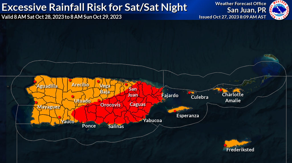
An unsettled weather pattern is forecast to create the potential for heavy rainfall this weekend and into next week. There is a possibility for flash floods and mudslides across the region, and multiple weather alerts are in effect for both the USVI and Puerto, including flood watches.
“Wet and unstable weather conditions along with hazardous marine and coastal conditions [are] expected through at least early next workweek,” according to a Friday afternoon update from the National Weather Service in San Juan, Puerto Rico.
“Due to the rainfall expected today onwards, there is an elevated risk for flooding of urban areas, roads, and small streams. Life-threatening flash flooding and mudslides are possible as well,” the update continued.
The forecast calls for the possibility of three to six inches of rain across the USVI and Puerto Rico, with locally higher amounts of up to eight inches.
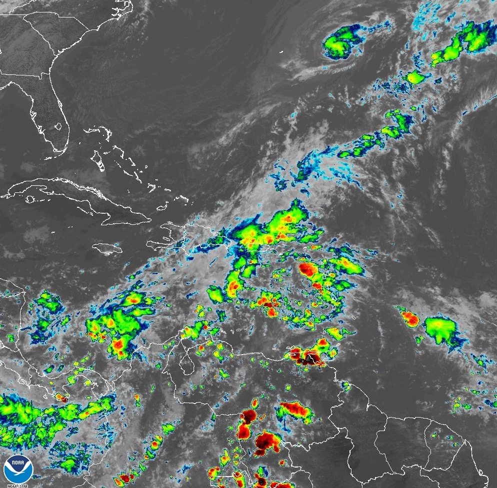
Several weather features are causing the current and unsettled weather pattern, including a tropical wave expected to pass through the area, as well as the continued influence of Tropical Storm Tammy, which is located far to the north of the local islands.
“Plenty of tropical moisture and favorable upper-level conditions will bring periods of showers and thunderstorms across the local islands through at least Tuesday. However, wet conditions are possible Wednesday through Friday next week,” the NWS explained.
Hazardous Seas Expected to Continue
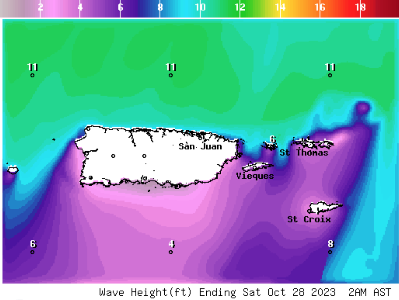
In addition to the potential for rain, the waters surrounding the local islands will remain choppy this weekend and next week. Northerly swells are expected to create wave heights between eight and 12 feet, along with an elevated risk of rip currents.
Several marine weather alerts are in effect across both U.S. territories, including a “High Surf Advisory,” a “High Rip Current Risk,” as well as a “Small Craft Advisory.” There will be a possibility of some coastal flooding.
“Beachgoers should avoid the Atlantic Coastline in Puerto Rico and the U.S. Virgin Islands due to hazardous coastal conditions. Coastal flooding during high tide hours has already been reported. Tides will be higher on Saturday morning,” according to a marine weather update from the NWS on Friday.
Severe Weather Updates
Extreme weather, including flash floods, mudslides, and rip currents, can quickly become extremely dangerous. Residents and visitors in Puerto Rico and the Virgin Islands are encouraged to stay updated about the weather, including severe weather alerts, from the Virgin Islands Territorial Emergency Management Agency (VITEMA) website and the National Weather Service.
Additionally, the weather forecast is published daily on the Source Weather Page.

