The National Weather Service has noted that a tropical wave will pass near Puerto Rico and the U.S. Virgin Islands early this week, resulting in the potential for heavy rain across the islands. Additionally, very warm temperatures are forecast to continue.
“As a tropical wave approaches the islands from the southeast and a broad surface trough [an area of low pressure] develops west of the region, we can expect a gradual increase in moisture content for the rest of the short-term period,” according to an update from the NWS on Sunday.
After the tropical wave passes, an unstable weather pattern is anticipated to continue through the middle of the week, and there will be an abundance of moisture around the islands. The soils across the islands are very saturated, and additional rainfall may increase the risk of flash flooding and mudslides.

Flash Flood and Mudslide Safety
Individuals across the region may be caught off-guard during a flash flood, including while driving in a vehicle, as described in a Source article regarding flash flood safety. If flooding occurs while driving, the NWS offers the following tips to stay safe.
“Never drive your car into water of unknown depth. Most flash flood deaths occur when people drive their vehicles into flood waters. Remember: Turn Around, Don’t Drown,” the NWS advised.
In the event of a mudslide or a landslide, the United States Geographical Survey recommends remaining alert and as far away from a debris flow as possible. Additional safety advice is available on the USGS official website.
Hot Temperatures
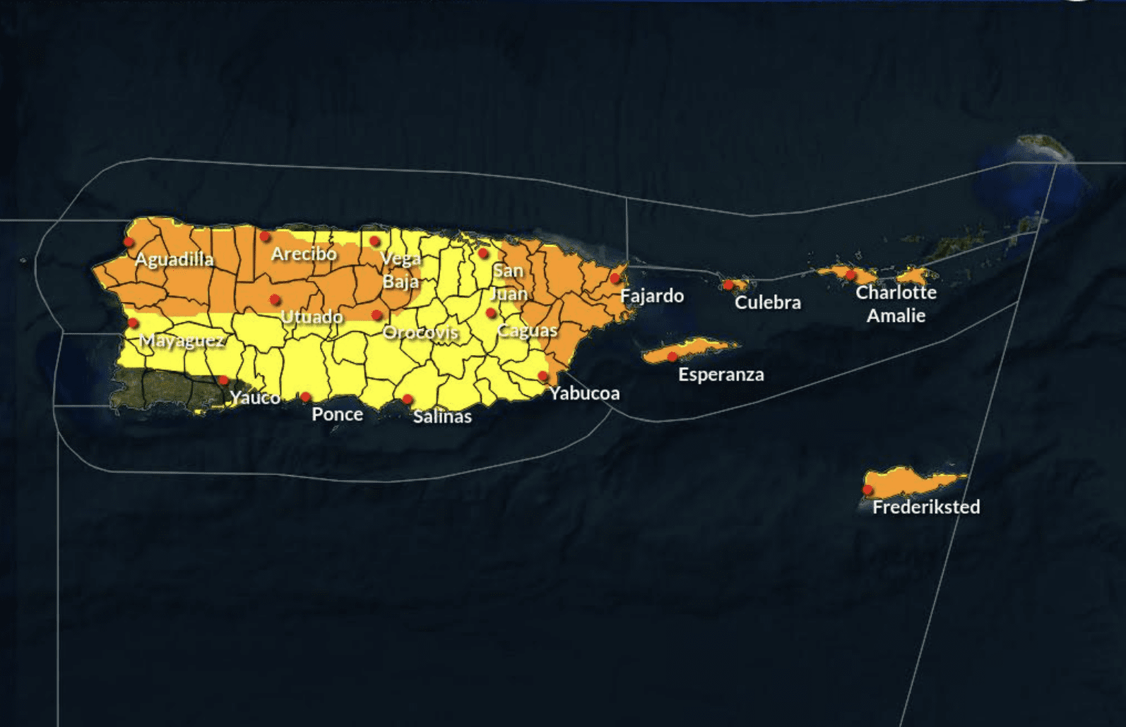
The USVI and Puerto Rico will face more sweltering temperatures this week, and Heat Advisories or Heat Warnings may be issued. The NWS also warned that the Heat Index, defined as “what the temperature feels like to the human body when relative humidity is combined with the air temperature,” may remain very high throughout the week. The NWS said that in addition to the possibility of more rain and hot weather, Saharan dust may be prevalent in the atmosphere over the next few days.
“A weak Saharan Air Layer remains over the area, leading to a combination of haze and increasing humidity,” the NWS said on Sunday. “This weather pattern will contribute to warm to hot temperatures, and heat indices are expected to reach Heat Advisory criteria, [especially] along the southern, western, and northern coastal and urban areas of Puerto Rico and St. Croix.”
As noted in a previous Source article regarding extreme heat across the USVI, excessive heat can be hazardous to the human body. When the body overheats, illnesses such as heat stroke and heat exhaustion are possible, and remaining hydrated and cool is essential.
Weather Updates
Weather conditions are projected to improve at the end of the workweek as an area of high pressure is forecast to settle over the region.
USVI residents are reminded that the 2024 Atlantic Hurricane Season officially began on June 1. Weather forecast information, including severe weather alerts, is available from the Virgin Islands Territorial Emergency Management Agency website and the National Weather Service.
The Source Weather Page also publishes a daily weather forecast, where readers can view weather forecast videos and disaster preparedness video segments.


