78.5 F
Charlotte Amalie
Friday, April 26, 2024
HomeNewsLocal newsUpdate: Flash Flood Warning Remains as Karen Heads North

Update: Flash Flood Warning Remains as Karen Heads North

6 p.m. satellite photo shows Tropical Storm Karen directly over St. Croix and heading north. (NOAA photo)

A flash flood watch is in effect in the U.S. Virgin Islands through Wednesday night as Tropical Storm Karen moves slowly away from the islands.

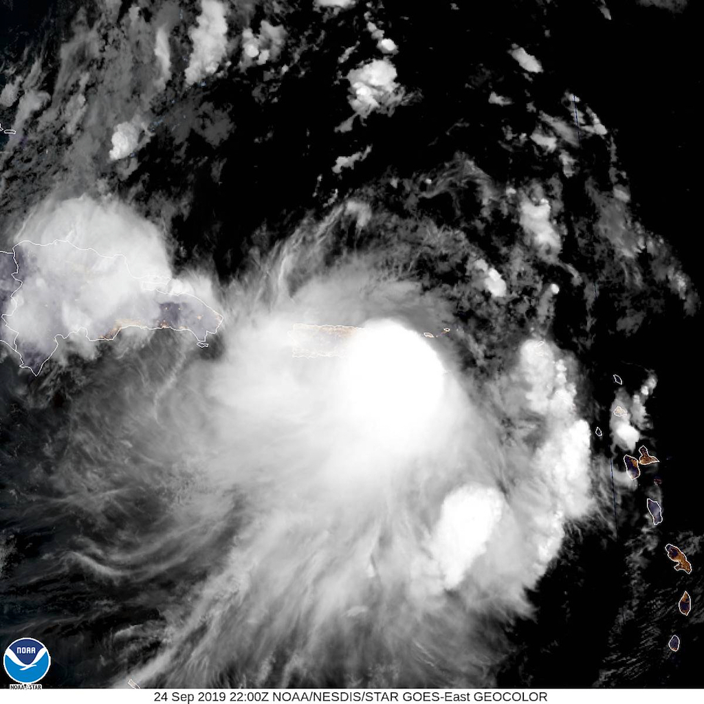
The 5 p.m. Tuesday National Hurricane Center advisory estimated Tropical Storm Karen to be 70 miles west-northwest of St. Croix. The storm is moving to the north at eight miles per hour. Top winds are at 45 miles per hour. Tropical storm force winds extend outward up to 80 miles mainly to the southeast of the center.

The Virgin Islands remain under a tropical storm warning, and wind gusts of tropical-storm force were reported in the territory Tuesday afternoon.

According to the NHC, tropical-storm force winds will continue to affect the territory through midnight. Peak wind gusts of 39 to 40 miles per hour will be felt across the territory from 6 p.m. to 9 p.m.

Tropical Storm Karen is expected to produce rainfall accumulation totals between two and four inches, with the possibility of isolated rainfall amounts to eight inches.

Print Friendly, PDF & Email
Keeping our community informed is our top priority.
If you have a news tip to share, please call or text us at 340-228-8784.

Support local + independent journalism in the U.S. Virgin Islands

Unlike many news organizations, we haven't put up a paywall – we want to keep our journalism as accessible as we can. Our independent journalism costs time, money and hard work to keep you informed, but we do it because we believe that it matters. We know that informed communities are empowered ones. If you appreciate our reporting and want to help make our future more secure, please consider donating.

UPCOMING EVENTS

UPCOMING EVENTS