Helenites SC and Raymix FC notch decisive wins as league title races heat up on St. Croix and St. Thomas. (Source file photo)
St. Croix and St. Thomas teams battle for league supremacy in weekend matches.
Helenites SC delivered another devastating blow to Prankton SC on Sunday afternoon, cruising to an 8-0 victory at Bethlehem Soccer Complex on St. Croix in what marked their second dominant performance against their winless opponents this season.
The result maintains the tight race atop the St. Croix standings, where both Helenites SC and Champion Athletic Performance Academy sit level on nine points, though Champion Athletic holds the edge having played fewer matches.
RaeJae Joseph was the star of the afternoon, recording a commanding hat trick with goals in the 11th, 29th, and 40th minutes. The forward’s clinical finishing overwhelmed Prankton goalkeeper Andre Thomas, who had previously endured a 10-0 defeat from Helenites back in June.
Cleus Oville extended the lead to 4-0 just three minutes after Joseph’s third goal. Joseph added another before halftime to make it 5-0 at the break.
The second half saw continued dominance from Helenites, after a series of substitutions and disciplinary issues that resulted in yellow cards for both sides. Calvin Medcalfe found the net to make it 6-0, before Wodlin Basquin scored in the 83rd minute. Medcalfe capped off the scoring with the eighth goal in stoppage time.
Helenites goalkeeper Denali Nicholas maintained a clean sheet as Prankton struggled to create meaningful chances throughout the match.
Meanwhile, on St. Thomas at Ivanna Eudora Kean High School, Raymix FC secured a crucial 2-0 shutout victory over LRVI FC in what proved to be a hard-fought defensive battle.
The match remained scoreless through the first half despite both teams creating opportunities. Raymix squandered several scoring chances, while LRVI FC missed a crucial penalty kick that could have given them control of the match.
The game’s turning point came in the second half when LRVI FC was reduced to 10 men following a red card for shoving, leaving them to battle uphill for the remainder of the contest.
Capitalizing on their numerical advantage, Raymix finally broke through with 12 minutes remaining. In a surprising twist, it was captain Marco Emile — typically a defender — who opened the scoring with a corner kick. Wood Pierre sealed the victory with a second goal in the 87th minute.
The win keeps Raymix in second place in the St. Thomas standings with seven points, trailing leaders New Vibes SC, who have accumulated 12 points from their matches, while LRVI FC remains at the bottom with just one point.
Current Standings
St. Croix:
Champion Athletic Performance Academy — 9 points
Helenites SC — 9 points
Rovers SC — 6 points
Prankton SC — 0 points
St. Thomas:
New Vibes SC — 12 points
Raymix FC — 7 points
Massey SA — 3 points
LRVI FC — 1 point
The league action continues Aug. 24 with Prankton SC vs. Champion Athletic PA on St. Croix and Raymix FC vs. Massey SA on St. Thomas.
The family of the late Delores Cipriani is saddened to announce her passing on August 10, 2025.
Delores Cipriani
Delores was preceded in death by her five sisters and one brother.
She is lovingly remembered by her devoted husband, Enesico Cipriani.
She leaves behind her cherished children, Sons: Dennis Brown, Anton Brown, Quinton Santana, Daughters – Lahana Santana, Delia Clark Ali, Liz Rivera. She is also survived by her beloved brothers: Pedro, Eddy, and Herbert Brown; Sisters-in-law: Bernadine V., Linette Kuss, Annette Mongal; Brothers-in-law: Jerome, Ruben, and Lawrence Cipriani;
Cousin: Gregory Rampersad.
Many other relatives and friends, too numerous to mention, join the family in mourning her loss and celebrating her life.
Her memory will live on in the hearts of all who knew and loved her.
Her funeral service is scheduled to be held on Friday, August 15, at Divine Chapel, 129 Peter’s Rest, viewing at 10 am, service at 11 am.
The Magens Bay Authority announces that swimming at Lindquist Beach is once again temporarily closed following another significant wave of sargassum seaweed blanketing the shoreline and nearshore waters. This is the second such closure in recent weeks, as persistent sargassum influxes continue to affect the area.
Sargassum seaweed blankets the shoreline at Lindquist Beach, prompting a temporary ban on swimming. (Photo courtesy Magens Bay Authority)
While Lindquist Beach remains open for walking and other recreational land-based activities, the public is strongly advised against swimming due to compromised water quality and potential health concerns.
Sargassum is a floating brown seaweed that occurs naturally in the Atlantic Ocean. However, the Caribbean region has experienced an increase in both the frequency and volume of sargassum landings in recent years, believed to be influenced by shifting ocean currents, nutrient levels, and climate conditions. Although non-toxic, large accumulations can produce unpleasant odors, disrupt marine ecosystems, and create safety hazards for swimmers.
The Magens Bay Authority will continue monitoring conditions closely and will reopen the beach for swimming as soon as it is safe to do so. We appreciate the public’s patience and cooperation as we work to ensure the safety and enjoyment of all beachgoers.
We appreciate your understanding and cooperation as we work to ensure the safety and enjoyment of all beachgoers.
For ongoing updates, please visit www.magensbayauthority.org or follow us on our official Facebook and Instagram pages.
Due to the projected impact of Tropical Storm Erin on the U.S. Virgin Islands, the Virgin Islands Territorial Emergency Management Agency, in partnership with the Virgin Islands Fire and Emergency Services, the Department of Public Works, the Office of ADA Coordinator, and the Department of Human Services, has accelerated the territory-wide sandbag distribution program. While the exact impact of Tropical Storm Erin remains uncertain at this time, VITEMA is taking proactive measures to ensure all residents have access to critical hurricane preparedness resources before the storm’s arrival.
A projection of the storm’s path.
This accelerated distribution represents the only sandbag distribution for the 2025 hurricane season, and we strongly encourage all residents to take advantage of this opportunity to protect their homes and property.
Revised Distribution Schedule
General Public Distribution:
Fire Stations
Dates: Aug. 14, 15, and 16
Time: 8 a.m. — 3 p.m.
Requirements: Bring identification and your own shovel
Call-in Dates: August 11-14th, 2025 from 9:00 AM-3:00PM
Delivery Dates: August 18-19th, 2025
St. Croix District: 340-718-2980
St. Thomas/St. John District: 340-473-1848 or 340-998-3571
Due to the accelerated timeline and short notice, all partner agencies will do their best to deliver sandbags to as many individuals as possible. However, we strongly encourage the Access and Functional Needs and Aging Community to seek assistance from neighbors, family members, and community support networks to obtain sandbags during the general distribution period.
Distribution Locations
Water Island
Date: September 6, 2025
Provided by: Department of Public Works
Times: 08:30 AM (Barge Dock, Water Island)
Note: On Saturday, August 16, only fire stations will be open for distribution.
Due to the short notice period, the scheduled Water Island distribution cannot be accommodated before the storm’s arrival. We strongly encourage Water Island residents to travel to either St. Thomas or St. John to obtain sandbags during the general distribution period.
St. Croix
Department of Public Works Estate Anna’s Hope, Department of Public Works Concordia Site, Cotton Valley Fire Station, and Grove Station Fire Station.
St. Thomas
Department of Public Works Sub Base Operations Yard, Fortuna Fire Station, Tutu Fire Station, and Omar Brown Fire Station.
St. John
Department of Public Works Susannaberg and Coral Bay Fire Station.
For more information about hurricane preparedness and emergency management resources, visit VITEMA.VI.GOV.
VITEMA reminds all residents to stay informed about Tropical Storm Erin’s development and to follow all emergency preparedness guidelines. Monitor local weather updates and be prepared to take additional protective measures as the storm approaches.
The family of the late Maria Colon-Ortiz is saddened to announce her passing on July 27, 2025.
Maria Colon-Ortiz
She was preceded in death by her husband, Genaro Ortiz; her son, Genaro Ortiz Jr.; her daughters, Luz Rivera and Aurelia Torres; and her grandsons, Jose Rodriguez Jr., Jose Torres Jr., and Julio Rivera Jr.
She is survived by her daughter, Maria Ortiz; her sons, Jorge Ortiz and Mario Ortiz; grandchildren: Luis, Alma, Emily, Carolyn, Veronica, Josefa, José, Janet, Virginia, Maryluz, Ruth, Nilda, Delbert, Luz, Angel, Curtis, Jorge Jr., Jessica, Mario Jr., Omar, Alexander, Carlos, Joel, Alex, Lillie, Millie, and Amneris; 44 great-grandchildren; 27 great-great-grandchildren, her brother, Nando Colon; nephews, Eliza, Jose and Carlos Roldan; cousin, Sabina Colon; and brother-in-law, Andre Ortiz.
She will be fondly remembered by special friends: Juana Johnson (Amanda), Carmen (Manu), Glendina Isaac, Avelino (Buli) Romero, Aracelis Rivera, Maria Deleon, Mathilda Ramos, Midin, Diana Cruz, Anamery Cruz, Suzie Solomon, Julio & Mayra Davis, Baltazar Felix, Jose Torres, Rafael & Marisol Rivera, Comay Marilyn, and many other family and friends too numerous to mention.
Family and friends viewing will be held on August 21, 2025, at Divine Chapel, 129 Peter’s Rest between 3pm-5pm.
Funeral Services is scheduled to be on August 22, 2025, at St. Joseph Catholic Church, Viewing 9 a.m., service 10 a.m.
Interment follows Kingshill Cemetery.
In celebration of Maria’s life, the family request to wear bright and pastel colors
The picturesque Charlotte Amalie waterfront set the stage Sunday for the Second Annual Rock City Road Race, presented by the Virgin Islands Cycling Federation and hosted by Left Lane Cyclers VI, a group of avid and competitive St. Thomas cyclists. The event blended fierce competition with camaraderie, music, and refreshments, creating an energetic community atmosphere.
(Submitted photo)
The roughly 6-mile course began on Veteran’s Drive near the police station, heading west to Crown Bay, looping back through the historic district to Yacht Haven, and returning to the start. Its central location offered prime viewing for spectators. Racers from St. Thomas, St. Croix, and Tortola competed across multiple categories.
The small but powerful Elite field featured the 2024 VI National Road Race Champion, the 2024 BVI National Road Race Champion, and the territory’s top Elite female cyclist. Riders tackled eight laps, totaling 48 miles. On lap six, St. Thomas’s Michael Steimle was forced to abandon due to leg cramps from the high pace. In the final lap of the “battle of the champions”, St. Croix’s Stephen Swanton surged past Calvin Smith to take the win, crossing more than a minute ahead. Robin Seila, the sole female in the field, claimed third with a strong, steady ride.
(Submitted photo)
In the Expert category, the pack stayed together in a tight pace line until the sixth and final lap, setting up a dramatic sprint finish. St. Croix’s Ted Prosper edged out St. Thomas’s Thomas Barrows for the win in the 36-mile race. Joey Swanson repeated his third-place finish from last year.
The Sport category brought several newcomers to racing, keeping the outcome uncertain. Tortola’s Von Alphonso took the gold in a nail-biting finish, with St. Thomas chiropractor Tylur Arvidson claiming silver just one second ahead of his wife, Paige, who earned bronze. All seven riders finished within 10 seconds.
In the 18-mile Masters race, two riders dropped off after lap one. St. Thomas’s Howard Jones launched a decisive attack on the final lap to claim the win. St. Croix’s Nelson Rojas narrowly beat St. Thomas’s Michael Lewis for second place.
(Submitted photo)
The women’s field brought the biggest smiles to the start line. From the first lap, Kate Barrows and Annelia Graham pushed the pace, building a two-minute gap by lap two. Barrows powered away in the final lap for a commanding gold, with Graham in silver and St. Croix’s Enid Francis taking bronze.
Special guest Drew Hairston, born in St. Thomas but now living in North Carolina, competed in the Para Cycling division on his hand cycle. A former Marine Captain, Hairston completed two laps representing the Virgin Islands with pride.
Moe’s Fresh Market and Gas Works Inc. sponsored $2,500 in cash prizes for the top three in each category. Additional support came from Westline Productions, Boyd & Son Construction, Layah’s Vista, All Safe Driving School, Taphus Beer House, Bones Band Instrument Services, TSG Cares, Caribbean Food Service, and Chiropractic Connection.
The next race on the VICF calendar is the Triple Bypass Road Race, set for Sunday, August 10, at 7 a.m., starting and finishing in Sally’s Fancy. For more information, call 340-643-5050.
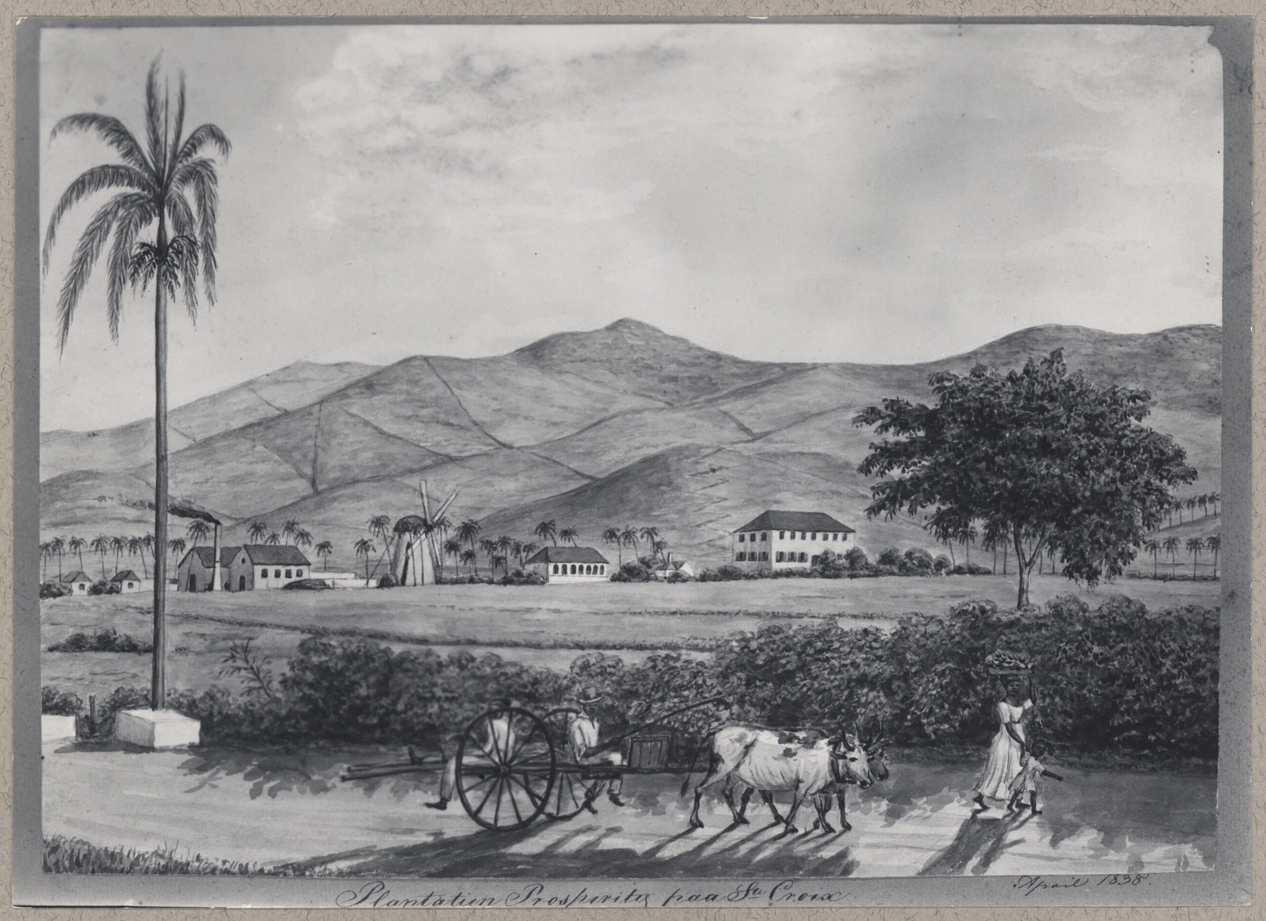
Estate Prosperity, Westend, St. Croix, whose owners were August Boyd, London, 1759; Isaac Markoe, 1770; and Isaac Markoe’s heirs, 1780. (Image courtesy St. Croix Landmark Society Archives)
Recently, Virgin Islanders celebrated the 177th anniversary of Emancipation with parades, festival Village activities, speeches, tramping behind Stanley and the Ten Sleepless Knights, J’ouvert at the St. John Celebration, vendors selling local cuisine and drinks, and entertainment reflecting our culture. It was great to celebrate such an event as Emancipation Day in the Virgin Islands.
Olasee Davis (Submitted photo)
However, when the enslaved laborers (Africans) of the Danish West Indies took their freedom, it didn’t end on July 3, 1848. Hundreds of enslaved laborers were arrested, some were put on trial, others executed, some sentenced, testimonies were heard, interrogations took place, some were acquitted, and looting on some plantations occurred. A massacre even took place in Christiansted that day of emancipation where some slaves were killed and wounded. The aftermath of July 3, 1848 went on for days, months, even a few years.
Katheen D. Dowling’s second book, entitled “Voice Us: The 1848 Executed Eight,” gave us insight into historic documents from the Danish Archives of what happened on July 3, 1848, and after Emancipation Day. These historic documents are not in Dowling’s own words of what she thought happened. They are in the words of slaves, judges, government officials, witnesses, and those that participated in the uprising to free themselves from the physically brutal agricultural system of slavery in the Danish West Indies.
There are so many angles from which I can write about the events that took place after July 3, 1848. Who were those eight enslaved Africans Dowling spoke about in her book that gave the ultimate sacrifice for our freedom 177 years ago? I must say this, many of us take life for granted and have no idea of the great sacrifices our ancestors made for us. I will go a step further by saying the true history of the Danish West Indies has never been told to the people of Denmark. Therefore, they remain ignorant to the brutal slave system that was once managed by the Danish administration, and they remain ignorant of the true source of Danish wealth today.
Furthermore, in many ways, the people of the Virgin Islands know very little of themselves other than they are descendants of slaves, enslaved, “free blacks,” and Maroons. As Virgin Islanders, we owe a gratitude of thanks to Dowling for digging deeper into historic documents, whether it’s from a Danish perspective, or our ancestors’ written testimonies that shed light on our history today.
Montpellier, Prince’s Quarter, St. Croix, whose owners were Francis Crecque, Christopher Mac Evoy and Mathew Farrild, 1758; and John O’ Farrild, 1780. (Image courtesy St. Croix Landmark Society Archives)
Two of eight enslaved Africans who were executed on July 8, 1848, were Big Robert and James Heyliger. Then we had Augustus, Decatur, Friday, and Adam, on July 11, and Martin Jim and John Simmons who were executed on July 15, 1848. From reading the historical documents of Capt. Carl Irminger, he was a heartless man. He was the one that declared martial law on St. Croix on July 5, 1848. Believe me, if he had his way, he would have killed thousands of enslaved laborers on St. Croix. He ordered the Danish soldiers to “shoot down enslaved Africans imprisoned with their hands tied behind their backs.”
Dr. Victor Prosch, the physician at that time, examined each case to verify the death of the men. Big Robert was from Mannings Bay, a south shore estate on St. Croix. Robert’s testimony explained his whereabout during July 3, 1848, and after. James Heyliger, a resident of Estate Enfield Green, also on the south shore of St. Croix and not far from Estate Mannings Bay, also explained his whereabouts during the insurrection of July 3, 1848.
Friday, another enslaved laborer, was arrested and was from Plantation Castle. “And he explained that he was not in the city last Monday, but he had been in the schoolhouse at Diamond, where Mr. McFarlane admonished him,” noted Friday in his testimony. Augustus, who was from Estate Concordia, explained in his testimony that he heard “… negroes had decided that they would not work as slaves anymore.”
Decatur was from Estate Lower Bethlehem, which is in the central plain of St. Croix. Concerning his arrest, Francis Newton said that Decatur wanted to attack Castle Plantation. When Decatur was chased away from the plantation property, he threatened to come back at night and light the place on fire. Adam, another arrestee from Estate Rose Hill on the northwest side (Maroon Country) of St. Croix, admitted setting fire to sugar cane land.
John Simmons, another arrestee from Estate Big Fountain (now Carambola Golf Course), explained under oath that he tried to organize others to help him destroy Mr. Van Brackle’s house at Estate Montpellier. Martin Jim of Estate Good Hope on the south shore of St. Croix was arrested and interrogated. He was accused of encouraging others with guns and weapons and admitted, according to his testimony, making threats saying that it should have been a “bucket of blood.” He never carried out any threats if you read his whole testimony.
Morning Star, Queen’s Quarter, St. Croix, whose owners were Friedrich Holmsted, 1736; Nicolaj Tuit, 1749; and Peter Lotharius Oxholm, 1786. (Image courtesy St. Croix Landmark Society Archives)
None of the eight enslaved laborers ever killed anyone or carried out their threats, except for Adam of Estate Rose Hill where he burned a cane field. They didn’t commit any “capital” crime so to speak. As Virgin Islanders, we should never forget those eight slaves that paid the ultimate sacrifice for our freedom today. In fact, we owe all enslaved Africans in the Danish West Indies for our physical emancipation.
I recommend to my readers, get a copy of “Voice Us: The 1848 Executed Eight.” Believe me, history comes alive when you read this historic document that has been sitting there for over three centuries in the Danish archives. Contact Kathleen D. Dowling at dowlingkathleen@hotmail.com or 340-332-1601. The book is also on amazon.com
— Olasee Davis is a bush professor who lectures and writes about the culture, history, ecology and environment of the Virgin Islands when he is not leading hiking tours of the wild places and spaces of St. Croix and beyond.
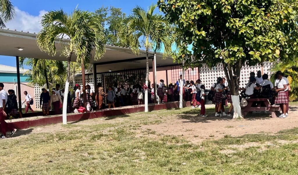
John H. Woodson Jr. High School will remain closed until mold remediation is complete, according to officials. (File photo by Diana Dias)
In a virtual meeting with more than 100 John H. Woodson Jr. High families, school leaders, and education officials Tuesday, Bureau of School Construction and Maintenance Director Craig Benjamin set a late-August reopening target for the St. Croix campus as crews finish a large-scale mold remediation and testing.
The school has been shuttered for the summer to allow for roof work and other repairs, but Benjamin said when Woodson’s administrators recently went in to prep the campus, the strong odor of mold permeated through.
The closure follows an earlier disruption in January, when teachers moved instruction outdoors in protest over years of unaddressed health and safety concerns, including mold that had spread from four to 13 classrooms. At the time, the Bureau of School Construction and Maintenance brought in contractors for a deep cleaning, with follow-up testing planned, but parents and teachers warned that the mold would return unless underlying leaks were fixed.
Benjamin said this summer’s repairs have focused on those underlying issues. Sealing the roof — completed Tuesday — was the top priority, stopping water from penetrating the structure. The school’s flood plain location and combination of concrete and organic materials mean that moisture is often absorbed into the building. “You don’t necessarily see it — you smell it,” Benjamin said when asked in an interview with the Source if his team was previously able to see the mold while walking through or working.
Now with the roof secure, Benjamin said crews have moved to removing ceiling tiles, cleaning ducts, and conducting the remediation, with final environmental testing scheduled for late August. Roof work began about three weeks ago, later than planned, he said when asked about the timeline, because funding had to be secured before contractors could be engaged. “We can’t engage contractors if the funding isn’t available,” Benjamin said, adding that the Education Department will oversee sharing the final test results with the community.
Other projects tackled during the summer included electrical upgrades, new transformers, restroom improvements, and new air conditioning units — though AC installation was paused until ducts are cleaned to ensure fresh airflow when the systems are turned on. Benjamin stressed that the bureau’s focus has been on infrastructure first — sealing roofs, replacing conduits, and preventing water from reaching electrical systems — before any cosmetic work like painting. “It’s not incompetence,” he said. “We’re not going to put up a pretty school full of paint that can’t function the way it’s supposed to.”
In response to questions from families about what happens to students in the meantime, Education Department officials said there will be no shift to virtual learning, citing data from previous closures that showed many families lacked reliable internet or devices for effective online instruction. Instead, in-person classes will begin once the repairs and safety verifications are complete, and all missed instructional time will be made up before the end of the school year. Continued updates will be forthcoming, though officials said they will also look at other options in the future if the school’s opening extends beyond Benjamin’s estimates.
According to the U.S. Environmental Protection Agency, large-scale mold remediation in schools requires stopping the source of moisture, removing contaminated materials, thorough cleaning with HEPA filtration, and final air testing before reoccupation — a process that can take weeks, particularly in humid climates where mold can grow within 24 to 48 hours.
Benjamin said crews are working evenings, weekends, and after hours to complete the work. “We don’t have the problem doing the work,” he told families. “We just need the patience of the community so that when students return, it’s to a safe, functioning space.”
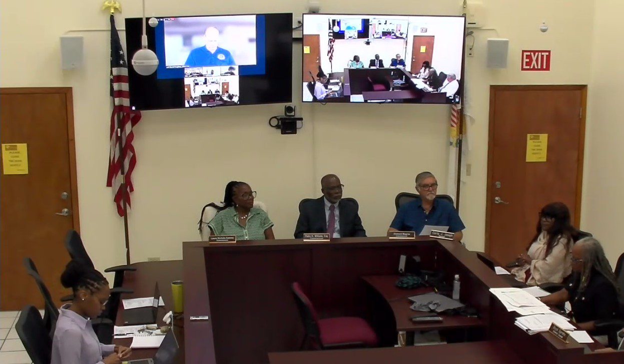
The V.I. Public Services Commission voted to accept a settlement agreement with the V.I. Water and Power Authority Tuesday and maintain the current electric LEAC rate of 22.22 cents per kilowatt-hour until June 30, 2026. (Screenshot from Zoom meeting)
Ratepayers shouldn’t expect their electric bills to go down until June at the earliest. The V.I. Public Services Commission settled with the Water and Power Authority Tuesday and voted to maintain the current Levelized Energy Adjustment Clause charge at a little more than 22 cents per kilowatt-hour until June 30, 2026.
The LEAC is a charge WAPA levies against its customers to cover the cost of fuel needed to provide the territory with electricity. For years, the LEAC rate has been approximately 22.22 cents per kilowatt-hour, and consultants hired by the PSC have repeatedly advocated for lowering it in light of rosy projections of savings following the commissioning of the St. Thomas power plant’s Wartsila generators, which are supposed to be able to run on propane in addition to costlier diesel. In reality, the utility has struggled to run the generators with the cheaper fuel, and the units have been plagued by mechanical issues.
The PSC voted in June to lower the rate to 17 cents per kilowatt-hour. The utility immediately decried the move as a “deliberate, ill-considered decision” and petitioned for reconsideration. On Tuesday, PSC attorney Boyd Sprehn laid out the terms of the settlement agreement, which gives the parties two months to hash out WAPA’s claims of a $147 million deficit resulting from $639 million in LEAC revenues and $766 million in fuel costs from 2021-2025. During a Senate Budget, Appropriations and Finance Committee hearing Monday, WAPA Chief Executive Officer Karl Knight said the utility’s shortfall would have been even greater if not for the $77 million in subsidies from the central government, which declared a state of emergency in April 2024 to help the authority keep the lights on.
Besides the static LEAC rate, Sprehn said Tuesday that “any remaining sum from the now current balance of $147 million will be zeroed out,” he said. “WAPA may accrue additional deferred fuel account claims between now and June 30. WAPA and the PSC staff will meet within 60 days to define acceptable changes and calculations to that deferred fuel balance … and return that to the commission.”
The commission approved the agreement in a 3-2 vote before moving on to an investigation into WAPA’s fuel acquisition process. In July, the utility’s governing board narrowly approved a fuel supply contract with the Puerto Rico-based Empire Gas Company and broke from years of reliance on Vitol. The contract raised eyebrows — including those of the board’s own chair, Maurice Muia, who said the board still had questions about the deal when it came to a vote last month. On Tuesday, Knight told commissioners that Empire “provided the best value from a logistics perspective, a technical perspective, payment terms, as well as pricing.”
Commissioner David Hughes noted that Empire “has no experience in bulk transportation” of liquid petroleum gas.
“They don’t own any ships. They don’t lease any ships. They never have. They run a distribution business out of Puerto Rico, and they’re supplied by third parties,” he said. “I don’t know that that necessarily makes them one of our stronger candidates — although … you’ve been through the field. There are roughly 15 or 16 entities operating in the Caribbean that operate their own ships or operate leased vessels — just seems strange to me that we’re going to depend on someone that has no experience and has never had any experience in that field.”
Knight pushed back on Hughes’s assessment, saying that no one in the region transports LPG in bulk.
“There’s bottled gas that goes up and down the Caribbean, primarily for cooking gas purposes,” he said. “It’s either bullets or it’s bottled. Diageo, for instance, takes on fuel for their power generation — it’s bullets that they use. No one does bulk LPG other than Vitol. They built the market, they built the terminal. There’s not a single other utility in the Caribbean that has a propane terminal and takes on ocean-borne LPG in bulk. That doesn’t exist.”
Hughes noted that Vitol didn’t have ships in the region either and had been contracting regional carriers for the last three and a half years.
“And that carrier is an active entity — with ships in the Caribbean — and was in the list of those companies which you listed as having been solicited for the bid,” he said. “So Vitol doesn’t actually do this business anymore either, but there are companies that do. And I’m just suggesting those companies are fairly qualified to meet this bill, and if they were to come with a lower price, you should consider it.”
Knight suggested that other companies initially played hardball with the utility.
“And then once they realized that we were serious about looking for an alternative supplier, suddenly everyone wanted to have a conversation,” he said. “I look at that as a positive. The next time we put out a solicitation, I expect everyone to sharpen their pencils, and they’ll be ready to actually meet our needs in a way that makes sense for the Water and Power Authority. But at the time, I think they felt the market was cornered, and this was the pricing that the market would produce, and they thought we didn’t have options. We found a solution that works for all the people of the Virgin Islands.”
NHC Tropical Storm Erin projected storm track as of 5 p.m. on Tuesday, Aug. 12. The system is expected to intensify into a hurricane this week. (Photo courtesy NHC)
Tropical Storm Erin is forecast to pass near the U.S. Virgin Islands and Puerto Rico this weekend, but the National Hurricane Center says it is still too early to know what impacts the storm might bring. Forecasters advise residents to keep a close watch.
As of the 5 p.m. Tuesday update from the NHC, Erin was about 950 miles west of the Cabo Verde Islands off the west coast of Africa, moving quickly west with maximum sustained winds near 45 mph.
“At 5:00 PM AST, the center of Tropical Storm Erin was located near latitude 17.0 North, longitude 38.3 West,” the NHC reported. “Erin is moving toward the west near 22 mph, and a slightly slower westward motion is expected tonight through Thursday, with a west-northwestward motion beginning Thursday night and continuing into the weekend. On the forecast track, the center of Erin is likely to move near or just north of the northern Leeward Islands over the weekend,” the NHC said.
Indeed, as of Tuesday evening, the official NHC track takes the cyclone north of the USVI and Puerto Rico, and no alerts have been issued. Notably, while Erin’s forecast track edged slightly closer to the local islands in Tuesday morning’s update, the 5 p.m. advisory showed no further shift toward the islands.
“The new 5 p.m. NHC track forecast has no appreciable difference from the morning forecast, with no additional shifting toward the northern Leeward Islands,” the NHC said. “Keep in mind that NHC track forecasts have an average error of 120-180 nautical miles at days four and five in the future, and additional adjustments in the forecast are still possible,” the NHC added.
“Key Messages” regarding Tropical Storm Erin from the NHC 5 p.m. update on Tuesday. (Photo courtesy NHC)
The Track of Tropical Storm Erin
Erin is expected to maintain a path slightly south of due west through Wednesday, steered by strong high pressure over the Atlantic. By Thursday night, a gradual turn toward the west-northwest is possible as the ridge of high pressure weakens, a track that would take the cyclone northeast of the local islands. However, there is still uncertainty about when that turn will occur, and future forecast adjustments are possible.
The NWS in San Juan, Puerto Rico, continues to track Tropical Storm Erin. (Photo courtesy NWS)
While the core of the cyclone may pass north of the U.S. Virgin Islands and Puerto Rico, the NHC said Tuesday that it is still too early to determine whether there could be any direct impacts across the local islands.
“Erin could move close enough to the northern Leeward Islands, Virgin Islands, and Puerto Rico over the weekend to produce some impacts on those islands,” according to an update from the NHC Tuesday. “However, the magnitude of those impacts is still not known, and interests there should continue to monitor the progress of this storm.”
“There is even greater uncertainty in what impacts might occur in portions of the Greater Antilles, the Bahamas, the east coast of the United States, and Bermuda next week,” the NHC acknowledged. “As we approach the climatological peak of the hurricane season, this is the opportune time to ensure your preparedness plans are in place,” the NHC added.
Erin Expected to Strengthen Soon
As was reported in a Source article published Monday, forecasters say the storm will likely strengthen slowly at first due to cooler waters and dry air, but could intensify more quickly as environmental conditions improve. The system is eventually anticipated to intensify into a hurricane, with maximum sustained winds of at least 74 mph or higher.
The Source reached out to Alex DaSilva, lead hurricane specialist at AccuWeather, to obtain more information about Tropical Storm Erin and the potential threat to the USVI and Puerto Rico. DaSilva noted that, while the cyclone has been traveling through cooler water temperatures and dry air on Tuesday, it will soon move into an environment that is more conducive for potential intensification.
“Erin has been really struggling from dry air and also the cooler sea surface temperatures on Tuesday,” DaSilva said. “From this point forward, the water temperatures are going to be getting warmer as Erin advances through the weekend. Disruptive wind shear is not a factor for this storm right now, and therefore, Erin is forecast to intensify on Wednesday,” DaSilva noted. “The process may be slow because it’s going to be dealing with some of that dry air, but the waters will be warmer.”
Erin’s Updated Forecast Track
DaSilva explained the reasons for the slight adjustment of Erin’s track on Tuesday morning, possibly bringing the disturbance closer to the USVI.
“Weaker storms tend to travel further west,” DaSilva said. “Stronger storms tend to be driven more by the upper levels of the atmosphere, which will tend to turn the storm to the north. When a storm is weaker, it just tends to move more with the trade winds, which are usually from east to west. This is a factor that we’re going to have to monitor very closely. This is likely part of the reason why we’re seeing a westward shift in some of the model guidance. Erin is currently a bit on the weaker side and it’s getting pushed more by the trade winds,” DaSilva continued.
“If Erin remains weak and is unable to gain intensity, there is a chance that it may track closer to the islands. If this storm strengthens, as it is expected to, it should start to pull to the north.”
DaSilva went on to explain some of the possible effects that the local region could receive due to Erin, primarily between Saturday and Monday.
“However, at this time, the core of the storm is forecast to track north of the islands,” DaSilva reported. “Still, we are concerned about rain bands on the outside of the storm, which are common with many tropical cyclones and hurricanes. They can be fairly slow-moving at times, and some areas could see localized rainfall totals of three to five inches, with locally higher amount up to seven inches across the northeastern Caribbean.”
“Everyone on the islands should remain on guard and be prepared for the weather to deteriorate on Saturday. Rip currents and rough surf are a serious concern for boaters and at the beaches,” DaSilva advised.
In addition to Tropical Storm Erin, the National Hurricane Center is monitoring a disturbance in the northwestern Atlantic and a cluster of showers and thunderstorms near the Gulf, both with a low chance of development.
The NHC is currently monitoring three areas across the Atlantic basin, including Tropical Storm Erin. (Photo courtesy NHC)
The NWS notes that while direct impacts across the local islands remain uncertain, Erin could still produce indirect effects even if it passes to the north, including choppy seas and an elevated risk of rip currents. (Photo courtesy NHC)
“By the weekend, the forecast depends on the future of Tropical Storm Erin,” the NWS said. “It is currently forecast to move northeast of the region, but it could trigger marine hazards. Stay informed and monitor future forecasts,” the NWS said.
In addition to any impacts that may occur from Tropical Storm Erin this weekend, warm temperatures are expected to persist, with the possibility of heat alerts. Saharan dust is forecast to be prevalent in the atmosphere through early Thursday, causing hazy conditions through midweek. Showers and thunderstorms are also possible throughout the week.
It is crucial to remember that the forecast can change very quickly. USVI residents and visitors are encouraged to continue to remain prepared. Weather information is available from the NWS, the NHC, and NOAA.