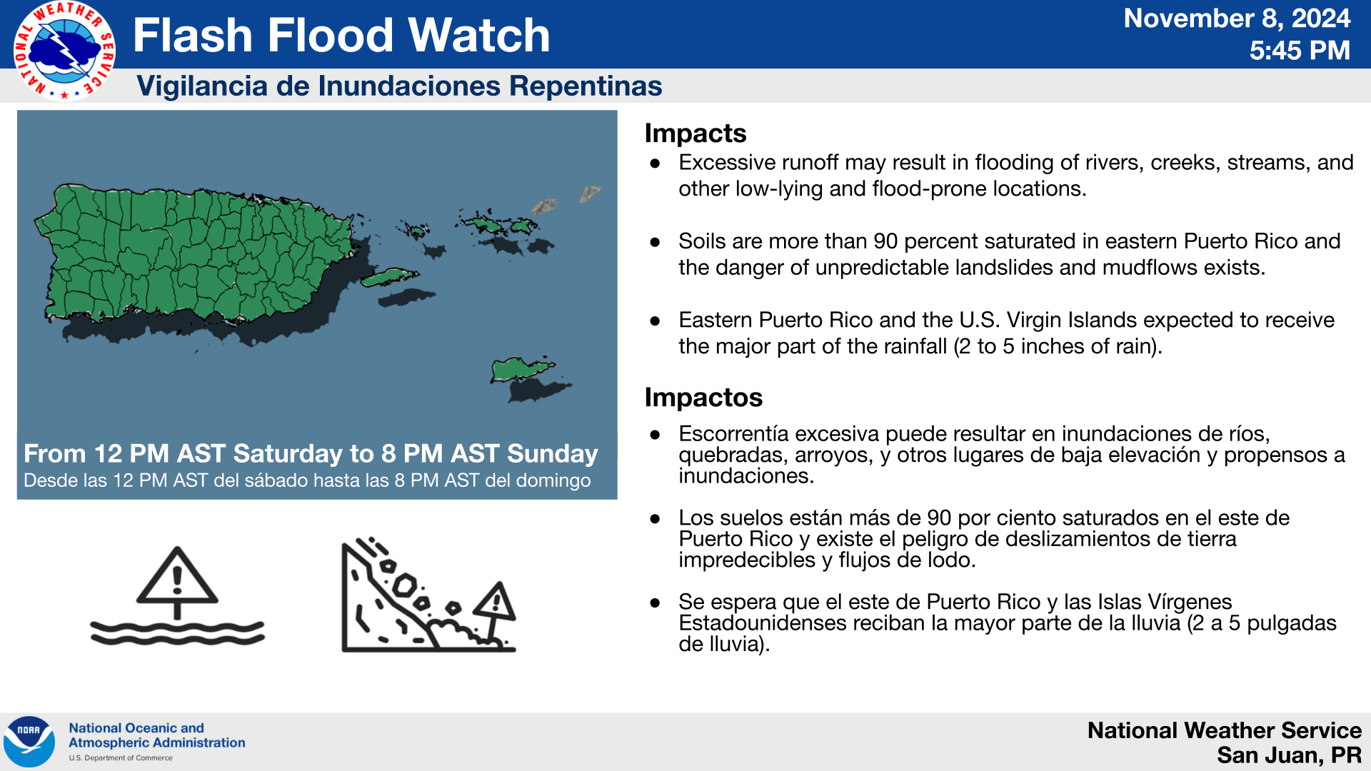
The National Weather Service (NWS) in San Juan, Puerto Rico, has issued a Flash Flood Watch for areas of Puerto Rico and the U.S. Virgin Islands as an unsettled weather pattern continues across the region.
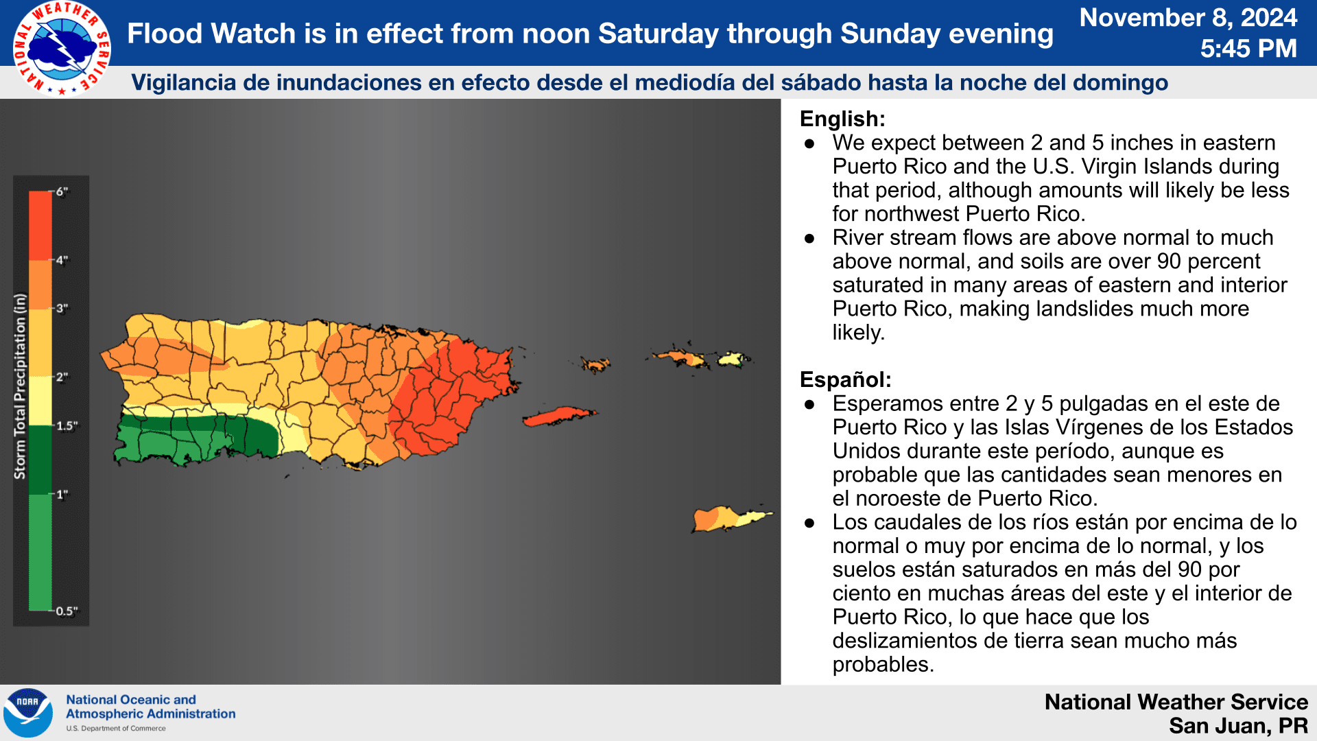
A Flash Flood Watch will be in effect for portions of both U.S. territories from noon on Saturday until 8 p.m. on Sunday, and excessive rainfall is expected.
“Rain showers and thunderstorms will continue intermittently overnight [on Friday] and [will] redevelop on Sunday for another round of heavy rains,” according to an update from the NWS on Friday. “We expect between 2 and 5 inches in eastern Puerto Rico and the U.S. Virgin Islands during that period, although amounts will likely be less for northwest Puerto Rico,” the NWS said.
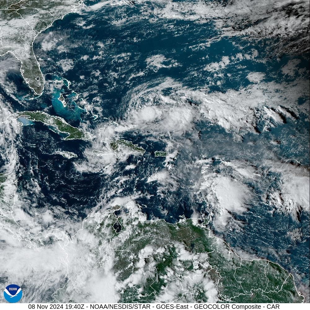
On Friday, The Source spoke with Ernesto Morales, a warning coordination meteorologist at the NWS in San Juan. Morales noted that the combination of an unstable weather pattern, abundant moisture traveling across the islands, and an approaching tropical wave will lead to the anticipated wet weather.
“There is a lot of moisture [over] the [local] area,” Morales explained. “There is a trough [an area of low pressure] [located] just along the north side of the region, and we are going to have a tropical wave passing by [between Saturday and Sunday],” Morales said. “[These weather features] will be interacting with each other and will generate the [expected] rain,” he added.
Possible Impacts to the Local Islands
Friday’s update from NWS explained that saturated soils, as well as rivers that are already flowing full of water, may lead to the possibility of flash flooding and landslides.
“Excessive runoff may result in flooding of rivers, creeks, streams, and other low-lying and flood-prone locations,” the NWS said. “Creeks and streams may rise out of their banks, [and] flooding may occur in poor drainage and urban areas,” the NWS continued.
“Storm drains and ditches may [also] become clogged with debris, [and] extensive street flooding and flooding of creeks and rivers are possible,” the NWS warned. “Soils are more than 90 percent saturated in eastern Puerto Rico and the danger of unpredictable landslides and mudflows exists,” the NWS noted.
In addition to the potential for rain on Saturday and Sunday, conditions will remain unsettled through next week.
“Be aware, however, that this will not be the end of wet conditions,” the NWS cautioned. “The synoptic pattern [the current weather pattern across the region] will be favorable to the continuation of periodic heavy rains through at least Friday of next week,” the NWS stated.
The NWS also explained that marine conditions will be hazardous, and there will be an elevated risk of rip currents over the next few days.
“Life-threatening rip currents are expected along the Atlantic coastline of Puerto Rico and the northern US Virgin Islands, as well as the north and east-facing [coastline] in St Croix throughout the holiday weekend,” according to the NWS.
National Hurricane Center Monitoring Tropics
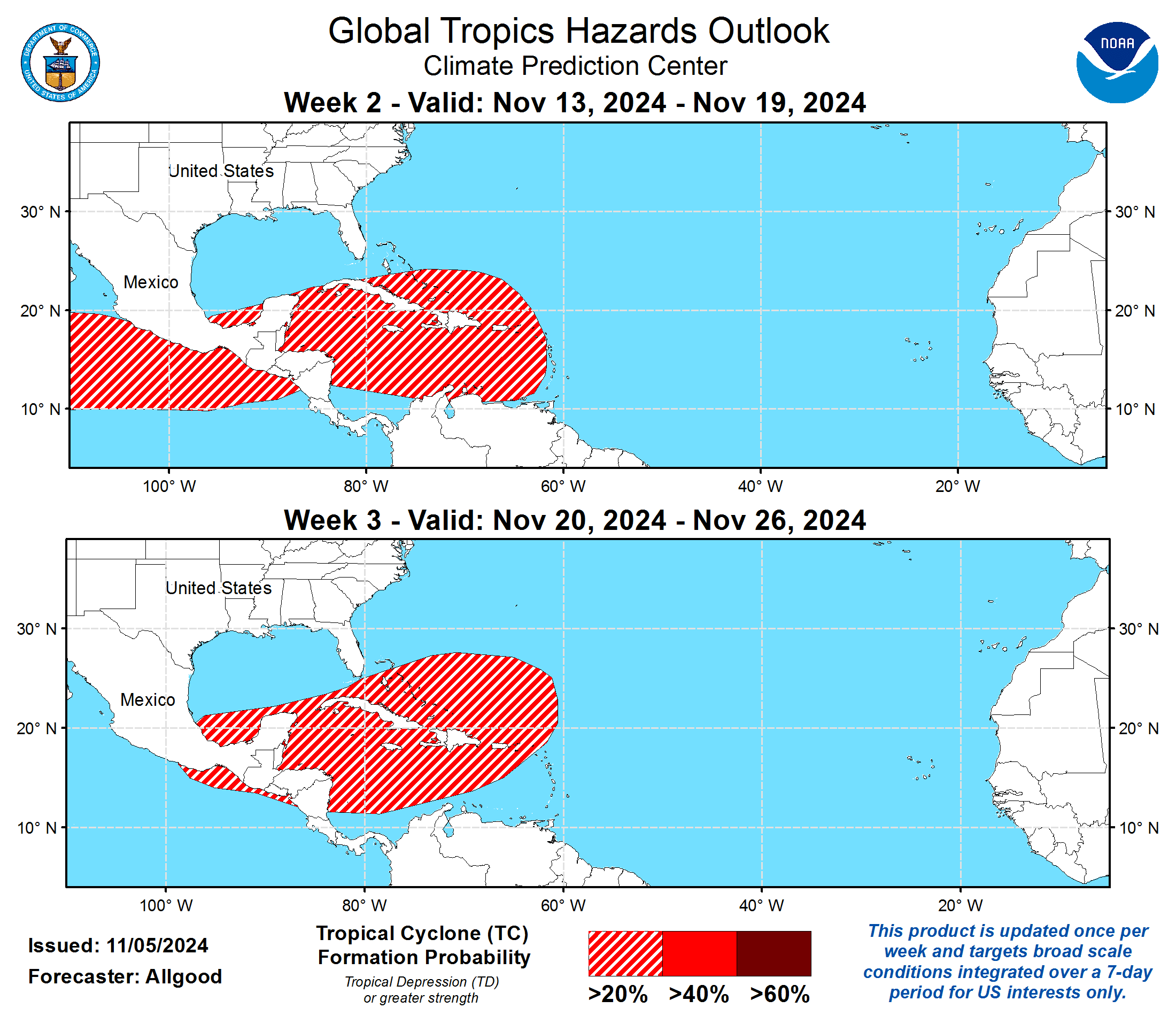
The National Hurricane Center (NHC) continues to monitor the tropics for cyclonic development.
As of Friday afternoon, Hurricane Rafael was spinning in the Gulf of Mexico, packing maximum sustained winds of 100 mph. The system is expected to take a turn to the south, potentially avoiding a strike on the U.S. mainland.
The Climate Prediction Center’s Global Tropics Hazards Outlook indicates an elevated chance of cyclonic development over the next few weeks. Hurricane season officially ends on Nov. 30, and USVI residents and visitors are encouraged to stay up to date with forecasts from the NHC. Hurricane preparedness tips are available from the Virgin Islands Territorial Emergency Management Agency and the National Oceanic and Atmospheric Administration.
Weather Updates
Detailed weather information and forecasts, including severe weather alerts, are available from the VITEMA website and the National Weather Service.
The Source Weather Page also publishes a daily weather forecast and offers readers the opportunity to view weather forecast videos and disaster preparedness video segments.


