The 2026 Atlantic hurricane season officially began on Monday, with many forecasters calling for a slightly below-average season due in large part to an expected El Niño weather pattern. However, experts are encouraging residents to prepare and not let their guard down.
Atlantic Season Kicks Off on June 1
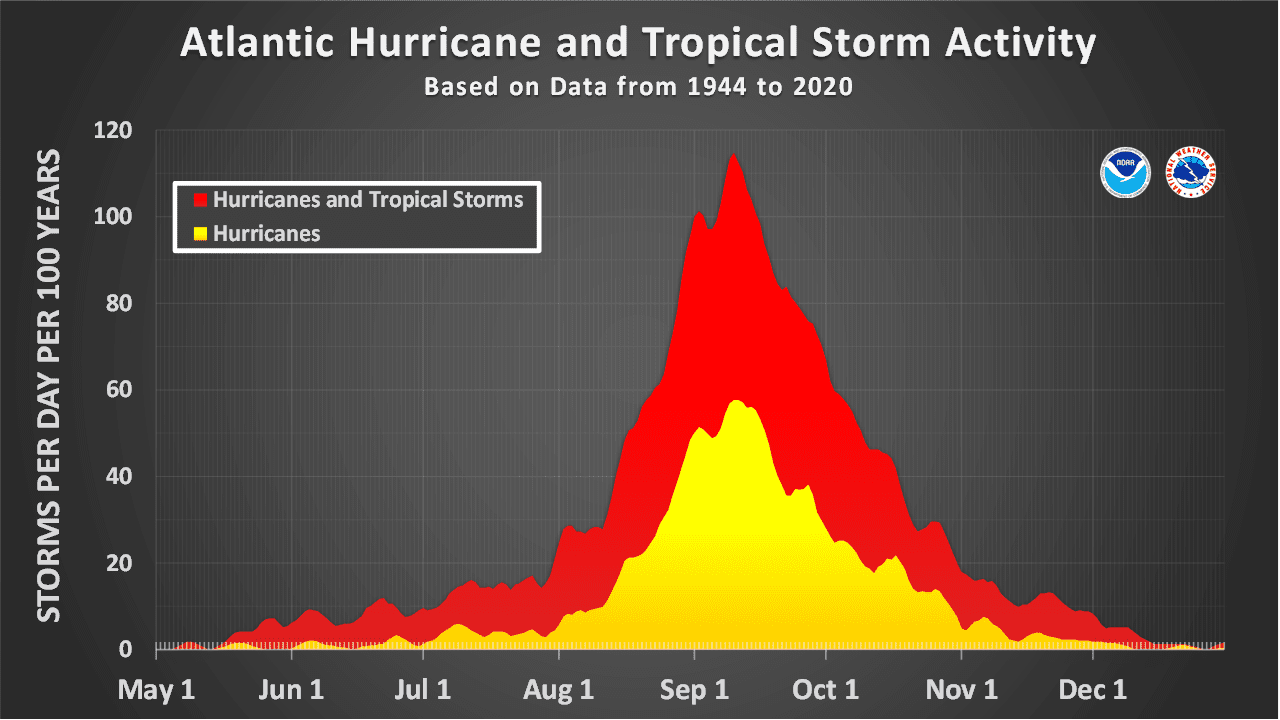
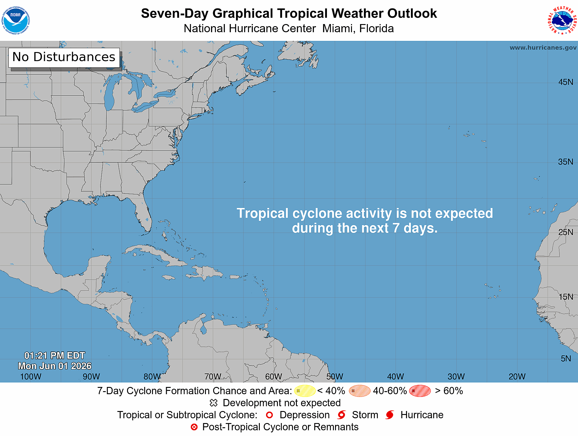
The Atlantic hurricane season runs annually from June 1 through Nov. 30, and the National Hurricane Center said Monday morning that tropical cyclone formation is not expected across the Atlantic basin during the next seven days, although several tropical waves are being monitored.
While the Atlantic basin is relatively quiet as the season begins, meteorologists stress that conditions can change quickly, and residents should not wait until a storm is approaching to prepare.
Multiple Forecasts Point to a Slightly Below-Average Season
Several major hurricane season outlooks have called for a near- to below-average 2026 Atlantic hurricane season, largely because of the expected development of an El Niño weather pattern.
According to the National Oceanic and Atmospheric Administration, “Scientists call the two opposing climate patterns of El Niño and La Niña the ‛El Niño-Southern Oscillation’ (ENSO) cycle. El Niño and La Niña can both have global impacts on weather, wildfires, ecosystems, and economies.” An ENSO-neutral phase typically occurs between phases of a La Niña or an El Niño event.
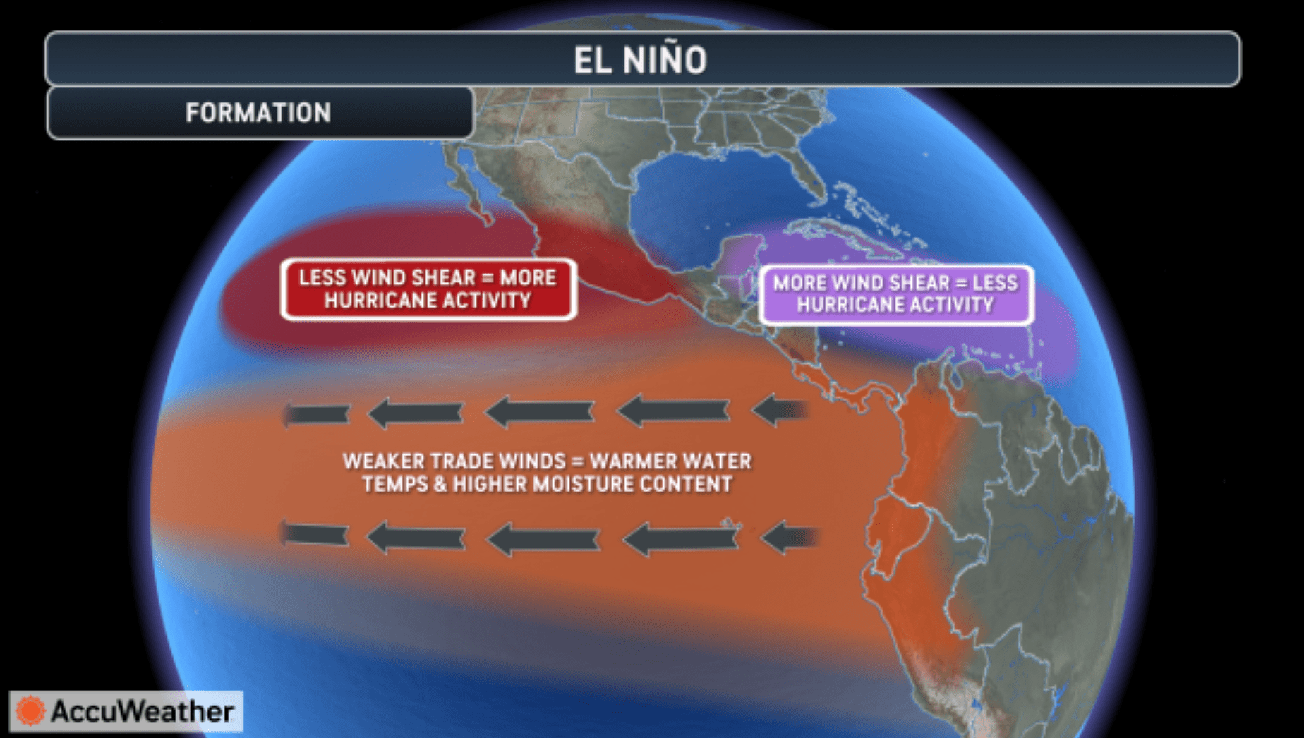
El Niño, which involves a warming of the equatorial Pacific Ocean, usually helps to increase wind shear — a change in wind direction and velocity with height in the atmosphere. In the Atlantic Ocean the increase in wind shear from El Niño helps to rip apart storms and prevent hurricane formation and intensification. This is the opposite of a La Niña cycle, when the ocean waters across the equatorial Pacific cool significantly. During La Niña, wind shear typically decreases in the Atlantic, and a reduction in wind shear can favor cyclone development.
According to the NHC, the Atlantic hurricane season averages are 14 named storms, seven hurricanes and three major hurricanes.
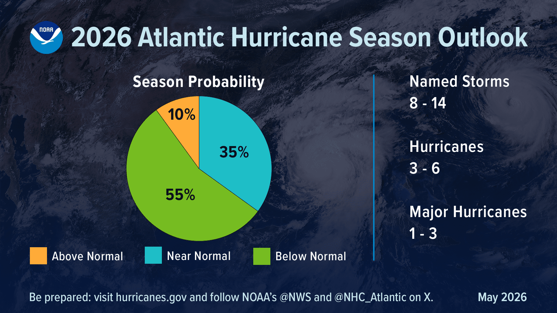
As the Source previously reported, NOAA’s official hurricane season outlook calls for eight to 14 named storms, including three to six hurricanes and one to three major hurricanes of Category 3 strength or higher. NOAA said there is a 55% chance of a below-normal season, a 35% chance of a near-normal season and a 10% chance of an above-normal season.
However, NOAA Administrator Neil Jacobs, Ph.D., emphasized that a below-normal forecast should not lead to complacency.
“Even though we’re expecting a below-average season in the Atlantic, it’s very important to understand that it only takes one storm,” Jacobs said.
The Source also previously reported that AccuWeather predicted 11 to 16 named storms, including four to seven hurricanes and two to four major hurricanes. Colorado State University predicted 13 named storms, including six hurricanes and two major hurricanes.
All three outlooks highlighted the expected development of El Niño as a major factor that could limit Atlantic activity by increasing wind shear, which can make it more difficult for tropical systems to form or intensify.
Ken Graham, director of the National Weather Service, also warned residents not to lower their guard because of the seasonal forecast.
“Don’t let words like ‘below-average’ change the way you’re prepared,” Graham said.
Monitoring Hints of Early Tropical Development
Although there are no active cyclones in the Atlantic basin as of Monday, there are some early signals of the potential for development. An AccuWeather article said on Monday that forecasters are monitoring several tropical areas early in hurricane season, including the Gulf, Western Caribbean and southwestern Atlantic, as well as parts of the Eastern Pacific.
Alex DaSilva, lead hurricane expert at AccuWeather, acknowledged that the chances of cyclonic activity are slim.
“Tropical development chances remain low at this time,” DaSilva said.
AccuWeather noted, however, that the Gulf, Western Caribbean and southwestern Atlantic will need to be monitored during the first two weeks of June, especially if wind shear relaxes and a pulse of tropical thunderstorm activity moves into the region.
The Climate Prediction Center’s latest Global Tropics Hazards Outlook, valid June 3 through June 16, also highlights a greater chance of tropical cyclone development in the Eastern Pacific, while the Atlantic remains quiet.
Local Weather: Saharan Dust, Heat, and Limited Rain
Locally, the NWS in San Juan, Puerto Rico, said a dry, stable and hazy pattern will continue across Puerto Rico and the U.S. Virgin Islands through the middle of the week, driven by a Saharan Air Layer and high pressure.
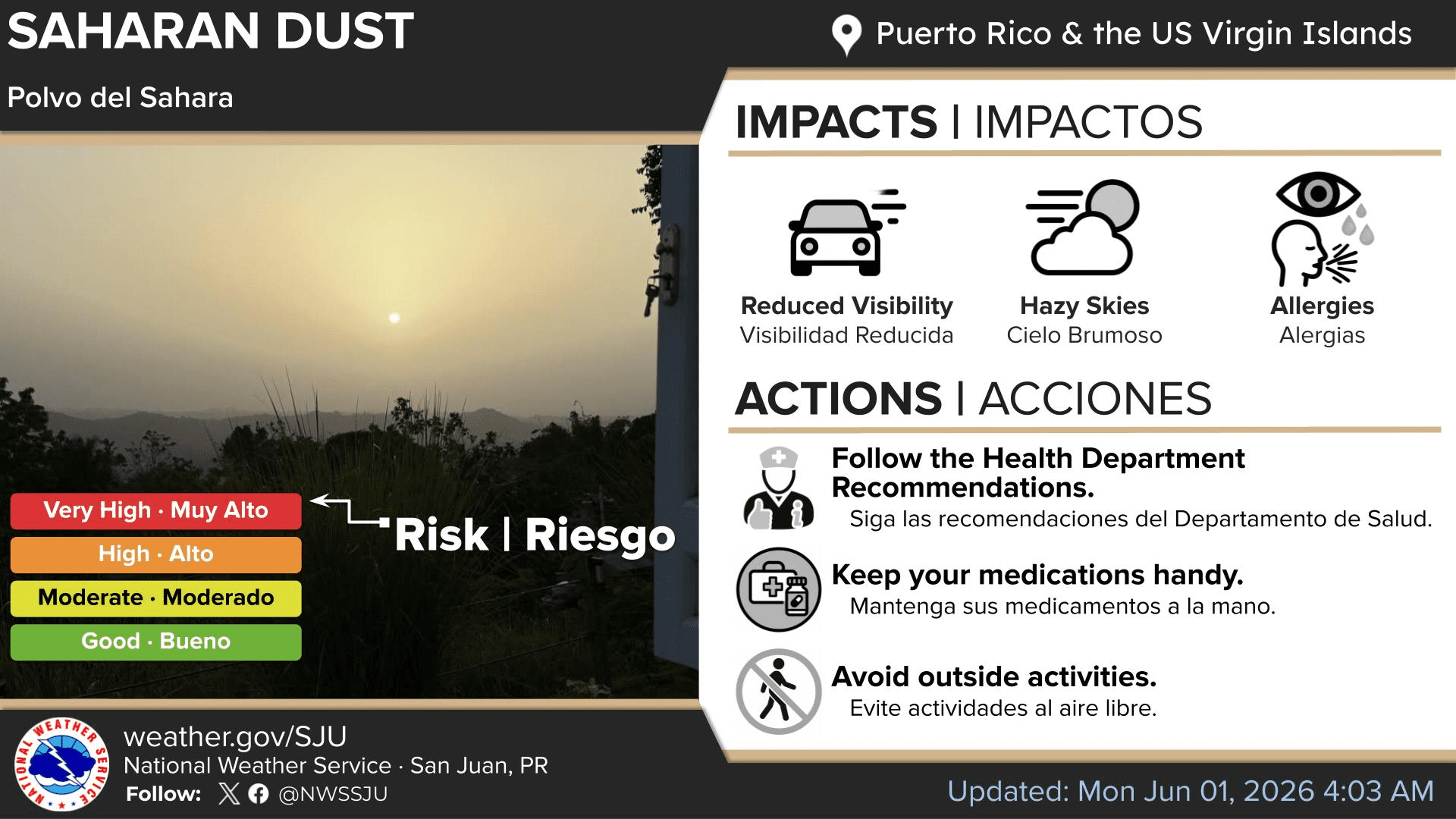
The NWS highlighted Saharan dust as one of the main local weather concerns.
“High concentrations of Saharan dust will promote hazy skies, poor air quality, and reduced visibilities through Tuesday,” the NWS said. Sensitive groups, especially individuals with respiratory conditions, should take precautions to limit outdoor exposure and follow medical guidance as needed.
Another influx of moderate Saharan dust is expected by the end of the week. The NWS said residents and visitors should expect hot, hazy and mostly dry conditions through at least Wednesday, with limited rainfall expected across the region.
“Hot temperatures are expected in general, particularly along the lower elevations and urban areas of the islands,” the NWS said.
The forecast also noted that limited shower activity is expected for the next few days, though a few brief, fast-moving trade wind showers may move across the U.S. Virgin Islands and Puerto Rico.
By Friday into Saturday, a weak tropical wave is forecast to pass well south of the area. The NWS said impacts from that wave are expected to be minimal.
Marine and Beach Conditions
The NWS also reported that gusty east-to-east-southeast winds will promote choppy seas across the local waters through much of the week.
Increasing winds and choppy seas may also raise the risk of life-threatening rip currents across beaches in Puerto Rico and the U.S. Virgin Islands. A moderate risk of rip currents is expected for the majority of beaches across both U.S. territories.
Daily Weather Updates
Regarding hurricane season, forecasters repeatedly caution that seasonal outlooks describe overall activity across the basin, not whether a specific island, coastline or community will be affected.
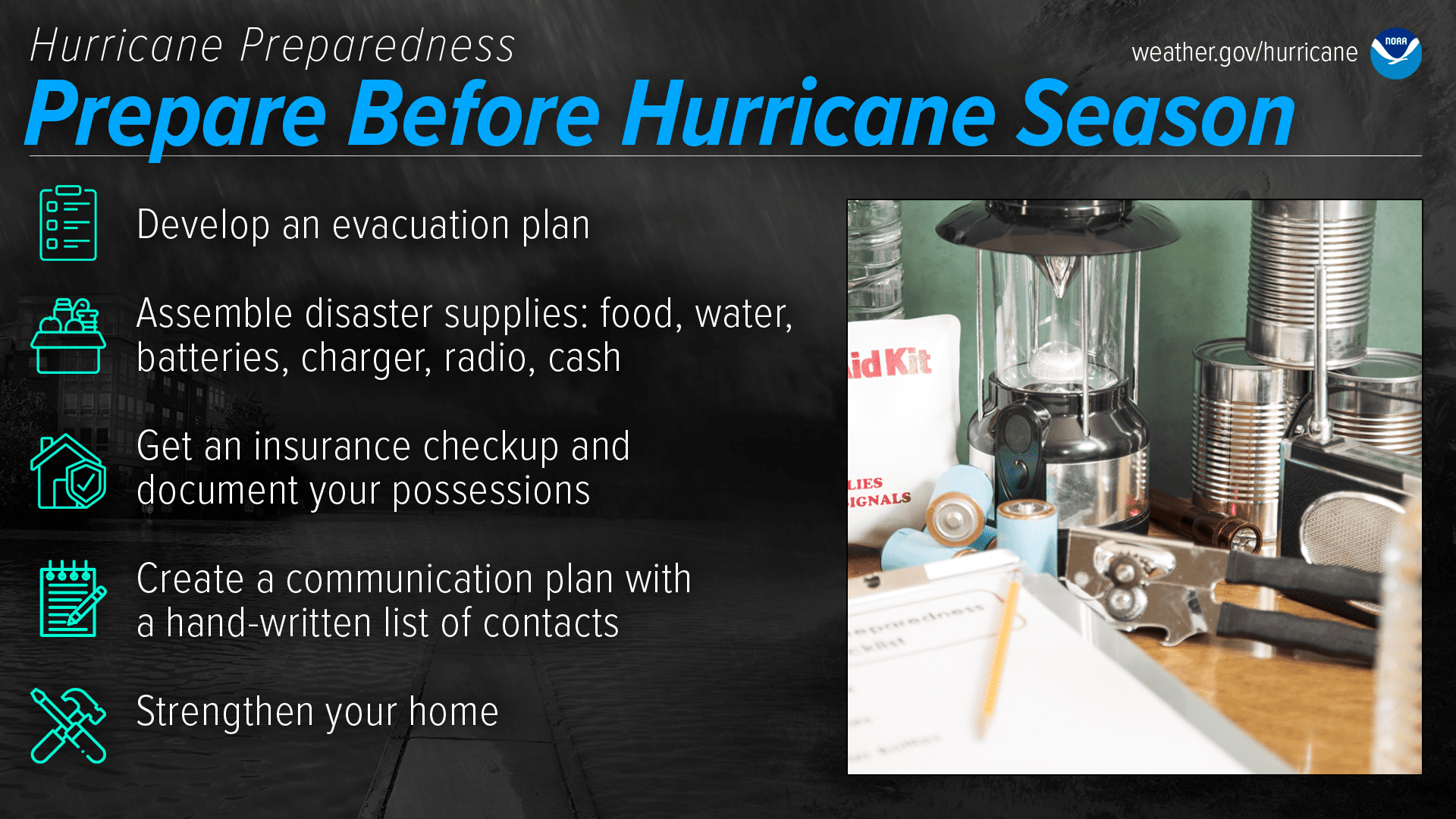
A quieter year overall can still include a dangerous storm for the Virgin Islands or any other location in the Atlantic basin, and individuals across the islands are encouraged to begin preparing now.
Information about the weather across the USVI, including marine forecasts, is available from the NWS and NOAA.
The local forecast is regularly updated on the Source Weather Page, and a weekly video forecast is available. Additionally, residents and visitors can view weather alerts and disaster preparedness information from the Virgin Islands Territorial Emergency Management Agency.

