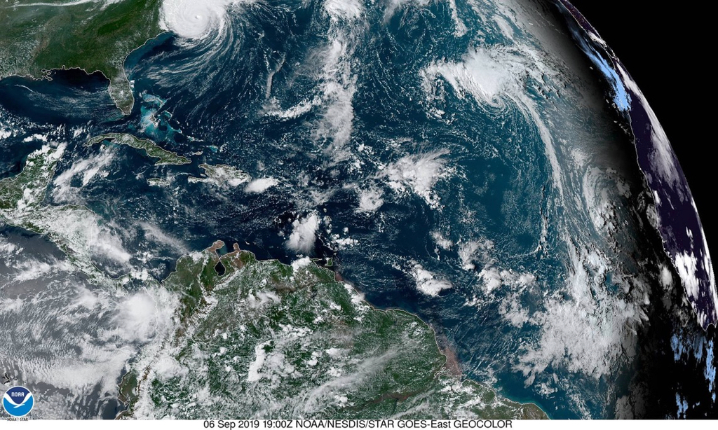
Two low pressure systems in the Atlantic bear the potential of affecting the Leeward Islands in the coming week, although forecasters at the National Hurricane Center drew back Friday from making such a prediction.
A broad area of low pressure located just west of the Cabo Verde Islands, designated by the NHC as Invest 94-L, was producing disorganized shower and thunderstorm activity Friday afternoon. Little development, if any, of this disturbance is expected for the next couple of days, but environmental conditions are likely to become more conducive for a tropical depression to form by Tuesday or Wednesday while the system moves westward across the tropical Atlantic Ocean.
In its 8 p.m. Friday update, the NHC gave 94-L only a 10 percent chance for formation during the next 48 hours but a 70 percent chance within five days.
Meanwhile a system of disorganized cloudiness and showers located just a few hundred miles northeast of the Leeward Islands is associated with a trough of low pressure. The NHC gave that system almost no chance of significant tropical development while it moves slowly west-northwest, away from the region. The system has only a 10 percent chance of development within five days.
Given the inconsistency of the forecast models so far this season, and the on-again, off-again development of this system that is being advanced by the models, focusing on actual weather data shows the presence of a low-riding westward moving tropical disturbance in early September within an environment that is favorable for development. While it is too early to project the track of this weather system, it still bears watching closely.
Also, there are suggestions that a disturbance coming along behind Invest 94-L may outpace it and pose a threat to the Caribbean around September 16/17.


