
The following article was written for and used with permission of Mongabay.com, a web site that publishes news on environmental science, energy, and green design. The article was written for World Oceans Day, which is celebrated every June 8.
PUNTA CANA, Dominican Republic – At 8 o’clock on a May morning the Caribbean Sea was calm, offering a clean window to the underwater realm.
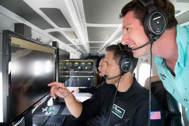
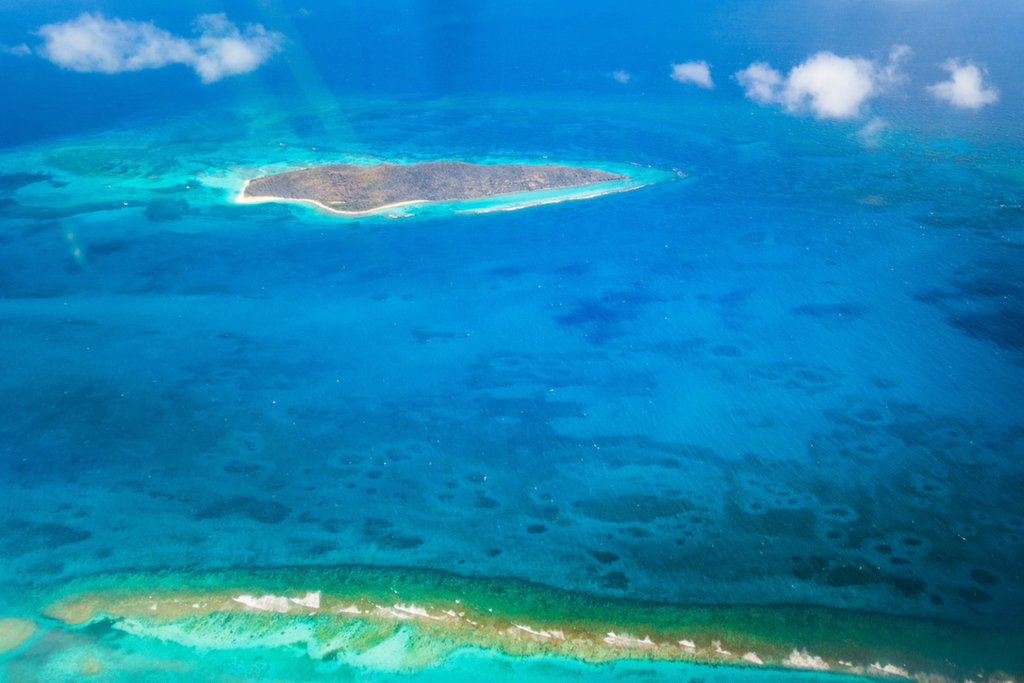
Flying 2,000 meters (6,560 feet) above the ocean, ecologist Greg Asner’s twin-propeller flying laboratory was at what he calls the “goldilocks distance.” Fly higher and the textured detail of each turquoise patch of coral reef below becomes invisible. Fly lower and the details overwhelm the big picture. This was “just right.”
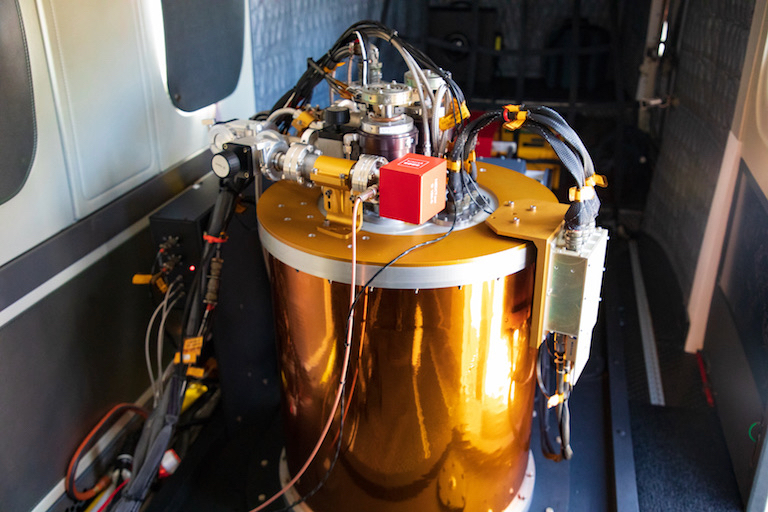
At this altitude, above the gemstone-like waters surrounding Punta Cana in the Dominican Republic, Asner’s plane can see both entire reefs and individual heads of coral in revolutionary detail. The plane is loaded with nearly a metric ton of sensors and computers that allow it to determine, at ten-centimeter (four-inch) resolution, not just where the coral is but also its health and even its species.
Based at the Carnegie Institution for Science in Stanford, California, Asner molded technology first developed by NASA to peer at the chemical composition of alien planets into what may be the most powerful instrument for conservation science here on Earth: the Carnegie Airborne Observatory (CAO), as his plane is called.
“Caribbean reefs are getting hammered by hurricanes, coral bleaching and pollution. But the CAO can see the patches of surviving coral that can repopulate this system,” Asner told Mongabay.
The flight was part of a mission to create the first ever high-resolution map of coral reefs throughout the Caribbean. In addition to the CAO, more than 100 satellites, drones and scuba divers will contribute data to the map, integrating layers of information at multiple scales. The project is a collaboration between Asner’s new Reefscape Project, which studies reefs around the world; the Arlington, Virginia-based conservation group The Nature Conservancy; and the San Francisco-based private satellite company Planet.
The resulting map of the Caribbean region’s coral reefs will help decision-makers identify the top priorities for conservation.
Improving on existing maps
Current maps of the Caribbean either leave out coral reefs or are badly outdated, which hampers governments seeking to protect their nations’ offshore natural resources. The new mapping mission will establish baselines so that ongoing monitoring efforts can track changes in reef health and distribution over time.
“The best maps of coral in the Caribbean are very basic,” Tyler Smith, a coral reef ecologist at the University of the Virgin Islands in St. Thomas, told Mongabay. “They’re created by looking at how deep the water is and then extrapolating where we expect reefs to be. As a result, there is very poor documentation for many of these reefs.”
Assessments of coral health exist for only about one percent of Caribbean island reefs, said Smith, who is not involved in the mapping initiative.
“These maps will show us the health of Caribbean coral reefs at a scale and resolution we have never had before,” Smith said of the new initiative. “A picture is worth a thousand words. You can’t underestimate that impact. For less developed countries this may help them visualize their coral resources, which could generate more support for conservation.”
Despite the dearth of existing data, it’s clear the Caribbean’s reefs are in trouble. A decline beginning in the 1970s destroyed 59 percent of the sea’s coral cover, according to a 2012 IUCN report. The region’s two most important reef-building coral species, elkhorn (Acropora palmata) and staghorn (Acropora cervicornis), declined by more than 90 percent during that time – both are now listed as threatened under the U.S. Endangered Species Act and as critically endangered by the IUCN.
Increasing pressures from nearly 44 million people living near the coast, overfishing, coastal pollution, climate change and invasive species drove the decline. Three massive global coral bleaching events in 1998, 2005 and between 2014 and 2017 also hit the Caribbean hard. Then last year back-to-back Category 5 hurricanes, Irma and Maria, compounded the damage to the region’s remaining reefs.
But the destruction has not been uniform. Different species have different responses to stressors such as warm water, resulting in a patchwork of live and dead coral. This makes resolution at the scale of individual corals key to understanding a reef’s condition and prospects for recovery.
Locating unknown nuggets of thriving coral is crucial to ensuring their protection and survival, according to Asner. These areas can be studied for insight into what allowed the coral there to survive. By using satellites, advanced airborne sensors, drones and divers, this comprehensive mapping project has the power to locate these pockets of healthy coral in time to protect them.
“Globally, we only know the location of coral reefs to 50 percent accuracy,” Asner said. “These maps will show us the good, the bad and the ugly of coral reefs in the Caribbean: where they are thriving, where they’re damaged and where they’ve [been] bleached or been destroyed by hurricanes.”
The highest-tech plane
Asner spent years developing the CAO, which is now packed to the gills with the world’s most advanced remote-sensing technology. The CAO allows Asner’s team to rapidly image entire ecosystems beyond what the human eye can see, without sacrificing detail. He’s used the CAO to study rainforests, biodiversity and land-use change, among other targets.
The CAO’s flights are at the heart of the Caribbean mapping initiative. As it flew over the Dominican reef, an instrument called LiDAR (Light Detection and Ranging) fired twin lasers 500,000 times per second to create 3D images with resolution down to individual heads of coral.
Another sensor, called a spectrometer, picked apart the light reflected by the coral, which Asner’s team can use to determine its health and even its species.
“We know some coral species are much more resistant to the insults we throw at them. These maps will let us find those species,” Smith said.
Once the CAO finds those resilient species, they can then be studied and bred in coral nurseries to help repopulate damaged reefs.
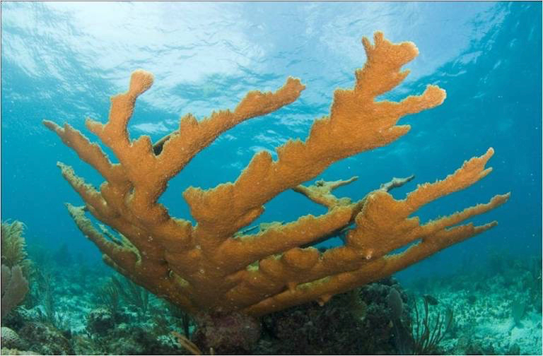
Asner’s team is developing an even deeper level of analysis of the spectrometer data that could pick out genetic differences within such key species as elkhorn and staghorn corals. Finding the subtle genetic differences that let some individuals survive when others die could help coral breeders accelerate those species’ ability to adapt to our swiftly changing planet.
The CAO flights are a “goldmine of data,” according to Luis Solórzano, executive director of The Nature Conservancy’s Caribbean program.
“Having a crystal clear picture of where the reefs are and how healthy they are improves our ability to protect and manage these ecosystems.”
A multipronged approach
The interpretation of the data the CAO gathers will be guided by underwater surveys. Divers on Asner’s team locate patches of living coral and, using a small waterproof spectrometer, create a library of the unique fingerprint of light reflected by each species. Supercomputers can then use the library to decode the CAO’s data and reveal which species are present.
Using a similar approach, the maps created by the CAO will serve as a library to interpret subtle differences in color embedded in the images from Planet’s fleet of shoebox-sized, camera-toting satellites.
“When these layers of verified data are matched up with Planet’s imagery the colors in these ordinary satellite photos come alive and can tell us a lot more about the reef,” Asner said.
The approach should enable the project to extend the piercing detail recorded by the CAO to the entire Caribbean without the CAO flying every square kilometer of ocean.
“There’s urgency and there’s opportunity for going down these kinds of paths,” Planet’s co-founder, Robbie Schlinger, told Mongabay. “This project will let us see if you can use satellite images to monitor coral. We’re hoping to make a leap here by pairing satellite images with ground-truthed data and detailed observations from the CAO.”
So far the CAO has flown missions in St. Croix in the U.S. Virgin Islands and in the Dominican Republic. Weather permitting, the CAO flew twice a day for 25 straight days.
In St. Croix, the CAO’s mission included assessing the damage that hurricanes Irma and Maria inflicted on coral reefs and helping to measure the coastal protection that healthy reefs provided during the storms. In the Dominican Republic the flights also served to map reefs within a newly designated marine protected area of nearly 8,000 square kilometers (3,088 square miles) called Arrecifes del Sureste. The maps created by Asner’s team will guide management of the protected area, from determining no-take zones for fishers to picking out damaged patches of coral for restoration.
Aboard the CAO, just before 9:30 a.m., the visibility got worse. Clouds appeared, and the blue sheet of the Caribbean became rumpled with waves. Asner looked out the window and back at his computer screen before instructing the pilot to return to the airstrip for the day. The plane banked around and accelerated toward shore, but Asner still had his eye on the reef.
“If you look at this whole coastline here we can’t save all of it,” he said. “We need to figure out what can be saved and what can’t. Without wanting to be dramatic, this is a race against time.”
Editor’s note: The Reefscape Project team, including Greg Asner, is publishing a series of articles about their research with Mongabay. The reporting and editing of this story was completed independently by Mongabay, with no editorial input from the Reefscape Project.

