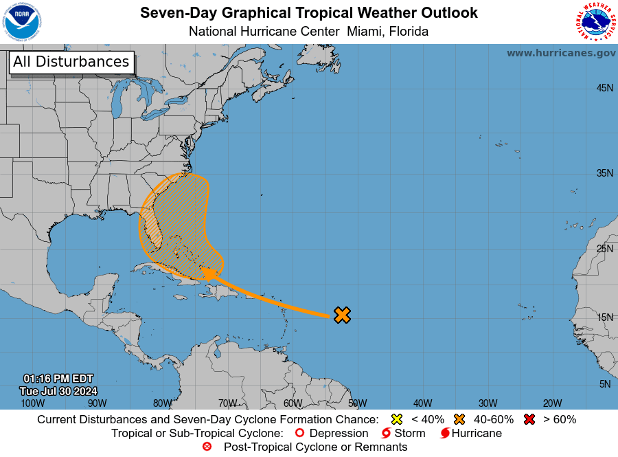
The National Hurricane Center continues to monitor the tropics for possible cyclonic development. A tropical disturbance is forecast to pass near the U.S. Virgin Islands and Puerto Rico on Wednesday, bringing inclement weather to the region.
“A large tropical wave centered several hundred miles east of the Lesser Antilles is producing limited shower activity due to environmental dry air,” according to an update on Tuesday from the NHC. “[However,] conditions are forecast to become a little more conducive for development over the warmer waters of the southwestern Atlantic Ocean, and a tropical depression could form late this week while the system is in the vicinity of the Greater Antilles or the Bahamas,” the NHC warned.
As of 2:00 p.m. on Tuesday, the chance of cyclonic development was moderate, at 60 percent. The National Weather Service in San Juan, Puerto Rico, explained that some current computer forecast models predict that the tropical wave may experience intensification after passing slightly to the north or northwest of the USVI and Puerto Rico.
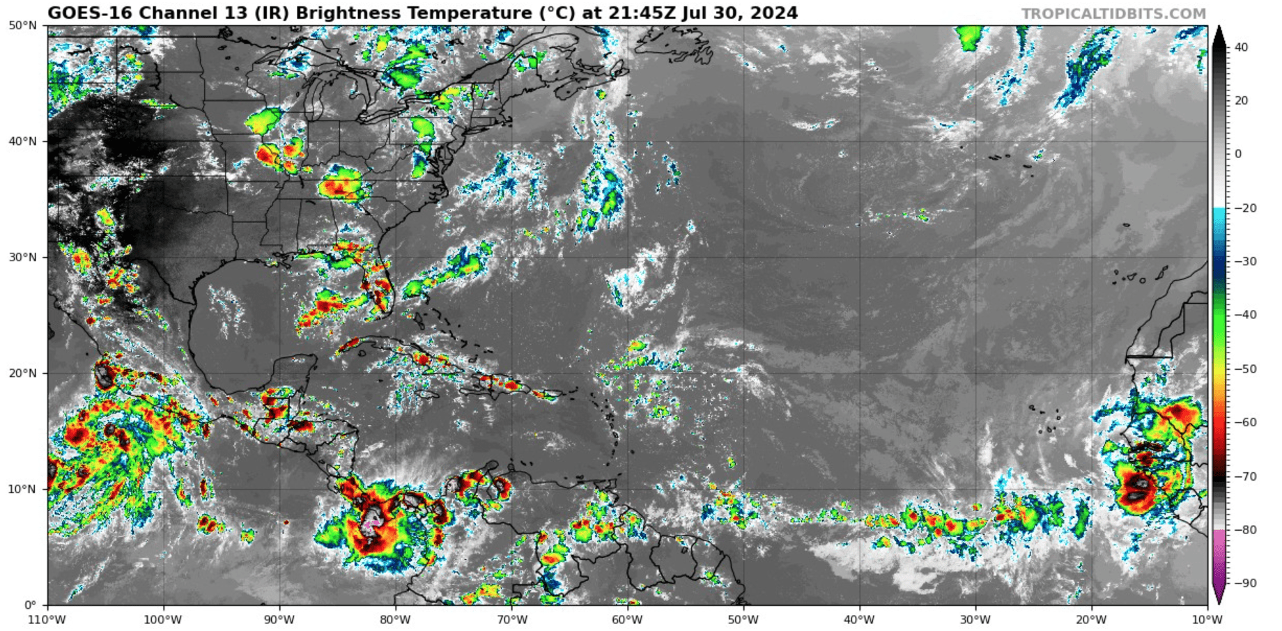
However, the forecast can change quickly, and regardless of any development, the local islands may be impacted by rain, thunderstorms, gusty winds, and choppy seas starting on Wednesday. The unsettled weather may last several days.
“A wind surge and vigorous tropical wave [will arrive] by Wednesday and Wednesday night, respectively [and] will bring an increase in showers and thunderstorms across the islands with the potential for flooding impacts,” according to the NWS on Tuesday.
“Breezy conditions are expected on Wednesday due to winds up to 25 knots, [particularly during] thunderstorm activity through this weekend. This wind surge will also cause choppy seas between six and eight feet across portions of the Atlantic and Caribbean waters. A moderate risk of rip currents will continue to increase and persist for the rest of the week,” the NWS explained.
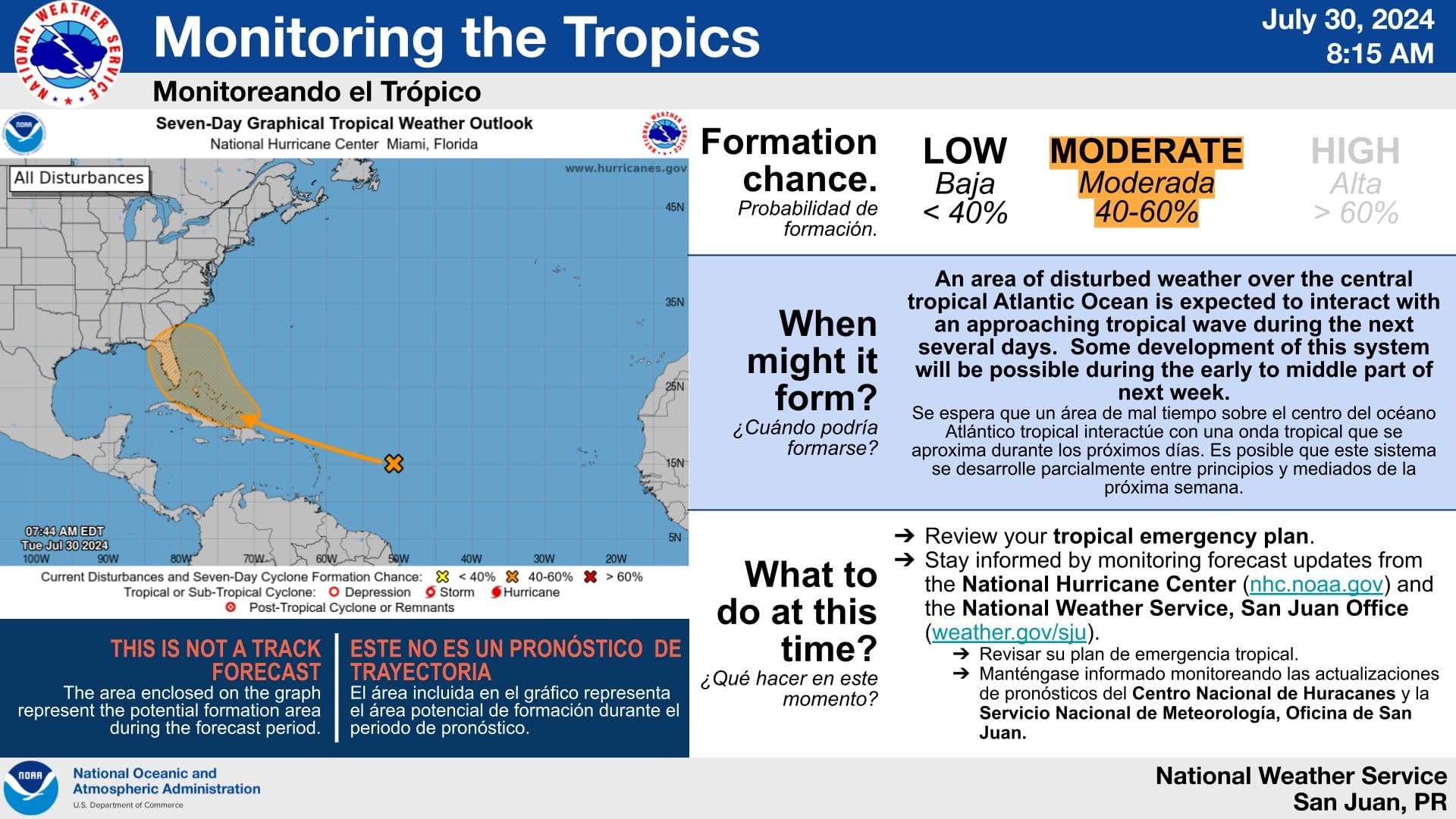
“Some areas will be impacted more than others, particularly in regions with previous rainfall activity and currently elevated stream flows,” the NWS stated. “Landslides and flash flooding events cannot be ruled out during this period, [and] for this reason, stay tuned for any advisories or warnings that our office may issue in the coming days,” the NWS advised.
Hurricane Preparedness
As mentioned in a previous Source article, the 2024 Atlantic Hurricane Season has already been record-breaking, largely due to destructive Hurricane Beryl, which rapidly intensified into a major hurricane and brought devastating impacts to portions of the Caribbean earlier this month.
A busy 2024 season is possible because of several factors, including a transition from an El Niño weather pattern to La Niña and extraordinarily warm sea surface temperatures across the North Atlantic. The combination of these elements may contribute to an increase in cyclones developing this year.
USVI residents and visitors are encouraged to review storm readiness and can find information regarding hurricane preparedness from the Virgin Islands Territorial Emergency Management Agency and the National Oceanic and Atmospheric Administration.
Follow Current Weather Updates
Weather forecast information, including severe weather alerts, is available from the VITEMA website and the National Weather Service.
The Source Weather Page also publishes a daily weather forecast and offers readers the opportunity to view weather forecast videos and disaster preparedness video segments

