
The National Weather Service in San Juan, Puerto Rico, has warned that weather conditions are expected to deteriorate through Thursday as a tropical wave moves past the local islands.
“A tropical wave, [called] Invest 96L, will cross the Lesser Antilles later today, with its leading moisture arriving late tonight across the local islands,” according to an update on Wednesday morning from the NWS. (An “invest” is an area under investigation for tropical development.)
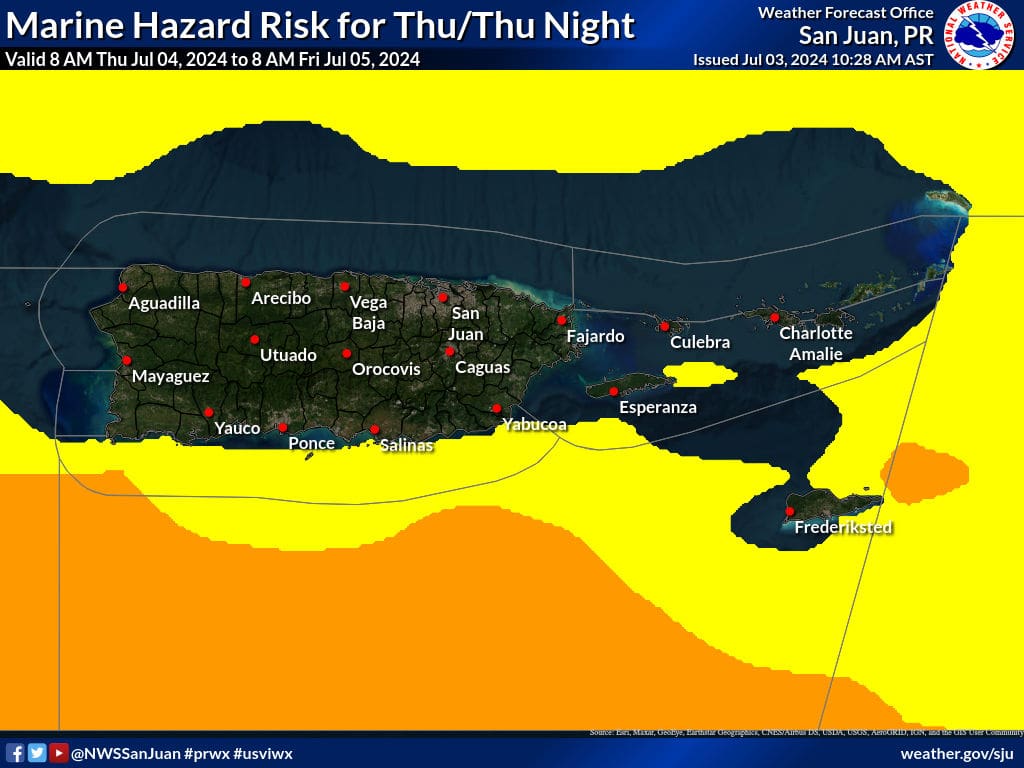
“The wave’s axis [center] should cross the region around early Thursday morning, promoting an unstable weather pattern through the Fourth of July. This wave may bring strong thunderstorms, producing downpours and frequent lightning, especially during the day and afternoon of July 4, [and] urban and small stream flooding may also be observed,” the NWS explained. (More information about how to remain safe from flash floods is available in a Source article here.)
There will be a moderate risk of rip currents across most of the local area, and a Small Craft Advisory is in effect for portions of the waters surrounding the islands until at least Thursday morning.
Drier air, along with Saharan dust, is forecast to arrive over the area this weekend, and hot temperatures are anticipated. Another tropical wave may approach the local islands early next week, and residents and visitors are encouraged to follow the National Hurricane Center for updates.
Hurricane Beryl Continues Traveling Across Caribbean
In other weather-related news, destructive Hurricane Beryl continues its assault on the Caribbean. There have been reports of extreme and widespread damage across islands in the southern Lesser Antilles, particularly in Grenada and St. Vincent and the Grenadines, near the core of where the Category 4 cyclone passed over the area on Monday. Sadly, there are reports of loss of life.

“At least seven people are dead after Hurricane Beryl slammed the Windward Islands Monday with winds up to 150 mph, heavy rainfall and dangerous storm surge flooding,” according to a report from the Weather Channel.
As of Wednesday morning, the system is moving west-northwest across the Caribbean and is forecast to pass over or near areas in the western Caribbean, including Jamaica and the Cayman Islands. While the hurricane may weaken somewhat, it is expected to remain a powerful hurricane.
“Beryl is forecast to be at or near major hurricane intensity while it passes near Jamaica later today and the Cayman Islands tonight or early Thursday,” according to an update from the National Hurricane Center on Wednesday morning. “Additional weakening [of the cyclone] is expected thereafter, though Beryl is forecast to remain a hurricane in the northwestern Caribbean,” the NHC added.
Weather Updates
Weather forecast information, including severe weather alerts, is available from the VITEMA website and the National Weather Service. The Source Weather Page also publishes a daily weather forecast and offers readers the opportunity to view weather forecast videos and disaster preparedness video segments.
Finally, residents are highly encouraged to be prepared throughout the potentially very busy 2024 Atlantic Hurricane Season. Information regarding hurricane preparedness is available from the Virgin Islands Territorial Emergency Management Agency and the National Oceanic and Atmospheric Administration.

