Residents of the Caribbean dodged a bullet Saturday when Tropical Storm Gonzalo passed through the region before fizzling out, but they don’t have a lot of time to relax as another system churns relentlessly across the Atlantic.
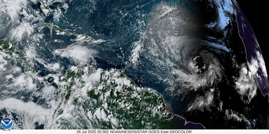
Invest 92-L is an area of low pressure located over the central tropical Atlantic, that is producing a wide area of disorganized showers and thunderstorms as it moves westward at about 20 mph, according to the National Hurricane Center’s 2 p.m. Sunday update.
The NHC gave the system a 70 percent chance of formation through 48 hours, and a 90 percent chance of formation in the next five days.
The V.I. Territorial Emergency Management Agency announced Sunday it is keeping an eye on 92-L and urged Virgin Islanders to make sure they’re prepared for the heart of the hurricane season, which is rapidly approaching.
VITEMA Director Daryl Jaschen encouraged the public to “take time now” to finalize their preparedness efforts as the peak of the 2020 Atlantic hurricane season draws near.
“Now is the time to make sure that you have supplies, such as water and dried goods, to last at least 10 days and that you and your family have a plan for communicating and know what to do if a storm or hurricane affects the territory,” Jaschen said in the news release issued Sunday evening. “Consider the needs of children, the elderly and pets in the home when you plan. Additionally, everyone should also prepare their homes and store any loose items that could become a projectile in a storm.”
Jaschen also reminded residents that the ongoing global pandemic adds a whole new layer to storm preparation.
“In this COVID environment, it is also imperative that you avoid waiting until the last minute to rush to the store to get what you need,” he said. “Preparing now means that you are being proactive in keeping your family safe, and knowing what to do means that there is that much less stress when a storm is headed our way.”
Satellite photos indicate the shower and thunderstorm activity of 92-L is disorganized due to dry air impacting it from the north and west. There is a broad circulation, and development will be a slow process for a few days as it will take some time for this large system to consolidate and for the dry air to subside. Additionally, Invest 92-L is located in an area of cooler ocean temperatures which is helping to inhibit development.
However, as the system moves westward it will encounter warmer ocean temperatures and move into a favorable environment for development.

