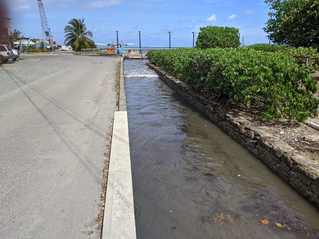
On a sunny day in Christiansted, rainwater drainage guts can be inundated with seawater inflows from swells that pass into the harbor. This can lead to flooding, especially during major storm events, since the outgoing rainwater has to fight the incoming seawater to drain into the ocean.
Sea level rise and coastal erosion are mounting global concerns, but the extent to which each is affecting shorelines in the U.S. Virgin Islands remains unknown. By the end of the century, climate change scientists predict that all coastal beaches could disappear, but what do these global projections mean for the territory?
To answer this question, scientists at the V.I. Department of Planning and Natural Resources and University of the Virgin Islands are teaming up to develop a locally relevant Coastal Vulnerability Index. Hilary Lohmann, coastal resilience coordinator for DPNR’s Division of Coastal Zone Management, and Greg Guannel, director of UVI’s Caribbean Green Technology Center, are spearheading the project that will inform the territory’s future coastal planning decisions.
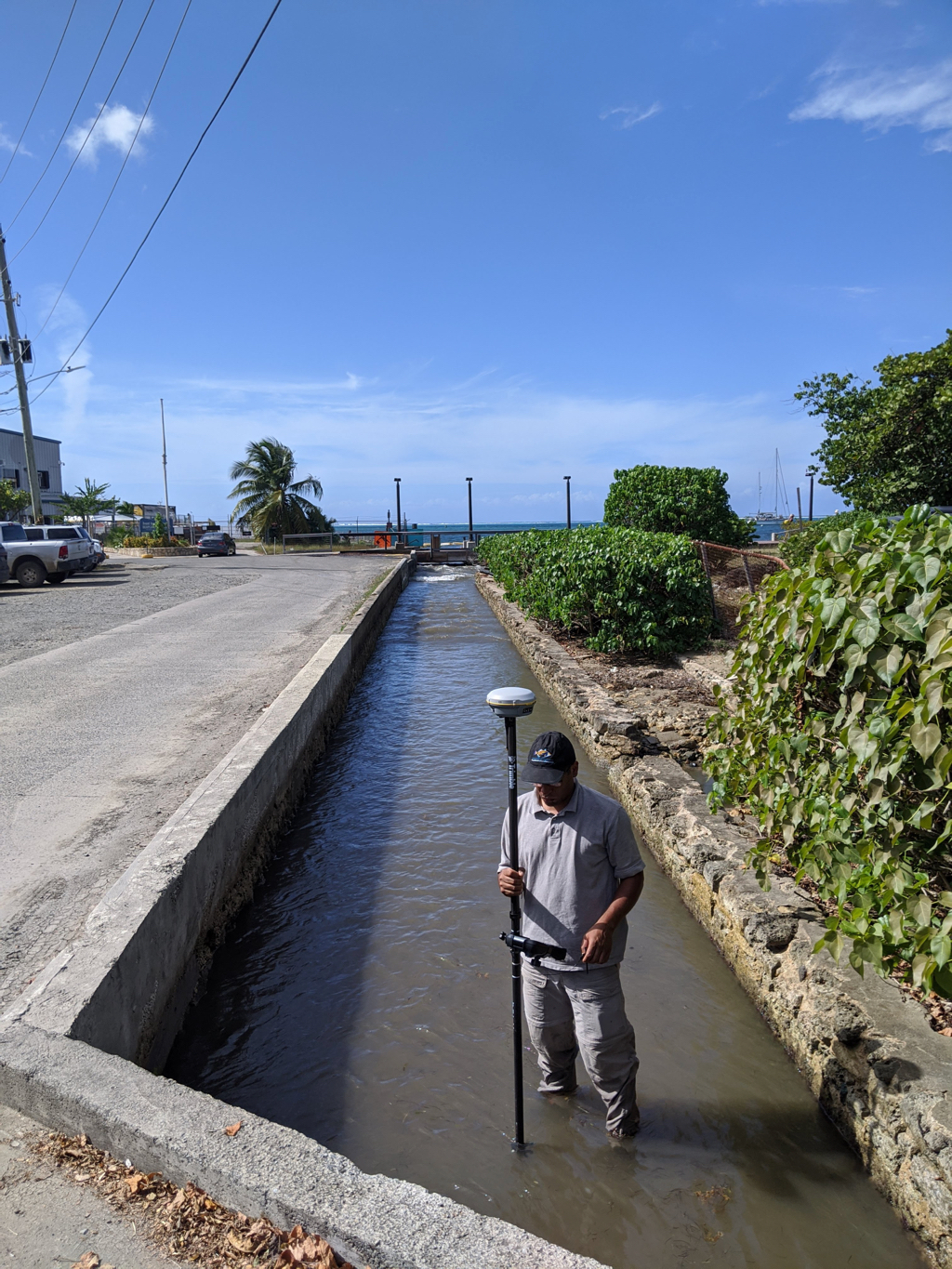
Speaking to the Source on March 10 from the west end of the Christiansted boardwalk near the seaplane terminal, Lohmann and Guannel pointed out that not only was the gut being filled with seawater on rain-free days, but so were the outflow pipes that drained the nearby parking lot.
Lohmann said the ocean swell was overflowing the gut, essentially turning the outflow channel into an inflow, during sunny day conditions. Seawater intrusion is a major concern if it’s a problem even when it’s not raining, she said.
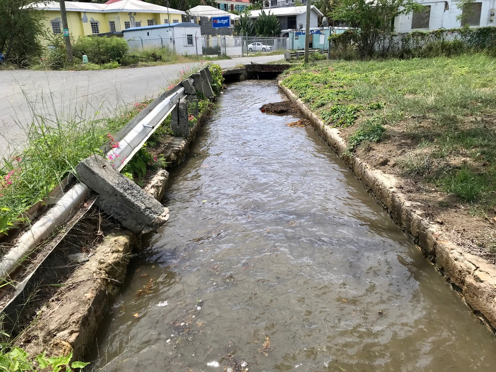
That confluence of water – where seawater inflow meets rainwater outflow – is a real issue for low-lying, developed areas in the Virgin Islands such as Christiansted and Charlotte Amalie, where seawater can be seen all the way to Main Street during the highest tide events.
In Christiansted, the waves that enter the harbor and intrude into the guts will likely become larger and stronger over time as the barrier reef that currently breaks them weakens and experiences less growth over time as coral bleaching events continue to occur and coral diseases like stony coral-tissue-loss progress.
To survey the elevation of guts, gut walls, seawalls, low-lying coastal roads, stormwater grates, sewer grates and other pertinent coastal infrastructure, Guannel and Lohmann use a Trimble GNSS platform, which uses satellites to determine the user’s location to within a few centimeters.
“We [are] measuring the elevation of solid surfaces, so we can compare them to mean sea level elevation, and other water surface elevations,” Guannel said.

Guannel and Lohmann recently measured the depth of the sediments that had accumulated in the gut that empties near the Christiansted seaplane terminal and found that there was 10 inches of accumulation. When the guts are clogged to this level, they cannot drain as quickly or efficiently as needed to prevent flooding.
Developed areas aren’t the only areas of concern that scientists are surveying.
“The V.I. might well see many of its beaches adversely impacted – Magens Bay, Trunk Bay, Sandy Point and many others – if sea level alone rises to the predicted values by 2100,” Lohmann said.
As a result of the 2017 hurricanes, the territory has access to more funding for coastal resiliency projects, Lohmann said, but before it can make major decisions about infrastructure plans or policy changes it’s needs a greater understanding of the current coastal infrastructure and how it could be impacted by hazards.
This characterization phase of the project will take up to a year and a half to complete.
During this phase, scientists also will conduct a geomorphologic survey to characterize the makeup of the territory’s coastlines. Sandy coastlines are impacted by rising seas and erosion much differently than rocky coastlines are, so it’s important for scientists to know where each exists.
“The results of this effort will help the Virgin Islands government, including the Department of Planning and Natural Resources, Public Works and the Waste Management Authority by increasing the amount, type and quality of information available during local decision-making processes that aim to increase long-term coastal resilience and protection against hazards,” Lohmann said.
The research will also help inform the latest update of the territory’s hazard mitigation and resiliency plan, which the Federal Emergency Management Agency requires as a condition for receiving certain types of non-emergency disaster assistance. According to FEMA, jurisdictions must update their hazard mitigation plans and resubmit them for FEMA approval every five years to maintain eligibility.
“We live, work and play in the coastal plain, so we must assess our options for adaptation,” Lohmann said. “We are maxing out our existing infrastructure.”

