The historic Oxholm map of St. John, 1788-1780, a mountainous island of 20 square miles. (Image courtesy of Olasee Davis)

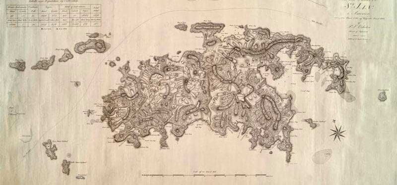
The historic Oxholm map of St. John, 1788-1780, a mountainous island of 20 square miles. (Image courtesy of Olasee Davis)
Since 1999 the Virgin Islands Source – the only online newspaper of general circulation in the U.S. Virgin Islands – has been providing the community with reliable, accurate and balanced local journalism.
Contact us: visource@gmail.com
© 1999-2025 Virgin Islands Source
