Tropical storm winds have already begun to spread across portions of the U.S. and British Virgin Islands, and this trend will likely continue through late Wednesday or early Thursday.
At 11 a.m., the center of Potential Tropical Cyclone Nine was approximately 150 miles south-southeast of St. Croix, tracking to the west-northwest near 23 miles per hour, with top winds of 45 miles per hour.
In its 11 a.m. update, the National Hurricane Center said Potential Tropical Cyclone Nine will produce heavy rains and potentially life-threatening flash flooding and mudslides across the U.S. Virgin Islands, the northern Leeward Islands, Puerto Rico, and the Dominican Republic.
The system center will make its closest point of approach to the territory at 4 p.m. Wednesday when it passes some 85 miles to the south-southwest of St. Croix, with top winds of 45 to 50 miles per hour. The tropical-storm-force winds – that is, winds in excess of 39 miles per hour – extend outward 275 miles primarily to the north and northeast of the center.
The system has the potential to produce three to six inches of rainfall as it passes the territory. The strongest winds will affect both districts between 4 p.m. and 6 p.m. with sustained winds of 44-47 miles per hour. Swells generated from the large circulation associated with this storm system will affect the coastal waters of the Virgin Islands over the next few days.
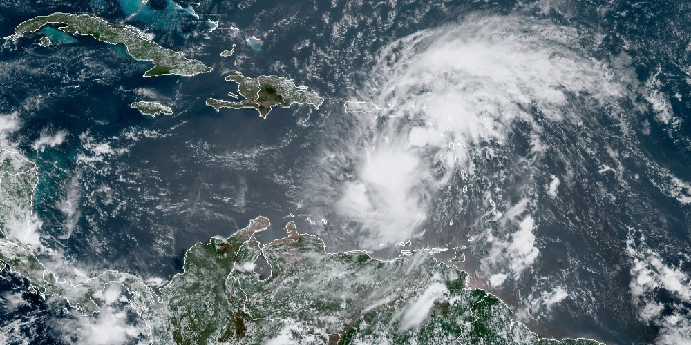
Surface observations from the Lesser Antilles show that the broader circulation of the disturbance has become slightly better defined, according to the NHC, but a recent Air Force Reserve reconnaissance aircraft was still unable to find a well-defined circulation. Therefore, the system has not yet become a tropical cyclone.

