The National Weather Service in San Juan, Puerto Rico, is warning that rough seas, gusty winds, and unsettled weather will affect Puerto Rico and the U.S. Virgin Islands this week, with dangerous surf, life-threatening rip currents, and marine alerts among the main concerns.
Hazardous Marine Conditions
In an update on Tuesday, NWS forecasters said an area of high pressure over the Western Atlantic will produce gusty east-northeasterly winds that, combined with a long-period northerly swell, will create hazardous seas expected to remain choppy over the coming days.
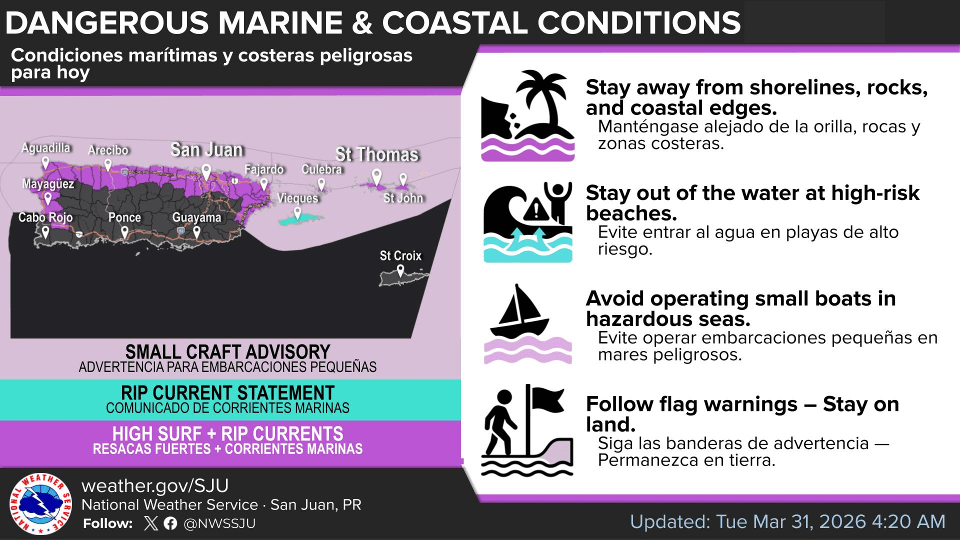
“The combination of these winds and a building swell will result in hazardous marine conditions, with choppy to rough seas across the local waters,” the NWS reported.
Unsafe marine conditions are particularly possible along north- and east-facing coastlines across both U.S. territories.
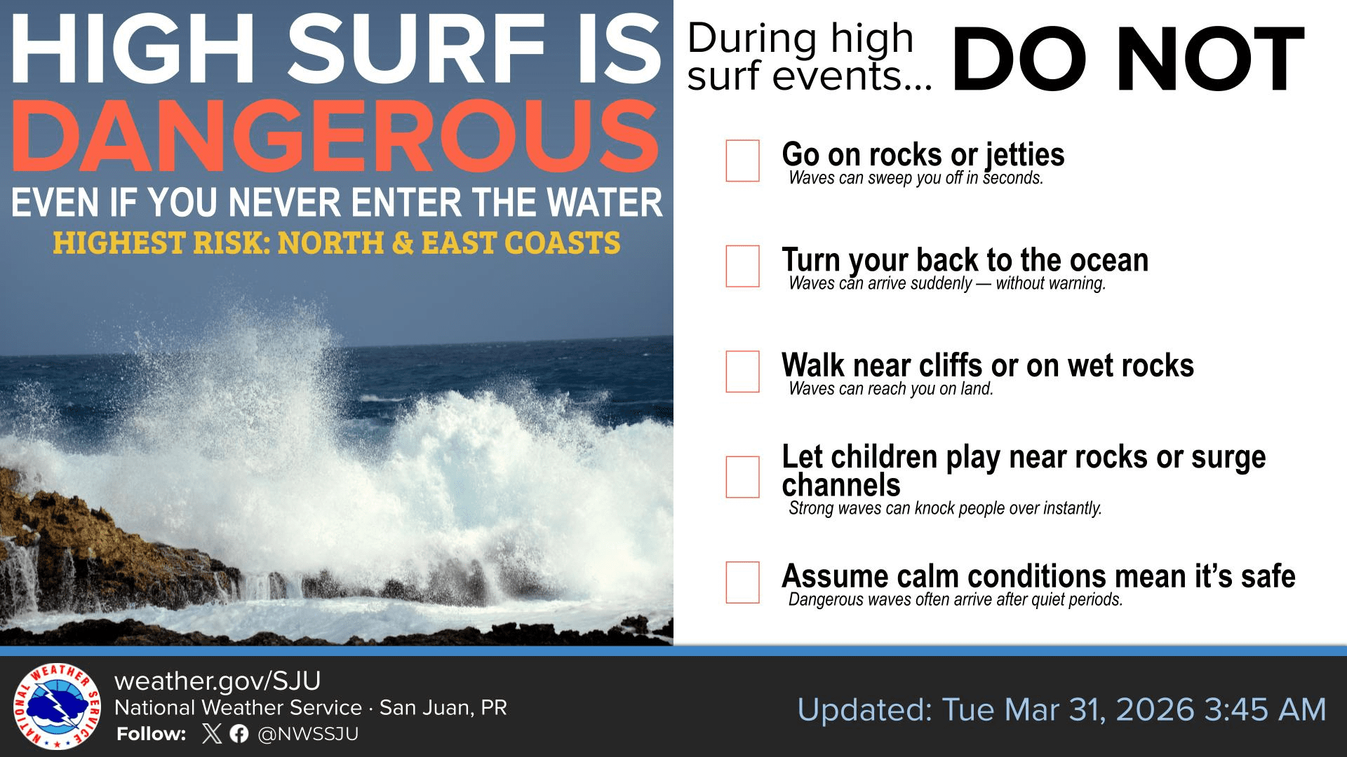
“Dangerous surf will create life-threatening rip currents and hazardous shoreline conditions, including strong breaking waves and wave run-up that can sweep people off rocks or the shoreline,” the NWS warned.
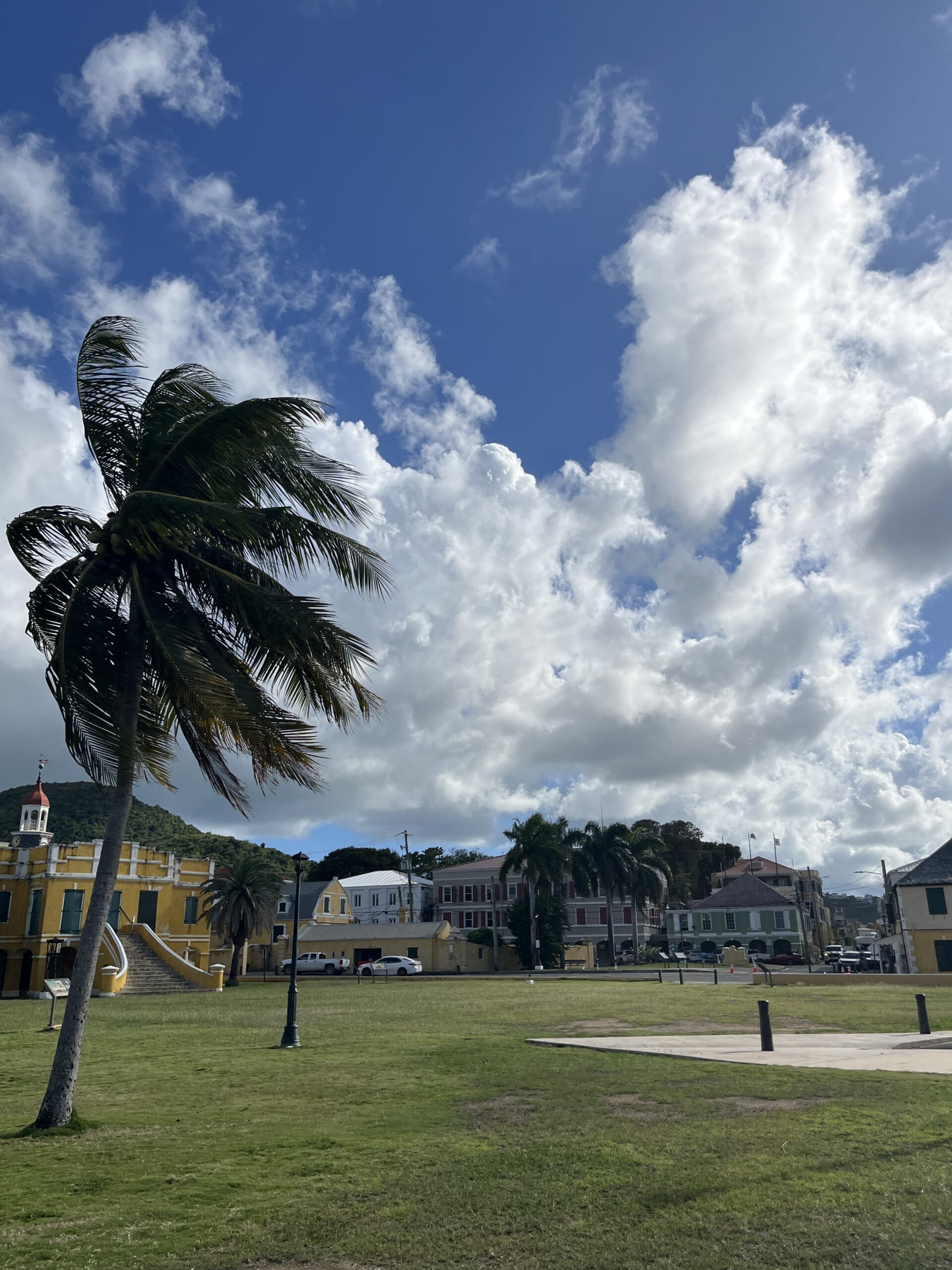
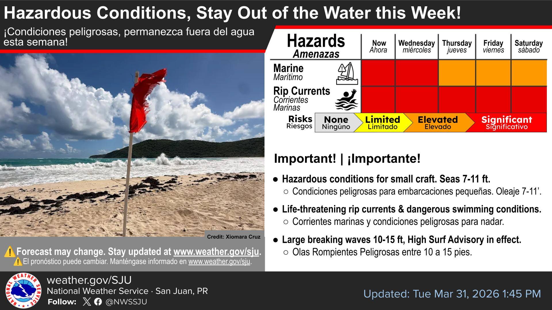
For St. Thomas, St. John, and adjacent islands, a High Surf Advisory is in effect until at least 6 p.m. Wednesday, and a High Rip Current Risk remains in effect through at least 12 a.m. on Saturday.
Small Craft Advisories are also in effect for surrounding waters, including those around St. Thomas and St. John, until at least 12 a.m. on Saturday, according to the latest NWS update. While St. Croix was not included in the High Surf Advisory or High Rip Current Risk alerts as of Tuesday afternoon, the waters east of St. Croix are included in the Small Craft Advisory.
Additionally, NWS meteorologists reported that showers and thunderstorms will affect the area at times, creating further hazards.
“Periods of frequent showers, and possibly isolated thunderstorms, will also move across the waters, locally reducing visibility and producing brief higher winds and rougher seas. Overall, hazardous marine conditions are expected to persist through much of the week,” forecasters explained.
“Beachgoers are urged to stay out of the water and use caution near the shoreline at affected beaches, as conditions can be dangerous even for those not entering the water,” the NWS said.
Breezy Weather, Showers and Thunderstorms Possible
Across the region, breezy conditions and passing showers, with isolated thunderstorms possible at times, are expected to continue into early next week. The NWS said the weather could affect outdoor plans during the holiday week, including Easter Sunday, for example.
“During this ongoing holiday week, periods of showers and breezy conditions may lead to interruptions in outdoor activities across the islands,” the NWS cautioned. “While showers will move quickly, repeated activity may result in localized flooding in urban areas, roadways, and poor drainage locations, especially by midweek as moisture increases,” the NWS said. “Breezy to locally windy conditions will persist, especially across exposed coastal areas and higher elevations,” the NWS added.
Looking further ahead, the NWS local forecast for the USVI notes that breezy conditions and passing showers will prevail, with an unsettled pattern possible from Friday into the weekend and early next week, and isolated flooding is possible. Temperatures across the area are also forecast to trend above normal.
Local Weather Updates
As the Source reported in a recent interview with the NWS, weather hazards can occur year-round. Information regarding the weather across the USVI, including marine forecasts, is available from the NWS and NOAA. And with the Atlantic hurricane season set to begin June 1, the Source recently covered AccuWeather’s latest 2026 hurricane season forecast, which can be viewed here.
Additionally, the local forecast is regularly updated on the Source Weather Page, where a weekly video forecast is available.
Finally, residents and visitors can also view weather alerts and disaster preparedness information from the Virgin Islands Territorial Emergency Management Agency.

