Tropical Storm Arthur formed near the Texas coast Wednesday, becoming the first named cyclone of the 2026 Atlantic hurricane season. While not a threat to the USVI or Puerto Rico, the National Hurricane Center said Arthur will bring rain, winds and coastal impacts to the Gulf and Southeast region.
Tropical Storm Arthur Forms Near Texas Coast
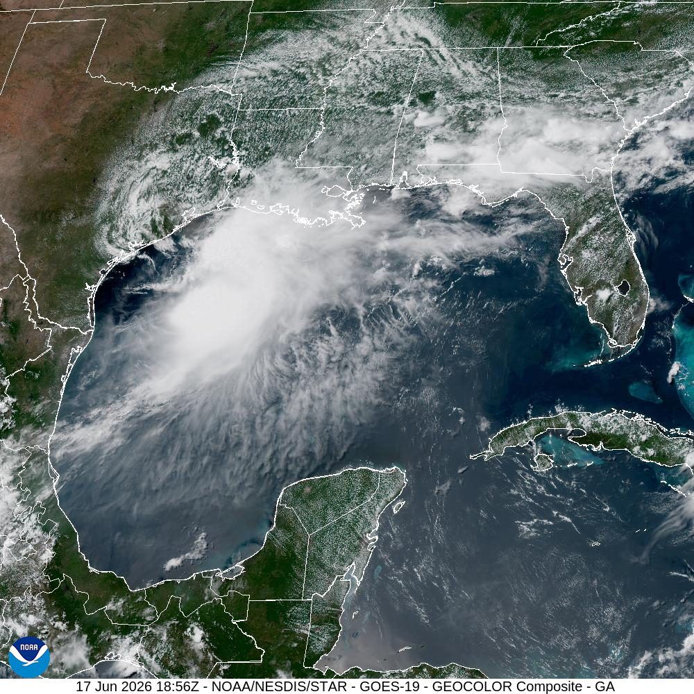
The NHC explained that Tropical Storm Arthur formed Wednesday morning near the middle Texas coast and was moving toward Louisiana. A Tropical Storm Warning is in effect for portions of Texas and Louisiana.
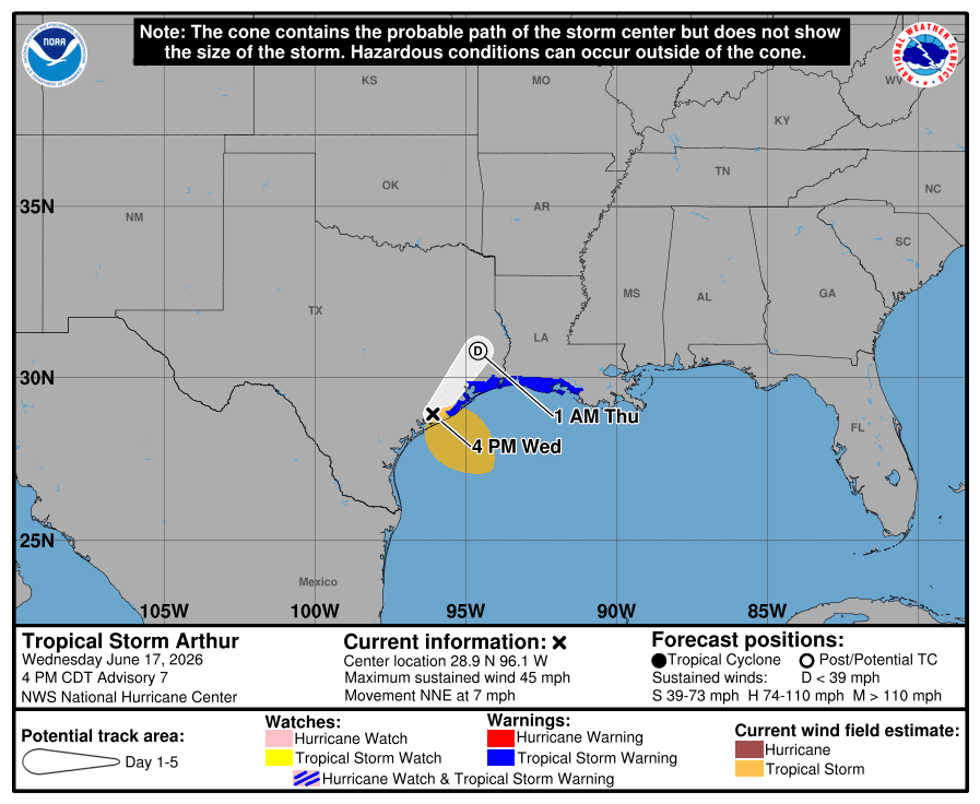
As of the 5 p.m. AST advisory from the NHC, Arthur was located about 20 miles north-northwest of Matagorda, Texas, and about 195 miles west-southwest of Lake Charles, Louisiana. The storm was packing maximum sustained winds of approximately 45 mph and moving north-northeast at about seven mph.
On the forecast track, Arthur is expected to move farther inland over southeastern Texas through Wednesday night. The system is anticipated to quickly weaken as it moves farther inland, and Arthur could dissipate as soon as Wednesday night or early Thursday, although rainfall across the region will continue for several days.
Heavy Rain and Flooding Main Concerns
The main threat from Arthur is expected to be heavy rainfall and flooding over the coming days across areas of the Gulf and the southeastern United States. The NHC said Arthur could produce rainfall totals of five to 10 inches. Isolated areas may experience total rainfall near 20 inches through early Friday from the middle and upper Texas coast east-northeast into portions of Louisiana, Mississippi, and Alabama, along with Western Georgia and the Florida Panhandle.
The excessive precipitation could generate dangerous flash flooding and storm surge, and life-threatening rip currents are also expected. The NHC warned that tornadoes are also possible.
Travelers flying to or from the U.S. Virgin Islands and areas along the Gulf Coast or portions of the southeastern U.S. are encouraged to check with airlines for possible delays or cancellations related to inclement weather.
Atlantic Basin Quiet Elsewhere
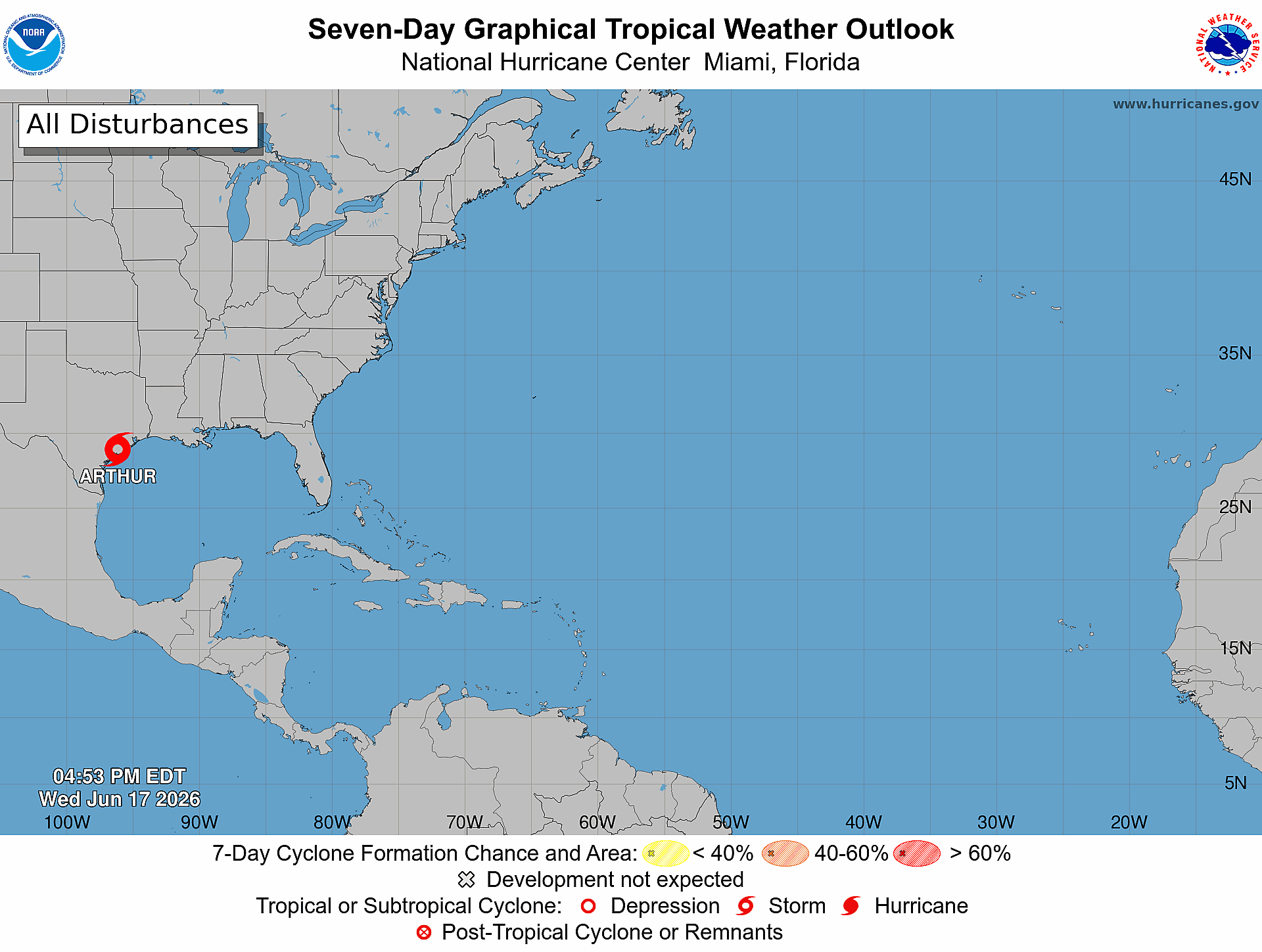
Aside from Tropical Storm Arthur, no additional development is expected across the Atlantic basin, although several tropical waves are being monitored by the NHC. Still, the tropical waves that are being watched are not anticipated to develop into any significant storms, and there are no immediate tropical cyclone threats to the U.S. Virgin Islands or Puerto Rico.
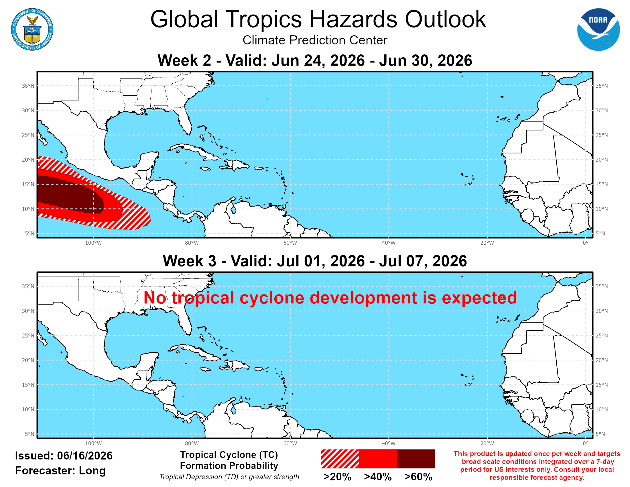
According to a Global Tropics Hazards Outlook released Tuesday, the Atlantic basin is expected to remain quiet in the coming weeks, while areas across the Pacific may experience cyclonic activity. The forecast tool, which is issued every Tuesday by NOAA’s Climate Prediction Center, provides insight into potential activity across tropical basins up to three weeks in advance.
Local Weather: Heat, Dust and Increasing Shower Chances
According to information from the National Weather Service in San Juan, the main local concerns across Puerto Rico and the U.S. Virgin Islands over the next few days include hot temperatures, breezy trade winds, and Saharan dust. There is also a possibility of an increase in showers and isolated thunderstorms later this week. Any rainfall may help to alleviate very dry conditions across the region that recently led to the implementation of a territory-wide burn ban.
“Moisture will increase noticeably on Thursday as a weak tropical wave moves into the region,” the NWS said on Wednesday. “A sharp drying trend takes hold on Friday, as the tropical wave exits and a dense layer of Saharan dust spreads across the region through the morning hours,” the NWS added.
Looking further ahead into early next week, the NWS pointed to a continuation of variable weather conditions.
“The primary hazards through the long-term forecast will include periods of elevated heat, occasional Saharan dust intrusions, strengthening trade winds at times, and localized impacts from isolated showers and thunderstorms,” the NWS reported.
Marine conditions will remain choppy, with breezy east-to-east-southeast winds expected. A low to moderate risk of rip currents is expected during the next several days, with the moderate risk expanding late in the week as winds increase.
Forecast Updates
The formation of Tropical Storm Arthur on Wednesday serves as an early-season reminder that even during a hurricane season that is predicted to be below average, residents across hurricane-prone areas should remain prepared. It only takes one storm to create dangerous impacts.
Information regarding the weather across the USVI is available from the NWS, the NHC and NOAA.
The local forecast is regularly updated on the Source Weather Page, and a weekly video forecast is available. Additionally, residents and visitors can view weather alerts and disaster preparedness information from VITEMA.

