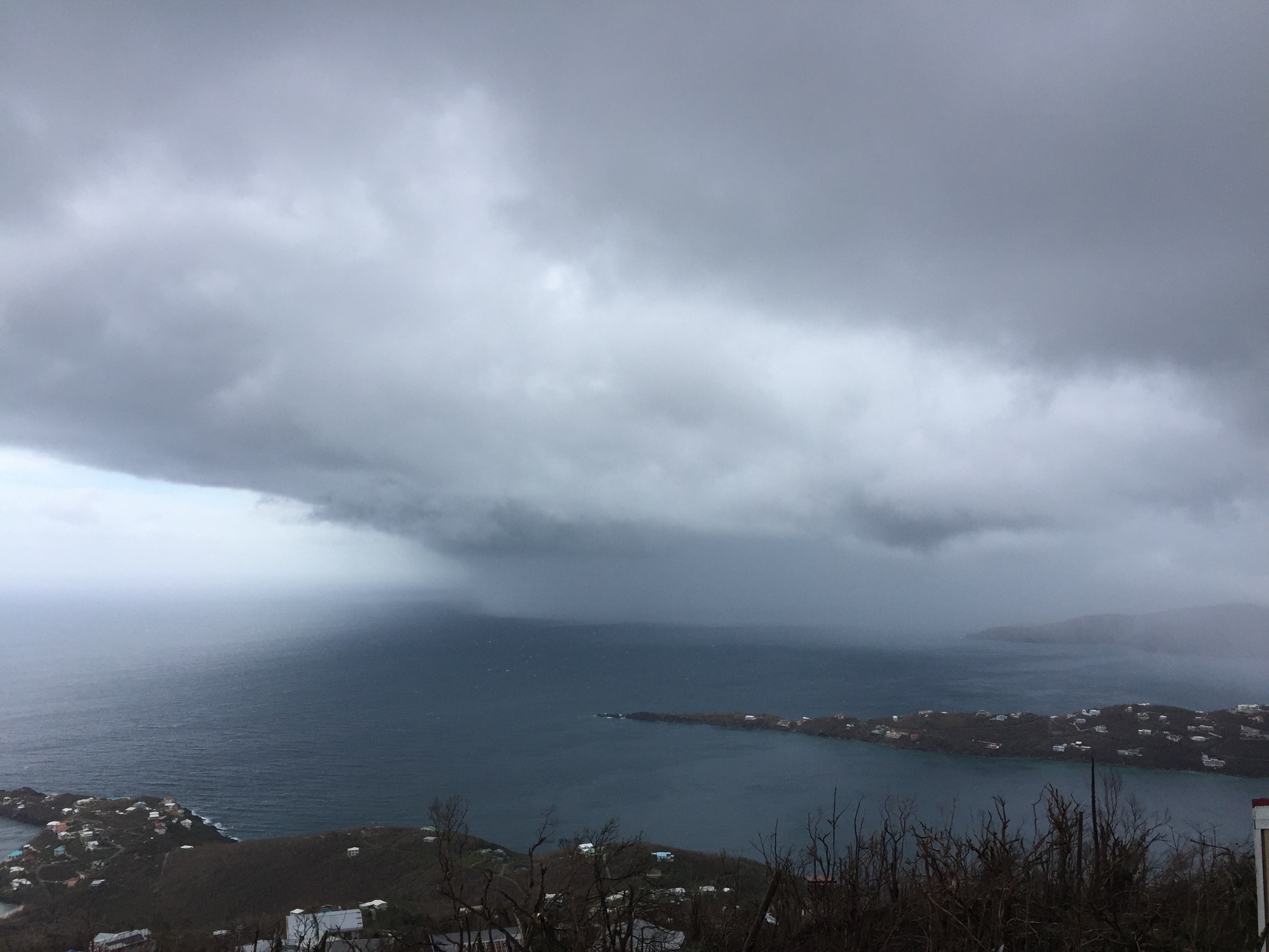
Hurricane Maria’s eye wall is projected to pass over the southwest quadrant of St. Croix, meaning the island will experience the highest possible wind levels from the Category 5 hurricane and the southwest shore may see a massive storm surge that could devastate anything near the shore on that part of the island.
At his 11 a.m. Tuesday briefing before the storm, Gov. Kenneth Mapp said the National Weather Service said to expect a storm surge of six to nine feet. The storm surge is like a high tide, a dome of water lifted by the low pressure zone in the eye of the hurricane. Along with sea levels up to nine feet higher than normal, there will be waves as high as 25 feet on the southern shore of the island.
“If you live there, you may need to move to a shelter,” Mapp said. “You will not be impeded by the curfew. Folks, we want people to be safe,” Mapp said.
Those on the south shore should consider leaving immediately. They can call 911 and police will help to get them rides to shelters, up until the storm hits, Police Commissioner Delroy Richards said.
The center of the storm had been projected to pass south of the island: at first it was predicted to pass 20 miles to the south, then less than 10 miles to the south and now it’s actually projected to pass over part of the island. Mapp cautioned that if the storm continues to move northward, it could mean maximum eye-wall winds throughout St. Croix.
And it would mean worse-than-projected conditions on St. Thomas, St. John and Water Island.
Those who decide to get to shelter have to get there before 2 p.m. Mapp said.
St. Croix is already experiencing tropical storm force winds as of noon. Hurricane force winds may begin by 10 p.m. and continue to 8 or 9 a.m. Wednesday.
St. Thomas should start seeing tropical storm force winds around 8 p.m. with high winds continuing until 2 to 4 p.m. Wednesday. Maximum winds for St.Thomas, St. John and Water Island are currently projected at around 65 to 75 miles per hour, Mapp said, adding that could change.
Som people on Water Island are sheltering at the fire station there. They have food, water, shelter, generators and fuel.
“The good folks on Water Island are set to go,” Mapp said.
The residents of Sea View Nursing Home have been moved to Lockhart Elementary School and that shelter is now full, VITEMA Director Mona Barnes reported.
There is room at Bertha C. Boschulte Elementary School and at Knud Hansen Complex on St. Thomas. On St. Croix, the shelters are at D.C. Canegata Park, Herbert Grigg Home and the St. Croix Educational Complex. The St. John shelters are at Guy Benjamin Oliver School and Bethany Moravian Church. Those with special needs should go to Charles Harwood Complex on St. Croix; Schneider Regional Medical Center on St.Thomas and the Myrah Keating Smith Clinic on St. John.
“Canegata still has room. … We ask that you make your way there right now,” Barnes said at 11 a.m.
Mapp said he had received texts that some individuals with special needs had arrived at Canegata.
“You are not being turned away. But we are asking you to go to Charles Harwood,” Mapp said.
The other shelters also have room, except for Lockhart.
Mapp previously ordered the evacuation of the heavily damaged Tutu Highrise apartments on St. Thomas. Some residents did not want to leave, but Mapp said Tuesday morning that one or two residents who had refused to leave “wised up if you will,” and called for rides to shelters.
One hour before the eye wall hits, an alert will be texted to everyone on V.I. Alert warning everyone. Asked whether anyone would be able to get that text at that point, Mapp said many St. Thomians got a similar text during Hurricane Irma and there may be some signal.
“We will just have to hope for the best on that,” Mapp said.
V.I. National Guard Adjutant General Deborah Howell said they were able to provision all the distribution sites Monday and gave out more than 87,000 meals, 113,500 liters of water and 580 tarps.
U.S. military contingents have left the territory but are poised to return as soon as the storm passes, Howell said.
All National Guard members are activated and as of noon will be at armory hunkered down, she said.
Well before the storm’s arrival, trees were already down across road on St. Croix, Police Commissioner Delroy Richards said.
“This means we have to enforce this curfew,” Richard said, asking people not to go out. ‘Trust me, this is going to be a terrible and devastating event,” he said.
After the storm, do not go out but stay around your own residence and clean up debris, Richards said.
Mapp said they have 100 military police and 30 New York State Troops on standby and that New Jersey Governor Chris Christie has told him New Jersey will be making some state troopers available as well.
“They will be embedded with the V.I. police,” Mapp said.
FEMA coordinator William Vogel said he had spoken with the head of FEMA and had been assured teams are prepositioned, ready to go and supplies are in place, for after the storm.
Mapp said he would be hunkering down in Government House and would be trying to give another update around 2:15 p.m.


